Miami Municipal Airport
| Miami Municipal Airport | |||||||||||
|---|---|---|---|---|---|---|---|---|---|---|---|
|
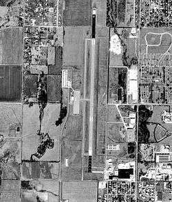
USGS 1995 orthophoto | |||||||||||
| IATA: MIO – ICAO: KMIO – FAA LID: MIO | |||||||||||
| Summary | |||||||||||
| Airport type | Public | ||||||||||
| Owner | City of Miami | ||||||||||
| Serves | Miami, Oklahoma | ||||||||||
| Elevation AMSL | 808 ft / 246 m | ||||||||||
| Coordinates | 36°54′33″N 094°53′15″W / 36.90917°N 94.88750°WCoordinates: 36°54′33″N 094°53′15″W / 36.90917°N 94.88750°W | ||||||||||
| Map | |||||||||||
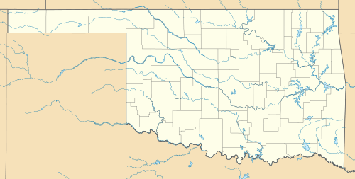 MIO Location in Oklahoma | |||||||||||
| Runways | |||||||||||
| |||||||||||
| Statistics (2008) | |||||||||||
| |||||||||||
Miami Municipal Airport (IATA: MIO[2], ICAO: KMIO, FAA LID: MIO) is a city owned airport two miles northwest of Miami, in Ottawa County, Oklahoma.[1] The National Plan of Integrated Airport Systems for 2011–2015 called it a general aviation facility.[3]
History
The airport opened in December 1937 with two 3,200' concrete runways aligned north-south (17/35) and northeast-southwest (05/22).
In summer 1941, the facility was taken over by the United States Army Air Forces and was used initially as part of the British Flying Training School program. This training was part of the Lend-Lease act where Royal Air Force (RAF) flying cadets had a 20-week basic flying course taught by civil contractors. Flight training was by Spartan Aircraft Company, using Fairchild PT-19s as the primary trainer. Also had several PT-17 Stearmans and a few P-40 Warhawks assigned.
In November 1942, RAF training ended at Miami and the airfield became a primary (stage 1) pilot training airfield assigned to AAF Flying Training Command, Gulf Coast Training Center (later Central Flying Training Command). The civil instructors were retained under USAAF control.
Three known auxiliary airfields were associated with Miami Airport for emergency and overflow landings, all in the Miami area. Training ended in mid-1944 with the drawdown of AAFTC's pilot training program and the airfield returned to civil control.
For a short time starting 1952 it had scheduled flights—Ozark DC-3s.
Facilities
Miami Municipal Airport covers 300 acres (121 ha) at an elevation of 808 feet (246 m). Its one runway, 17/35, is 5,020 by 100 feet (1,530 x 30 m) asphalt.[1]
In the year ending July 10, 2008 the airport had 12,000 general aviation aircraft operations, average 32 per day. 31 aircraft were then based at this airport: 74% single-engine and 26% multi-engine.[1]
Incidents
On November 8, 2010, a small plane crash landed at the airport. No one was injured as the Cessna 150 landed in a plowed field and sustained minor damage.[6]
See also
- Oklahoma World War II Army Airfields
- List of airports in Oklahoma
- 31st Flying Training Wing (World War II)
References
- 1 2 3 4 FAA Airport Master Record for MIO (Form 5010 PDF). Federal Aviation Administration. Effective April 5, 2012.
- ↑ "Airline and Airport Code Search". International Air Transport Association (IATA). Retrieved November 22, 2012.
- ↑ "2011–2015 NPIAS Report, Appendix A" (PDF, 2.03 MB). faa.gove. Federal Aviation Administration. October 4, 2010.
- ↑
 This article incorporates public domain material from the Air Force Historical Research Agency website http://www.afhra.af.mil/.
 - ↑ Shaw, Frederick J. (2004), Locating Air Force Base Sites History’s Legacy, Air Force History and Museums Program, United States Air Force, Washington DC, 2004.
- ↑ Kfor.com News. Retrieved on November 10, 2010
| Wikimedia Commons has media related to Miami Municipal Airport. |
External links
- Miami Municipal (MIO) at Oklahoma Aeronautics Commission
- Aerial image as of February 1995 from USGS The National Map
- FAA Terminal Procedures for MIO, effective December 8, 2016
- Resources for this airport:
- FAA airport information for MIO
- AirNav airport information for MIO
- FlightAware airport information and live flight tracker
- SkyVector aeronautical chart for MIO
| Flying Training |
|  | ||||||
|---|---|---|---|---|---|---|---|---|
| Technical Training |
| |||||||