Mid-Kent Line
| Mid-Kent Line | |
|---|---|
| Overview | |
| Type | Commuter rail, Suburban rail |
| System | National Rail |
| Status | Operational |
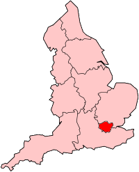
| Locale | Greater London |
| Termini |
Ladywell 51°27′22″N 0°01′09″W / 51.4562°N 0.0193°W Hayes 51°22′35″N 0°00′38″E / 51.3764°N 0.0105°E |
| Stations | 9 |
| Operation | |
| Opened | 1857 |
| Owner | Network Rail |
| Operator(s) | Southeastern |
| Rolling stock |
Class 376 "Electrostar" Class 465 "Networker" Class 466 "Networker" |
| Technical | |
| Number of tracks | 2 |
| Track gauge | 1,435 mm (4 ft 8 1⁄2 in) standard gauge |
Hayes Line | ||||||||||||||||||||||||||||||||||||||||||||||||||||||||||||||||||||||||||||||||||||||||||||||||||||||||||||||||||||||||||||||||||||||||||||||||||||||||||||||||||||||||||||||||||||||||||||||||||||||||||||||||||||||||||||||||||||||||||||||||||||||||||||||||||||
|---|---|---|---|---|---|---|---|---|---|---|---|---|---|---|---|---|---|---|---|---|---|---|---|---|---|---|---|---|---|---|---|---|---|---|---|---|---|---|---|---|---|---|---|---|---|---|---|---|---|---|---|---|---|---|---|---|---|---|---|---|---|---|---|---|---|---|---|---|---|---|---|---|---|---|---|---|---|---|---|---|---|---|---|---|---|---|---|---|---|---|---|---|---|---|---|---|---|---|---|---|---|---|---|---|---|---|---|---|---|---|---|---|---|---|---|---|---|---|---|---|---|---|---|---|---|---|---|---|---|---|---|---|---|---|---|---|---|---|---|---|---|---|---|---|---|---|---|---|---|---|---|---|---|---|---|---|---|---|---|---|---|---|---|---|---|---|---|---|---|---|---|---|---|---|---|---|---|---|---|---|---|---|---|---|---|---|---|---|---|---|---|---|---|---|---|---|---|---|---|---|---|---|---|---|---|---|---|---|---|---|---|---|---|---|---|---|---|---|---|---|---|---|---|---|---|---|---|---|---|---|---|---|---|---|---|---|---|---|---|---|---|---|---|---|---|---|---|---|---|---|---|---|---|---|---|---|---|---|---|---|
Legend
| ||||||||||||||||||||||||||||||||||||||||||||||||||||||||||||||||||||||||||||||||||||||||||||||||||||||||||||||||||||||||||||||||||||||||||||||||||||||||||||||||||||||||||||||||||||||||||||||||||||||||||||||||||||||||||||||||||||||||||||||||||||||||||||||||||||
The Mid-Kent Line[1] (referred to as the Hayes Line by train operators,[2] official bodies[3] and the general public[4]) is a British railway line running from Courthill Loop North junction[5] (just south of Lewisham station) to Hayes (Kent) station in the London Borough of Bromley. Despite its name, none of the line is in the present-day county of Kent.
Stations
- Ladywell
- Catford Bridge
- Lower Sydenham
- New Beckenham
- Clock House
- Elmers End
- Eden Park
- West Wickham
- Hayes
History
The name was used by the successors to railways built by the Mid Kent Railway and South Eastern Railway between 1857 and 1882. The line was originally planned to reach Westerham and Sevenoaks but a combination of factors prevented this occurring.
The line was opened on 1 January 1857[6] between Lewisham, now in the London borough of that name, and Beckenham Junction. Stations on that section were:
- Ladywell
- Catford Bridge
- Lower Sydenham - rebuilt on a new site in 1904-6
- Beckenham (renamed Beckenham Junction in 1864.
Operated by the South Eastern Railway the line was extended from a new station at New Beckenham to Elmers End and Addiscombe in 1864 with later intermediate stations at Clock House (1880) and Woodside and South Norwood (1881). The section between Elmers End and Addiscombe was closed in 1997 in preparation for its Tramlink replacement opened in 2000.
In 1882 two extensions were constructed; one the Hayes branch went to Eden Park, West Wickham and Hayes and the Woodside and South Croydon Railway (a joint South Eastern Railway and London, Brighton and South Coast Railway line) to the Oxted Line, and electrified as far as Sanderstead which closed in 1983. The Mid Kent line and Hayes Branch was electrified in 1925-6 and the Sanderstead line in 1935.
Current use
Today passenger trains run only over the main section to Hayes, as track of the former line south of Elmers End is now used by Tramlink.
Goods services were withdrawn in 1964 with the exception of Beckenham Junction which survived until 1982.[7]
References
- ↑ Quail Map 5 - England South [page 4]. September 2002. Retrieved 2011-12-05.
- ↑ "Lines of route". Southeastern.
- ↑ "TfL funds Hayes Line station improvements" (Press release). Transport for London. 17 September 2004.
- ↑ http://www.londonbanter.co.uk/london-transport/1368-hayes-kent-line.html
- ↑ Network Rail (April 2001). South Zone Sectional Appendix. Module SO. p. SO330 1/118. SO/SA/001A.
- ↑ "The History of Railways in Beckenham". Beckenham History. Retrieved 22 February 2011.
- ↑ "The Railways of Beckenham", Andrew Hajducki, 2011
Coordinates: 51°24′57″N 0°02′07″W / 51.4158°N 0.0353°W
