Middleton on the Wolds
| Middleton on the Wolds | |
 Middleton on the Wolds |
|
| Population | 825 (2011 census)[1] |
|---|---|
| OS grid reference | SE944495 |
| – London | 170 mi (270 km) S |
| Civil parish | Middleton on the Wolds |
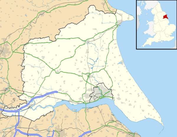
| Unitary authority | East Riding of Yorkshire |
| Ceremonial county | East Riding of Yorkshire |
| Region | Yorkshire and the Humber |
| Country | England |
| Sovereign state | United Kingdom |
| Post town | DRIFFIELD |
| Postcode district | YO25 |
| Dialling code | 01377 |
| Police | Humberside |
| Fire | Humberside |
| Ambulance | Yorkshire |
| EU Parliament | Yorkshire and the Humber |
| UK Parliament | Beverley and Holderness[2] |
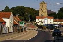
Coordinates: 53°56′01″N 0°33′44″W / 53.933730°N 0.562340°WMiddleton on the Wolds is a village and civil parish on the Yorkshire Wolds in the East Riding of Yorkshire, England. It is situated on the A614 road midway between Driffield and Market Weighton.
According to the 2011 UK census, Middleton on the Wolds parish had a population of 825,[1] an increase on the 2001 UK census figure of 774.[3]
History
Middleton on the Wolds was served by Middleton-on-the-Wolds railway station on the Selby to Driffield Line between 1890 and 1954.[4]
The church dedicated to St Andrew was designated a Grade II* listed building in 1966 and is now recorded in the National Heritage List for England, maintained by Historic England.[5]
Governance
The civil parish was in the East Yorkshire parliamentary constituency until the 2010 general election when it was transferred to the constituency of Beverley and Holderness.[2]
References
- 1 2 "Key Figures for 2011 Census: Key Statistics: Area: Middleton CP (Parish)". Neighbourhood Statistics. Office for National Statistics. Retrieved 6 February 2013.
- 1 2 "Are you ready to vote in the next election?". East Riding News. East Riding of Yorkshire Council: p. 3. April 2010.
- ↑ "2001 Census: Key Statistics: Parish Headcounts: Area: Middleton CP (Parish)". Neighbourhood Statistics. Office for National Statistics. Retrieved 19 May 2008.
- ↑ Butt, R. V. J. (1995). The Directory of Railway Stations: details every public and private passenger station, halt, platform and stopping place, past and present (1st ed.). Sparkford: Patrick Stephens Ltd. ISBN 1-8526-0508-1. OCLC 60251199.
- ↑ Historic England. "Church of St. Andrew (1084151)". National Heritage List for England. Retrieved 16 August 2013.
- Gazetteer — A–Z of Towns Villages and Hamlets. East Riding of Yorkshire Council. 2006. p. 8.
External links
 Media related to Middleton on the Wolds at Wikimedia Commons
- Middleton on the Wolds in the Domesday Book