Mississippi Highway 16
| ||||
|---|---|---|---|---|
| Route information | ||||
| Maintained by MDOT | ||||
| Length: | 166.472 mi[1] (267.911 km) | |||
| Major junctions | ||||
| West end: |
| |||
|
| ||||
| North end: |
| |||
| Location | ||||
| Counties: | Issaquena, Sharkey, Yazoo, Humphreys, Madison, Leake, Neshoba, Kemper | |||
| Highway system | ||||
| ||||

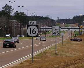
Mississippi Highway 16 westbound in Neshoba County.
Mississippi Highway 16 (MS 16) is a state highway in Mississippi. It runs for 166.472 miles (267.911 km) and serves 8 counties: Issaquena, Sharkey, Yazoo, Humphreys, Madison, Leake, Neshoba, and Kemper.
Locales on Route
From West to East
Major intersections
| County | Location | mi | km | Destinations | Notes | ||
|---|---|---|---|---|---|---|---|
| Issaquena | Grace | Grace Road | to MS 1 | ||||
| Sharkey | Rolling Fork | Rosenwald Avenue | east end of state maintenance | ||||
| Gap in route | |||||||
| Yazoo | Holly Bluff | Sartaria Road - Lake George Wildlife Management Area | to MS 433 | ||||
| | west end of MS 149 overlap | ||||||
| Yazoo City | interchange | ||||||
| east end of MS 149 overlap; west end of US 49 overlap | |||||||
| | east end of US 49 overlap | ||||||
| | |||||||
| Madison | | I-55 exit 124 | |||||
| Canton | west end of US 51 overlap | ||||||
| east end of US 51 overlap | |||||||
| west end of MS 43 overlap | |||||||
| east end of MS 43 overlap | |||||||
| | |||||||
| Leake | | Natchez Trace | interchange | ||||
| Wiggins | interchange | ||||||
| Carthage | |||||||
| Edinburg | |||||||
| Neshoba | Philadelphia | west end of MS 15 / MS 21 overlap | |||||
| Cooper Williams Drive - Williamsville | |||||||
| east end of MS 15 overlap; west end of MS 19 overlap | |||||||
| east end of MS 21 overlap | |||||||
| east end of MS 19 overlap | |||||||
| Williamson Avenue | proposed MS 894 | ||||||
| | |||||||
| | Road 547 | proposed MS 853 | |||||
| Crossroads | |||||||
| Kemper | | west end of MS 495 overlap | |||||
| | east end of MS 495 overlap | ||||||
| | Joe W. Williams Field | proposed MS 493 north | |||||
| | |||||||
| | |||||||
| De Kalb | |||||||
| Scooba | |||||||
| | |||||||
| 1.000 mi = 1.609 km; 1.000 km = 0.621 mi | |||||||
References
- ↑ "Mississippi Public Roads Selected Statistics" (PDF). Mississippi Department of Transportation. 2008. Retrieved 2010-06-03.
This article is issued from Wikipedia - version of the 1/18/2015. The text is available under the Creative Commons Attribution/Share Alike but additional terms may apply for the media files.