Mississippi Highway 28
| ||||
|---|---|---|---|---|
| Route information | ||||
| Maintained by MDOT | ||||
| Length: | 124.601 mi[1] (200.526 km) | |||
| Major junctions | ||||
| West end: |
| |||
| ||||
| East end: |
| |||
| Location | ||||
| Counties: | Jefferson, Copiah, Simpson, Smith, Jones | |||
| Highway system | ||||
| ||||

Mississippi Highway 28 (MS 28) is a two-lane state highway in Mississippi that runs east–west from U.S. Highway 84 (US 84) west of Laurel, Mississippi to MS 33 near Fayette. It travels approximately 126 miles (203 km), serving Jefferson, Copiah, Simpson, Smith, and Jones counties.
Route description
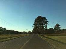
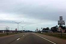
MS 28 is a largely two-lane, paved road that travels east and west across central Mississippi. The route does have several dangerous intersections and sharp curves, the most notable being the intersection with MS 37 in Taylorsville and the intersection with MS 35 in Mize. The road is heavily traveled, and is a major corridor from Laurel to Jackson. The road does share a four-lane concurrency with US49 for about two miles (3.2 km) in the city of Magee before turning south.
Future
There have been some discussions among residents in communities along MS 28 concerning plans to completely four-lane MS 28 from its terminus with US 84 in Laurel to US 49 in Magee. The route already shares a two-mile-long (3.2 km) concurrency with US 49 in Magee, and some residents feel that a four-lane highway would better alleviate heavy truck traffic.
There have been no official plans from the Mississippi Department of Transportation (MDOT) to upgrade MS 28 to freeway standards. Residents opposed to the potential change claim that "four-laning" the Highway would also entail bypasses for several small towns along the route, stifling business opportunities.
However, MDOT does have some improvements scheduled for the dangerous intersection with MS 37 in Taylorsville. A $3,000,000 project for "various intersection improvements at MS 37/MS 28" is set to begin in 2018.
Major intersections
| County | Location | mi | km | Destinations | Notes |
|---|---|---|---|---|---|
| Jefferson | | Western end of MS 33 concurrency | |||
| | Eastern end of MS 33 concurrency | ||||
| Union Church | Western terminus of MS 550 | ||||
| Copiah | Pleasant Hill | Eastern terminus of MS 552 | |||
| Allen | Southern terminus of MS 547 | ||||
| Hazlehurst | I-55 exit 61 | ||||
| Georgetown | |||||
| Simpson | Union | Southern terminus of MS 469 | |||
| Pinola | Western end of MS 43 concurrency | ||||
| | Eastern terminus of MS 472 | ||||
| | Eastern end of MS 43 concurrency | ||||
| | |||||
| | Southern terminus of MS 545 | ||||
| | Western end of MS 541 concurrency | ||||
| Magee | Western end of US 49 concurrency | ||||
| Eastern end of MS 541 concurrency | |||||
| Eastern end of US 49 concurrency | |||||
| Western end of MS 149 concurrency | |||||
| Eastern end of MS 149 overlap | |||||
| Smith | Mize | Western end of MS 35 concurrency | |||
| | Eastern end of MS 35 concurrency | ||||
| Taylorsville | Northern end of MS 37 concurrency | ||||
| Southern end of MS 37 concurrency | |||||
| | |||||
| Jones | Soso | Southern terminus of MS 533 | |||
| Northern terminus of MS 29 | |||||
| Calhoun | Eastern terminus of MS 28 | ||||
1.000 mi = 1.609 km; 1.000 km = 0.621 mi
| |||||
See also
-
 Mississippi portal
 -
 U.S. Roads portal
References
- ↑ "Mississippi Public Roads Selected Statistics" (PDF). Mississippi Department of Transportation. 2008. Retrieved 2010-06-03.