Missouri Route 177
| ||||
|---|---|---|---|---|
| Route information | ||||
| Length: | 23.168 mi[1] (37.285 km) | |||
| Major junctions | ||||
| South end: | Morgan Oak Street in Cape Girardeau | |||
| North end: |
| |||
| Highway system | ||||
| ||||

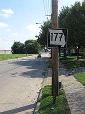
Missouri Route 177 in Cape Girardeau; Cape's flood wall is visible at the left. Note the euro-style 7s on the sign.
Route 177 is a highway in Cape Girardeau County, Missouri, USA. Its northern terminus is at U.S. Route 61 at Fruitland, Missouri; its southern terminus is at Morgan Oak Street, a few blocks north of Route 34/Route 74 in Cape Girardeau.
Major intersections
The entire route is in Cape Girardeau County.
| Location | mi[1] | km | Destinations | Notes | |
|---|---|---|---|---|---|
| Cape Girardeau | 0.000 | 0.000 | Morgan Oak Street | Begin state maintenance | |
| Randol Township | 11.646 | 18.742 | |||
| Shawnee Township | 15.767 | 25.375 | |||
| 16.596 | 26.709 | ||||
| 22.798 | 36.690 | ||||
| Fruitland | 23.168 | 37.285 | |||
| 1.000 mi = 1.609 km; 1.000 km = 0.621 mi | |||||
References
- 1 2 Missouri Department of Transportation. Flex Map Viewer (Map). Missouri Department of Transportation.
This article is issued from Wikipedia - version of the 12/21/2014. The text is available under the Creative Commons Attribution/Share Alike but additional terms may apply for the media files.