Mostviertel
| Quarters and Districts of Lower Austria | |
|---|---|

Mostviertel (English: Must Quarter) is the southwestern quarter of the four quarters of Lower Austria (the northeast state of the 9 states in Austria). It is bordered on the north by the Danube and to the south and west by the state borders of Styria and Upper Austria respectively. The Wienerwald forms the natural border to the east and gives the quarter its second name, "The Quarter Over the Wienerwald".
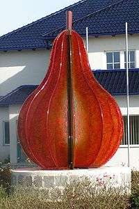
The name Mostviertel comes from the apple and pear must (or heavy juice) made there. The lands between the Rivers Ybbs and Enns enjoy favorable conditions for growing fruit trees and are therefore the heart of a flourishing must industry. Typical in the Mostviertel are vast meadows of mixed orchards surrounding a farmhouse, in the center of which is usually a square courtyard, and the lightly rolling foothills of the Alps.
Business and Industry
Economy
The economy of Mostviertel is still mainly based on iron and steel as well as forestry. In earlier times, when iron ore was still mined at Erzberg, the work was done in hammer mills; today the steel mills take the half-finished product from the blast furnaces of Linz and Donawitz and turn it into blades for machines. In the Mostviertel, there is one large sawmill, plus many smaller ones, which process the wood taken from the forests. However, most of the economy is made up of small and mid-sized companies.
Must
For many years, must has been held in the greatest cultural importance in this region and is seen as an identifying characteristic. Most must production is used in homemade meals, pastries, schnaps, and other cooking. The variety of musts is large; there is a clear difference between apple must and pear must, but also a common form that is a mixture of the two.
Geography
The Mostviertel is made up of the following districts:
- Amstetten
- Waidhofen an der Ybbs
- Scheibbs
- Melk south of the Danube
- Lilienfeld
- Tulln south of the Danube
- The City of St. Pölten and St. Pölten-Land
External links
| Wikimedia Commons has media related to Mostviertel. |
Coordinates: 48°00′00″N 15°20′00″E / 48.0000°N 15.3333°E