Mota (island)
|
Mota in the Banks Islands | |
 | |
| Geography | |
|---|---|
| Coordinates | 13°51′S 167°42′E / 13.850°S 167.700°ECoordinates: 13°51′S 167°42′E / 13.850°S 167.700°E |
| Archipelago | Banks Islands |
| Area | 9.5 km2 (3.7 sq mi)[1] |
| Highest elevation | 411 m (1,348 ft)[1] |
| Administration | |
| Province | Torba |
| Demographics | |
| Population | 683[2] (2009) |
| Pop. density | 71.89 /km2 (186.19 /sq mi) |
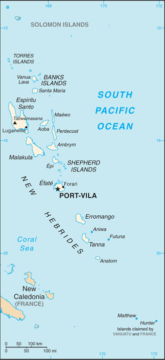
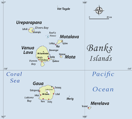
Mota is an extinct volcanic island in the Banks group of Torba Province in northern Vanuatu.
History
It was discovered by the Portuguese navigator Pedro Fernández de Quirós who served for the Spanish expedition on 25 April 1606 and named it Nuestra Señora de la Luz (Our Lady of Light).[3]
The island is famous because its language was used by the first missionaries in Melanesia. For the better part of a century from 1849, most teaching in classrooms and schools of all kinds, and most prayers and hymns from Isabel in the Solomons all the way through Pentecost in Vanuatu were done in the language of this small island. Some Mota words are still known throughout the Melanesian archipelago, e.g. tasiu (brother, taken here in the religious sense of "member of a brotherhood" i.e. the Melanesian Brotherhood)
The famous missionary John Coleridge Patteson lived on Mota, in the village of Veverao. The first Melanesian priest, Father George Sarawia was from Mota, and the first Christian baptisms and Eucharist and Confirmations were there. Mota is generally held to be the first Melanesian island to become Christian, though missionary work began a year later than on Aneityum.
Population
683 people live on Mota[2] in coastal villages around the island. The names of the villages are Liwotqei, Lotawan, Mariu, Tasmate, Garamal, Tuqetap, and Veverao.
All Mota people are Christians, Anglicans of the Church of the Province of Melanesia. The big days of celebration are the saints' days of the church in each village on the island. However, kastom, i.e. the Melanesian traditions, still means a lot to the islanders.
Presently, the island is ruled by a council of chiefs elected from each village. There is a school, Pasaleli Primary School, formally named Panel School. There is a dispensary where a nurse lives, access to teleradio and a public phone on the island. There are also small settlements of Mota people in Santo, especially at Lorevilko and Turtle Bay, and in Port Vila.
References
- 1 2 "Islands of Vanuatu". Retrieved October 10, 2011.
- 1 2 "2009 National Census of Population and Housing: Summary Release" (PDF). Vanuatu National Statistics Office. 2009. Retrieved October 10, 2011.
- ↑ Saint-Martin, M. Vivien de Nouveau dictionnaire de géographie universelle Paris, 1879-1895, vol III, p. 1029.
External links
- Documents in Mota from Project Canterbury
- O As Oraora nan 1904 collection of songs in Mota.

