Mount Tohivea
.jpg)
Mount Tohivea (or Tohiea) is a volcanic peak and the highest point on the island of Moorea in French Polynesia at 3,960 feet (1,207 m). On its slopes are many streams and fertile soils. There are hiking trails along the summit close to Belvedere Point where people can view Mont Routui and the two bays and three peninsulas of Moorea. Mount Tohivea is a dormant volcano that is easily visible from Papeete, the capital of French Polynesia. The surrounding peaks are almost as tall as Mount Tohivea.
Hiking trails
There about 5 miles (8.0 km) of dirt hiking trails along the Mount Tohivea's slopes. The trails are about 2 feet (0.61 m) wide. There are some points with views of Cook's Bay, Opunohu Bay, the Pacific Ocean, and Pao Pao, the largest commune of Moorea. The animals that people can see are mainly Geckos and Salamanders. The hiking trails end close to Mont Mouaroa which is only a couple of miles west of Mont Tohivea. People can also see Mont Mouaroa from both the main road and the two bays. People can mainly see Mont Mouaroa from Opuhunu bay.Some of the hiking trails go to the bottom of Moorea from the south point. People can also see Mont Tohivea from the south point and get on the trails from there.
Location
Mount Tohivea is located at the center of Moorea. As seen from Tahiti, Mount Tohivea appears to be in the southern part of Moorea. The mountain is about 2 miles (3.2 km) from Pao Pao, 20 miles (32 km) from the town center of Papeete, 2,000 miles (3,200 km) south of Honolulu, Hawaii, 2,000 miles (3,200 km) east of Sydney, Australia, and 4,000 miles (6,400 km) southwest of Los Angeles, California. It is at about 20 degrees south of the equator and at the same longitude as Anchorage, Alaska.
Belvedere Point
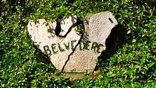
Belvedere Point is on the slope of Mount Tohivea. It is about 1,000 feet (300 m) below the peak. It starts the hiking trails that go around the slopes. Roosters and Chickens walk around the Belvedere Point parking lot. The parking lot also ends the small two-lane road that goes from the bottom of the Opunohu Bay to Belvedere Point. There is an agriculture high school just north of, and below, the point. There are many visitors to the point each year, as it is easily accessible from Pao Pao.
Farms
There are farms at the bottom of Mount Tohivea. The farmers mainly farm pineapples and potatoes. The farmers give the pineapples to the Moorea Juice Factory. People can see the farms as they drive the small road up the valley. The farms are mainly located at where the small road starts at the bottom of Opuhunu Bay. There is also a shrimp farm.
History
Mount Tohivea was formed about two million years ago. Its last eruption was so big, there was a landslide that formed the 2 bays. After the eruption, the volcano became dormant. The area was first settled by early Polynesians during the early 4th century. Then Charles Darwin explored the area. After many years the area became very populated. Then people made trails and then it become a park. Today, the park is a tourist attraction.
Tourism
Mount Tohivea is visited a lot since it has easy access from Papeete. Many people walk the trails since there is beautiful scenery. People from Tahiti use the Moorea Temae Airport or the Aremeti Ferry to get to Moorea. Mount Tohivea is visible behind Mount Rotui from the two bays.
Surrounding peaks
Mt. Tohivea has many peaks surrounding it. Mount Rotui is the second highest peak on Moorea. It is about 3,200 feet (980 m) tall. People can see it from Belvedre Point. Some people hike Mount Rotui since it is closer to Pao Pao. Other nearby peaks include Mount Mouaputa, Mount Mouaroa, and Mount Taufuapae.
See also
External links
Coordinates: 17°32′42″S 149°48′46″W / 17.5449°S 149.8127°W