Nabesna, Alaska
| Nabesna Nabaesna’ | |
|---|---|
| Unincorporated community & census-designated place | |
| Nabesna | |
 Nabesna Location within the state of Alaska | |
| Coordinates: 62°22′19″N 143°0′31″W / 62.37194°N 143.00861°WCoordinates: 62°22′19″N 143°0′31″W / 62.37194°N 143.00861°W | |
| Country | United States |
| State | Alaska |
| Census area | Valdez-Cordova |
| Government | |
| • State senator | Click Bishop (R) |
| • State rep. | Dave Talerico (R) |
| Elevation | 2,979 ft (908 m) |
| Population (2010) | |
| • Total | 5 |
| Time zone | Alaska (AKST) (UTC-9) |
| • Summer (DST) | AKDT (UTC-8) |
| GNIS feature ID | 1406770[1] |
Nabesna (Nabaesna’ in Ahtna) is a census-designated place and unincorporated community in northern Valdez-Cordova Census Area, Alaska, United States, in the northern part of the Wrangell-St. Elias National Park and Preserve. It lies along the Nabesna Road, a gravel road that connects it to the Tok Cut-Off at Slana.[2] Its elevation is 2,979 feet (908 m). Founded by and named for the Nabesna Mining Company, the community received a post office in 1909. Located at the base of White Mountain in the Wrangell Mountains, it lies west of the Nabesna River.[1] According to the 2010 Census, there were five people residing at this location.
Gold was discovered at White Mountain in 1891, and the site was first developed in the early 20th century. Through the efforts of Carl Whitham, the Nabesna Mining Company was formed in 1929, resulting in an expansion of the camp and the construction of Nabesna Road. The mine was closed during World War II, and only briefly reopened afterward, closing permanently after Whitham died in 1947. The location was used as a secret supply cache by the United States Army during the Cold War. The mine produced 2.5 short tons (2.3 t) of gold during its active period, as well as many tons of silver, copper, and lead. The old mining camp is now a ghost town, and was listed as Nabesna Gold Mine Historic District on the National Register of Historic Places in 1979.[3][4]
See also
- National Register of Historic Places listings in Valdez-Cordova Census Area, Alaska
- National Register of Historic Places listings in Wrangell-St. Elias National Park and Preserve
References
- 1 2 "Nabesna, Alaska". Geographic Names Information System. United States Geological Survey.
- ↑ Rand McNally. The Road Atlas '08. Chicago: Rand McNally, 2008, p. 6.
- ↑ "NRHP nomination for Nabesna Gold Mine Historic District" (PDF). National Park Service. Retrieved 2015-03-11.
- ↑ National Park Service (2010-07-09). "National Register Information System". National Register of Historic Places. National Park Service.
Municipalities and communities of Valdez–Cordova Census Area, Alaska, United States | ||
|---|---|---|
| Cities | 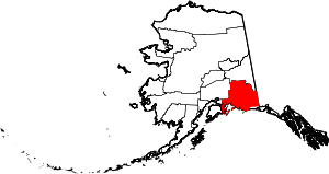 | |
| CDPs | ||
| Unincorporated communities | ||
| Ghost towns | ||