Nakhatrana
For the taluka of the same name, see Nakhatrana Taluka.
| Nakhatrana નખત્રાણા | |
|---|---|
| village | |
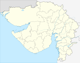 Nakhatrana  Nakhatrana Location in Gujarat, India | |
| Coordinates: 23°21′00″N 69°15′48″E / 23.35000°N 69.26333°ECoordinates: 23°21′00″N 69°15′48″E / 23.35000°N 69.26333°E | |
| Country |
|
| State | Gujarat |
| District | Kutch |
| Taluka | Nakhatrana |
| Area | |
| • Total | 2 km2 (0.8 sq mi) |
| Population (2001) | |
| • Total | 12,534 |
| • Density | 6,300/km2 (16,000/sq mi) |
| Languages | |
| • Official | Gujarati, Hindi |
| Time zone | IST (UTC+5:30) |
| PIN | 370615 |
| Telephone code | 02835 |
| Vehicle registration | GJ-12 |
| Nearest city | Bhuj |
| Climate | Dry (Köppen) |
| Website |
gujaratindia |
Nakhatrana (![]() pronunciation ) is a panchayat village and headquarters for a taluka in the middle of Kutch, Gujarat, in India.[1]
pronunciation ) is a panchayat village and headquarters for a taluka in the middle of Kutch, Gujarat, in India.[1]
Demographics
In the 2001 census, the village of Nakhatrana had 12,534 inhabitants with 6,346 (%) males, and 6,188 (%) females, for a gender ratio of females per thousand males.[2]
Street food
A large village, it is famous for its spicy Dabeli snack and bangles. It is also known as the origin of onion samosas.
Education
K.V. High School is an old school with a history.
The village contain 6 government primary school, 2 high schools, 4 private schools, 1 college and ITI. Nakhatrana is developing educational centre. Nakhatrana is located on National Highway 8.
References
- ↑ Villages of Nakhatrana Taluka
- ↑ "Census 2001 Population Finder: Gujarat: Kachchh: Nakhatrana: Nakhatrana". Office of The Registrar General & Census Commissioner, Ministry of Home Affairs, Government of India. Archived from the original on 30 May 2013.
This article is issued from Wikipedia - version of the 10/2/2016. The text is available under the Creative Commons Attribution/Share Alike but additional terms may apply for the media files.