Narayamkulam
| Narayamkulam നരയംകുളം | |
|---|---|
| village | |
 Narayamkulam  Narayamkulam Narayamkulam Location in Kerala, India | |
| Coordinates: 11°29′30″N 75°50′30″E / 11.49167°N 75.84167°ECoordinates: 11°29′30″N 75°50′30″E / 11.49167°N 75.84167°E | |
| Country |
|
| State | Kerala |
| District | Kozhikode |
| Government | |
| • Type | panchayath |
| • Body | kerala sarkaar |
| Languages | |
| • Official | Malayalam, |
| Time zone | IST (UTC+5:30) |
| PIN | 673614 |
| Telephone code | 0496 |
| Vehicle registration | KL-11. KL-56 |
| Nearest city | Perambra, Balussery |
| Climate | meadium hot (Köppen) |
Narayamkulam is a village in Kottur Panjayath, Kozhikode district, India.
Demographics
Most of the people are Hindus and there are many Muslim families T. P. Rajeevan, Veerankutty, Sajeevan puvalath, Suresh Ellath, Arathi S,Prasanth PK, Prakasan Ellath Bijeesh Ellath and Rajan Narayamkulam are famous people from Narayamkulam.
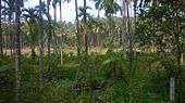
Geography
Veyapara is the highest place in Narayamkulam. we can see whole part of Kozhikode and western part of Wayanad from Veyapara.
Economy
People are following many kind of economic cooperation
1 panam payattu
2 sahayakuri
There are many kutumbasree units. Contribution of these are valuable in the economic and social development of the village.
Thandappuram is the main part of Narayamkulam..
Transportation
Narayamkulam village connects to other parts of India through Vatakara town on the west and Kuttiady town on the east. National highway No.66 passes through Vatakara and the northern stretch connects to Goa and Mumbai. The southern stretch connects to Cochin and Trivandrum. The eastern National Highway No.54 going through Kuttiady connects to Mananthavady, Mysore and Bangalore. The nearest airports are at Kannur and Kozhikode. The nearest railway station is at Koyilandy.