Narpatganj
| Narpatganj Madhura | |
|---|---|
| Town | |
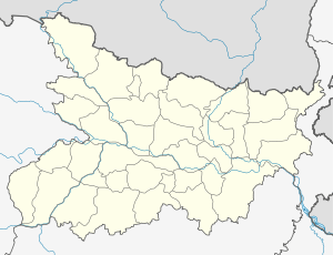 Narpatganj Location in Bihar, India | |
| Coordinates: 26°20′0″N 87°6′0″E / 26.33333°N 87.10000°ECoordinates: 26°20′0″N 87°6′0″E / 26.33333°N 87.10000°E | |
| Country |
|
| State | Bihar |
| District | Araria |
| Government | |
| • Body | Narpat Ganj |
| Area | |
| • Total | 2,828.83 km2 (1,092.22 sq mi) |
| Elevation | 68 m (223 ft) |
| Population | |
| • Total | 1.8 million |
| • Density | 1,000/km2 (3,000/sq mi) |
| Languages | |
| • Official | Maithili, Hindi |
| Time zone | IST (UTC+5:30) |
| PIN | 854335 |
| Telephone code | 06455 |
| Vehicle registration | BR38 |
| Coastline | 500 kilometres (310 mi) |
| Nearest city | Forbesganj, Katihar |
| Sex ratio | 89.94% ♂/♀ |
| Literacy | 48%% |
| Lok Sabha constituency | Narpatganj |
| Civic agency | Narpat Ganj |
| Climate | Humid (Köppen) |
| Precipitation | 1,020 millimetres (40 in) |
| Avg. summer temperature | 32 °C (90 °F) |
| Avg. winter temperature | 3 °C (37 °F) |
| Website |
www |
Narpatganj is a town in Araria district of Bihar state, India.
Geography
Narpatganj is one of the 9 blocks in Araria district. The total population of the block is 270,128. There are 64 villages and 0 towns in this block. The literacy rate is 34.71%. The female literacy rate is 20.56%. The male literacy rate is 47.22%.
Narpatganj Town And village list
1. Ajitnagar 2. Amrori 3. Anchraand Hanuman nagar 4. Baghua Dibiganj 5. Bardaha 6. Barhara 7. Barhepara 8. Bariarpur 9. Barmotra Arazi 10. Basmatiya 11. Bela 12. Belsandi 13. Belwa 14. Bhadwar 15. Bhairoganj 16. Bhanghi 17. Bhawanipur 18. Bhorhar 19. Chakorwa 20. Dahrahra 21. Damiya 22. Dargahiganj 23. Dombana 24. Dumari 25. Fatehpur 26. Gadhgawan 27. Garuha Bishunpur 28. Ghurna 29. Goarpuchhri 30. GokhulPur 31. Hanumannagar 32. Jitwarpur 33. Kamat Pathraha 34. Kandhaili 35. khaira 36. Khapdeh 37. Kochgaon 38. koskapur 39. Kuchgaon 40. Lachhmipur 41. Madhubani 42. Madhura 43. Maheshpatti 44. Manikpur 45. Mirdaul 46. Nathpur 47. Nawabganj 48. Parasi 49. Patehpur Arazi 50. Pathraha 51. Pathraha 52. Pharhi 53. Pithaura 54. Pokharia 55. Posdaha 56. Rajganj 57. Ramghat 58. Rewahi 59. Sahabganj 60. Sawaldeh 61. Shyamnagar 62. Sonapur 63. Tamganj 64. Tamganj Toufir 65. Tope Nawabganj
Location
National Highway 57 passes through Narpatganj. Nearest airport is Bagdogra airport.
References
Nearest airport is Bagdogra closed to Nepal and Bihar,adjacent to Siliguri.