Naryab
| Naryab نرياب Narai Oba ('thin water') | |
|---|---|
| Town and Union Council | |
| Country | Pakistan |
| Region | Khyber Pakhtunkhwa |
| District | Hangu District |
| Tehsil | Thall |
| Elevation | 969 m (3,179 ft) |
| Time zone | PST (UTC+5) |
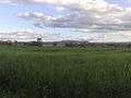
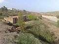
Naryab(نرياب) is a town and union council of Hangu District in Khyber Pakhtunkhwa, Pakistan. It is an old village of the Kohat Division and there is a Small Dam in upper area of Naryab by which the farmers of that village irrigate their farms.[1]
Naryab is bordered by Zargari to the north, Kahi to the east, Tora Wari to the west, and Doaba to the south.
Tribes
The main tribe in Naryab is Badha Khel,"Bangash" which is a dispersed sub-tribe of Para Chamkani, now affiliated with the Bangash tribe. Their second faction is in the neighboring village Chapri Naryab, which is considered a part of the Orakzai tribe. The third faction is in the Ali Zai area of Orakzai Agency in the Shiite Belt, which is affiliated with Orakzai. The fourth faction is in the Mirali area of North Waziristan, named as Bado Khel which is affiliated with the Dawar tribe. Their main tribe is in Karman Area of Kurram Agency which is considered a sub-tribe of the Turi tribe i.e. a major Shiite tribe by belief. But in history, these all factions are of the same sub-tribe of the tribe known as Para Chamkani.
History
The history of Naryab dates back to three hundred years, when this specific region was populated by the migrants from Kurram Agency. It was the same era when the Karman area was being populated by the Bada Khel sub-tribe of Para Chamkani. These Bada Khels, after settling in Karman, began to convert to Shiite sact under the influence of Turis of the region. According to the Bada Khels of Karman, some families who later migrated to Orakzai Agency also adopted Shiite faith under the influence of the local people. But the Bada Khel families migrated to Naryab and North Waziristan, only changed their tribal identity, and by belief they remained Ahl-e-Sunnat. The reason for the dispersal of this sub-tribe of Para Chamkani is unknown, but the most widely believed cause is their clash with other sub-tribes of the same tribe.[2]
References
Coordinates: 33°29′2″N 70°46′53″E / 33.48389°N 70.78139°E