Nash Harbor, Alaska
| Nash Harbor, Alaska | |
|---|---|
| Unincorporated community | |
|
| |
 Nash Harbor, Alaska | |
| Coordinates: 60°12′20″N 166°56′18″W / 60.20556°N 166.93833°WCoordinates: 60°12′20″N 166°56′18″W / 60.20556°N 166.93833°W | |
| Country | United States |
| State | Alaska |
| Census Area | Bethel |
| Government | |
| • State senator | Lyman Hoffman (D) |
| • State rep. | Bob Herron (D) |
| Elevation | 0 ft (0 m) |
| Time zone | Alaska (AKST) (UTC-9) |
| • Summer (DST) | AKDT (UTC-8) |
| Area code(s) | 907 |
| GNIS feature ID | 1406850[1] |

Nash Harbor is an unincorporated community on Nunivak Island in Bethel Census Area, Alaska, United States. Nash Harbor is located on the western shore of the bay of the same name, on the northern coast of the island. It lies 35 miles (56 km) west of Mekoryuk, the main city on the island.[2] The community was originally an Yupik settlement and had a population of 49 in 1950.[1] Ellikarrmiut Summer Science Field Camp, a college-level biology camp, is held in Nash Harbor.[2][3]
References
- 1 2 "Nash Harbor". Geographic Names Information System. United States Geological Survey.
- 1 2 Bauman, Margaret (August 30, 2004). "NIMA looks to education, tourism for next generation". Alaska Journal of Commerce. Archived from the original on February 27, 2006.
- ↑ "Ellikarrmiut Summer Science Field Camp". Kuskokwim Campus of the University of Alaska Fairbanks. Retrieved January 10, 2013.
Further reading
- Paul Souders. Ellikarrmiut Economy. Animal Resource Use at Nash Harbor (49-NI-003), Nunivak Island, Alaska. Archaeology at Nash Harbor; bibliography.
Municipalities and communities of Bethel Census Area, Alaska, United States | ||
|---|---|---|
| Cities | 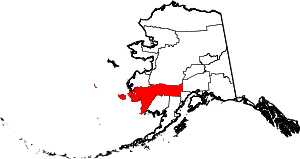 | |
| CDPs | ||
| Unincorporated communities | ||
| Ghost towns | ||
| Neighborhoods | ||
This article is issued from Wikipedia - version of the 9/14/2016. The text is available under the Creative Commons Attribution/Share Alike but additional terms may apply for the media files.