Neštin
| Neštin Нештин | |
|---|---|
| Village | |
|
Neštin | |
 Map of the Bačka Palanka municipality, showing the location of Neštin | |
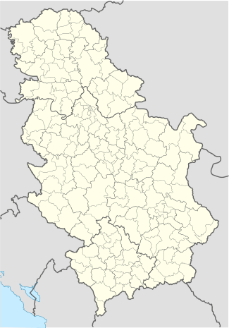 Neštin Map of the Bačka Palanka municipality, showing the location of Neštin | |
| Coordinates: 45°13′34″N 19°27′00″E / 45.226°N 19.45°ECoordinates: 45°13′34″N 19°27′00″E / 45.226°N 19.45°E | |
| Country |
|
| Province |
|
| Population (2002) | |
| • Total | 900 |
| Time zone | CET (UTC+1) |
| • Summer (DST) | CEST (UTC+2) |

Neštin (Serbian Cyrillic: Нештин) is a village located in the Bačka Palanka municipality, in the South Bačka District of Serbia, although it is not geographically located in Bačka, but in Syrmia. The village is situated in the Autonomous Province of Vojvodina. The population of Neštin numbering 900 people (2002 census), of whom 689 are ethnic Serbs. Vine produced in Neštin is famous.
Situated across the Danube from the municipality centre, Neštin is a practical exclave, as the shortest road (9 km) linking it with Bačka Palanka (across the Ilok–Bačka Palanka Bridge) leads halfway through the territory of Croatia, and includes two border crossings. Tightened border regime due to Croatia's accession to the European Union in 2013 caused inconvenience for daily commuting of pupils and workers. Agriculture producers of Neštin were hit in particular, because transport of goods through Croatia was not permitted anymore without extensive paperwork.[1]
Historical population
- 1961: 1,217
- 1971: 1,088
- 1981: 1,043
- 1991: 1,002
See also
References
- Slobodan Ćurčić, Broj stanovnika Vojvodine, Novi Sad, 1996.
- ↑ Do opštine preko granice (in Serbian), Radio Television of Serbia, 7 July 2013
External links
| Wikimedia Commons has media related to Neštin. |