Neckertal
| Neckertal | ||
|---|---|---|
_282.JPG) | ||
| ||
 Neckertal | ||
|
Location of Neckertal 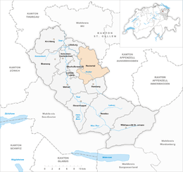 | ||
| Coordinates: 47°20′N 9°8′E / 47.333°N 9.133°ECoordinates: 47°20′N 9°8′E / 47.333°N 9.133°E | ||
| Country | Switzerland | |
| Canton | St. Gallen | |
| District | Toggenburg | |
| Area[1] | ||
| • Total | 49.03 km2 (18.93 sq mi) | |
| Elevation | 660 m (2,170 ft) | |
| Population (Dec 2015[2]) | ||
| • Total | 3,997 | |
| • Density | 82/km2 (210/sq mi) | |
| Postal code |
9125 Brunnadern 9122 Mogelsberg 9127 St. Peterzell 9115 Dicken 9114 Hoffeld 9123 Nassen 9126 Necker 9105 Wald/Schönengrund | |
| SFOS number | 3378 | |
| Localities | Brunnadern, St. Peterzell, Mogelsberg, Wald-Schönengrund, Nassen, Hoffeld, Ebersol, Dicken, Dieselbach, Necker | |
| Surrounded by | Oberhelfenschwil, Wattwil, Hemberg, Degersheim, Ganterschwil, Lütisburg, Schwellbrunn (AR), Schönengrund (AR) | |
| Website |
www SFSO statistics | |

Neckertal is a municipality in the Toggenburg district of the Canton of St. Gallen, Switzerland.
It was formed on January 1, 2009, through the merger of Brunnadern, St. Peterzell, and Mogelsberg.[3]
Geography

Neckertal has an area of 49.03 km2 (18.93 sq mi).[1] As of 2012, a total of 26.17 km2 (10.10 sq mi) or 53.4% is used for agricultural purposes, while 19.51 km2 (7.53 sq mi) or 39.8% is forested. The rest of the municipality is 2.8 km2 (1.1 sq mi) or 5.7% is settled (buildings or roads), 0.29 km2 (0.11 sq mi) or 0.6% is either rivers or lakes and 0.23 km2 (0.089 sq mi) or 0.5% is unproductive land.[4]
During the same year, housing and buildings made up 3.0% and transportation infrastructure made up 2.0%. A total of 36.9% of the total land area is heavily forested and 2.9% is covered with orchards or small clusters of trees. Of the agricultural land, 51.7% is pasturage and 1.1% is used for alpine pastures. All the water in the municipality is flowing water.[4]
It is made up of the villages of Brunnadern, St. Peterzell, and Mogelsberg as well as the hamlets of Wald-Schönengrund, Dicken, Nassen, Hoffeld, Dieselbach, Ebersol and Necker.
Demographics
Neckertal has a population (as of December 2015) of 3,997.[5] As of 2012, 7.9% of the population are resident foreign nationals. Between the last 2 years (2010-2012) the population changed at a rate of -2.0%. Migration accounted for -2.1%, while births and deaths accounted for 0.2%.[6]
Most of the population (as of 2000) speaks German (95.5%) as their first language, French is the second most common (0.2%) and Italian is the third (0.9%).[6]
As of 2012, children and teenagers (0–19 years old) make up 23.8% of the population, while adults (20–64 years old) make up 60.8% and seniors (over 64 years old) make up 15.3%.[6]
As of 2010, there were 460 households that consist of only one person and 206 households with five or more people.[7] As of 2012, the construction rate of new housing units was 0.5 new units per 1000 residents.[6] The vacancy rate for the municipality, in 2013, was 0.7%. In 2012, single family homes made up 56.9% of the total housing in the municipality.[8]
On 1 January 2009 there were 1,838 households in the municipality.[9]
Historic population
The historical population is given in the following chart:[10]

Economy
As of 2011, Neckertal had an unemployment rate of 1.51%. As of 2011, there were a total of 1,531 people employed in the municipality. Of these, there were 374 people employed in the primary economic sector and about 168 businesses involved in this sector. 404 people were employed in the secondary sector and there were 76 businesses in this sector. 753 people were employed in the tertiary sector, with 190 businesses in this sector.[6] Of the working population, 14.5% used public transportation to get to work, and 46.1% used a private car.[6]
In 2012 the average local and cantonal tax rate on a married resident, with two children, of Neckertal making 150,000 CHF was 10.6%, while an unmarried resident's rate was 17.9%.[11] For comparison, the average rate for the entire canton in 2011, was 11.9% and 20.7%, while the nationwide average was 12.3% and 21.1% respectively.[12]
In 2010 there were a total of 1,636 tax payers in the municipality. Of that total, 419 made over 75,000 CHF per year. There were 33 people who made between 15,000 and 20,000 per year. The greatest number of workers, 436, made between 50,000 and 75,000 CHF per year. The average income of the over 75,000 CHF group in Neckertal was 110,379 CHF, while the average across all of Switzerland was 131,244 CHF.[13]
In 2011 a total of 0.0% of the population received direct financial assistance from the government.[14]
Heritage sites of national significance
There are three buildings in Mogelsberg that are listed as Swiss heritage sites of national significance. They are the Haus Näf, the Oberes Türmlihaus and the Unteres Türmlihaus. The entire village of Mogelsberg and the Spreitenbach / Furth area are both part of the Inventory of Swiss Heritage Sites.[15]
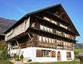 Haus Näf at Furt 520
 Oberes Türmlihaus at Furtstrasse 93
 Unteres Türmlihaus at Furtstrasse 95
Politics
In the 2011 federal election the most popular party was the Swiss People's Party (SVP) which received 37.1% of the vote. The next three most popular parties were the Christian Democratic People's Party (CVP) (17.4%), the FDP.The Liberals (13.7%) and the Social Democratic Party (SP) (12.3%). In the federal election, a total of 1,377 votes were cast, and the voter turnout was 46.5%.[16]
Religion
In 2000 about 53.9% of the population belonged to a Protestant church, 31.2% were Roman Catholic and 7.5% had no religious affiliation.[6]
Education
In Neckertal about 51.4% of the population have completed non-mandatory upper secondary education, and 14.5% have completed additional higher education (either university or a Fachhochschule).[6]
References
- 1 2 Arealstatistik Standard - Gemeindedaten nach 4 Hauptbereichen
- ↑ Swiss Federal Statistical Office - STAT-TAB, online database – Ständige und nichtständige Wohnbevölkerung nach institutionellen Gliederungen, Geburtsort und Staatsangehörigkeit (German) accessed 30 August 2016
- ↑ Amtliches Gemeindeverzeichnis der Schweiz published by the Swiss Federal Statistical Office (German) accessed 14 January 2010
- 1 2 Swiss Federal Statistical Office-Land Use Statistics 2009 data (German) accessed 25 March 2010
- ↑ Swiss Federal Statistical Office - STAT-TAB, online database – Ständige und nichtständige Wohnbevölkerung nach institutionellen Gliederungen, Geburtsort und Staatsangehörigkeit (German) accessed 30 August 2016
- 1 2 3 4 5 6 7 8 Swiss Federal Statistical Office accessed 8 August 2014
- ↑ Swiss Federal Statistical Office - Haushaltsgrösse (German) accessed 8 May 2013
- ↑ Statistischer Atlas der Schweiz - Anteil Einfamilienhäuser am gesamten Gebäudebestand, 2012 accessed 5 August 2014
- ↑ City of Neckertal website-numbers (German) accessed 15 January 2010
- ↑ Federal Statistical Office STAT-TAB Bevölkerungsentwicklung nach Region, 1850-2000 (German) accessed 29 January 2011
- ↑ Statistischer Atlas der Schweiz - Steuerbelastung, 2012 Politische Gemeinden (German) accessed 4 August 2014
- ↑ Swiss Federal Tax Administration - Grafische Darstellung der Steuerbelastung 2011 in den Kantonen (German) (French) accessed 17 June 2013
- ↑ Federal Tax Administration Report Direkte Bundessteuer - Natürliche Personen - Gemeinden - Steuerjahr 2010 (German) (French) accessed 5 August 2014
- ↑ Statistischer Atlas der Schweiz - Bezüger/-innen von Sozialhilfeleistungen (Sozialhilfeempfänger/-innen), 2011 accessed 18 June 2013
- ↑ Swiss inventory of cultural property of national and regional significance 21.11.2008 version, (German) accessed 15-Jan-2010
- ↑ Swiss Federal Statistical Office 2011 Election (German) accessed 8 May 2012
External links
- Official website (German)
- Neckertal in German, French and Italian in the online Historical Dictionary of Switzerland.
- Brunnadern in German, French and Italian in the online Historical Dictionary of Switzerland.
- Mogelsberg in German, French and Italian in the online Historical Dictionary of Switzerland.
| Wikimedia Commons has media related to Neckertal. |