Nesflaten
| Nesflaten | |
|---|---|
| Village | |
|
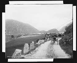
View of the village (c. 1880s) | |
 Nesflaten  Nesflaten Location in Rogaland county | |
| Coordinates: 59°38′47″N 06°47′59″E / 59.64639°N 6.79972°ECoordinates: 59°38′47″N 06°47′59″E / 59.64639°N 6.79972°E | |
| Country | Norway |
| Region | Western Norway |
| County | Rogaland |
| District | Ryfylke |
| Municipality | Suldal |
| Elevation[1] | 88 m (289 ft) |
| Time zone | CET (UTC+01:00) |
| • Summer (DST) | CEST (UTC+02:00) |
| Post Code | 4244 Nesflaten |
Nesflaten is a village in Suldal municipality in Rogaland county, Norway. The village is located on the northern end of the lake Suldalsvatnet, just west of the smaller village of Roalkvam. Nesflaten lies along the Norwegian National Road 13 which connects it to the village of Suldalsosen to the southwest and to the village of Botnen (in the neighboring municipality of Odda in Hordaland county). Nesflaten Chapel is located in the village.
The village lies in a valley in the northwestern part of Suldal. It is surrounded by many mountains to the northwest of the village including Mælen, Trollaskeinuten, Fitjanuten, Vassdalseggi, Kistenuten, and Knoda.
References
- ↑ "Nesflaten, Suldal (Rogaland)" (in Norwegian). yr.no. Retrieved 2015-05-25.
This article is issued from Wikipedia - version of the 8/4/2016. The text is available under the Creative Commons Attribution/Share Alike but additional terms may apply for the media files.