New York State Route 100C
| ||||
|---|---|---|---|---|
|
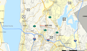
Map of Westchester County in southeastern New York with NY 100C highlighted in red | ||||
| Route information | ||||
| Auxiliary route of NY 100 | ||||
| Maintained by NYSDOT | ||||
| Length: | 1.24 mi[1] (2.00 km) | |||
| Existed: | late 1930s[2][3] – present | |||
| Major junctions | ||||
| West end: |
| |||
|
| ||||
| East end: |
| |||
| Location | ||||
| Counties: | Westchester | |||
| Highway system | ||||
| ||||

New York State Route 100C (NY 100C) is an east–west spur route of NY 100 located in Westchester County, New York, in the United States. It extends for 1.24 miles (2.00 km) as Grasslands Road along the Greenburgh–Mount Pleasant town line from an intersection with NY 9A (Saw Mill River Road) to a junction with NY 100 and NY 100A. NY 100C has a junction with the Sprain Brook Parkway near its eastern terminus. The eastern terminus of NY 100C also serves as NY 100A's northern endpoint.
Route description

NY 100C begins at an interchange with NY 9A (Saw Mill River Road) in the town of Greenburgh. The route heads eastward as Grasslands Road, a continuation of County Route 303 (CR 303, an unsigned route) which heads towards the hamlet of Eastview. Just east of the interchange, NY 100C crosses through a commercial park, entering the town of Mount Pleasant for a short distance before paralleling the Greenburgh town line. Along this line, NY 100C enters a grade-separated interchange with the Sprain Brook Parkway. A short distance from the interchange, NY 100C intersects with NY 100 (Bradhurst Avenue) and NY 100A (Knollwood Road). This intersection serves as the eastern terminus of NY 100C, as Grasslands Roads continues east as NY 100.[4]
History
All of what is now NY 100C was originally designated as part of NY 142 c. 1931. At the time, NY 142 overlapped with NY 9A along Old Saw Mill River Road (modern CR 303) to the east end of Neperan Road, where it broke from NY 9A and proceeded toward Hawthorne on then-Saw Mill River Road.[5][6] The NY 142 designation was short-lived, however, as it was eliminated c. 1938.[2][7] By 1940, the portion of NY 142's former routing northeast of the NY 9A overlap was replaced by an extended NY 141 while the section east of the concurrency on Grasslands Road was redesignated as NY 100C.[3] In the late 1940s, NY 9A was extended northward through Hawthorne to Ossining by way of a realigned Saw Mill River Road. The portion of Old Saw Mill River Road between Grasslands Road and the new highway became a short extension of NY 100C.[8][9]
Major intersections
The entire route is on the border between the towns of Greenburgh and Mount Pleasant, Westchester County.
| mi[1] | km | Destinations | Notes | ||
|---|---|---|---|---|---|
| 0.00 | 0.00 | Interchange | |||
| 0.20 | 0.32 | Saw Mill Road (CR 303) | Former routing of NY 9A | ||
| 1.10 | 1.77 | ||||
| 1.24 | 2.00 | Northern terminus of NY 100A | |||
| 1.000 mi = 1.609 km; 1.000 km = 0.621 mi | |||||
See also
.svg.png) New York Roads portal
New York Roads portal
References
- 1 2 "2008 Traffic Data Report for New York State" (PDF). New York State Department of Transportation. June 16, 2009. p. 237. Retrieved January 10, 2010.
- 1 2 Shell Road Map – New York (Map). Cartography by H.M. Gousha Company. Shell Oil Company. 1937.
- 1 2 New York Info-Map (Map). Cartography by Rand McNally and Company. Gulf Oil Company. 1940.
- ↑ Microsoft; Nokia (April 18, 2012). "overview map of NY 100" (Map). Bing Maps. Microsoft. Retrieved April 18, 2012.
- ↑ Road Map of New York (Map). Cartography by General Drafting. Standard Oil Company of New York. 1930.
- ↑ New York (Map). Cartography by H.M. Gousha Company. Kendall Refining Company. 1931.
- ↑ New York Road Map for 1938 (Map). Cartography by General Drafting. Esso. 1938.
- ↑ Official Highway Map of New York State (Map) (1947–48 ed.). Cartography by General Drafting. State of New York Department of Public Works.
- ↑ New York (Map) (1950 ed.). Cartography by General Drafting. Esso. 1949.
External links
| Wikimedia Commons has media related to New York State Route 100C. |
- New York State Route 100C at New York Routes • New York State Highway Termini
- NY 100C (Greater New York Roads)