Taconic State Parkway
| |
|---|---|
|
Map of southeastern New York with the Taconic State Parkway highlighted in red | |
| Route information | |
| Maintained by NYSDOT | |
| Length: | 104.12 mi[1] (167.56 km) |
| Existed: | 1925 – present |
| Restrictions: | No trucks; No vehicles over 10 feet |
| Major junctions | |
| South end: |
|
| North end: |
|
| Location | |
| Counties: | Westchester, Putnam, Dutchess, Columbia |
| Highway system | |
|
Taconic State Parkway | |
| Area | 7,067 acres (2,860 ha) |
| NRHP Reference # | 05001398[2] |
| Added to NRHP | December 8, 2005 |

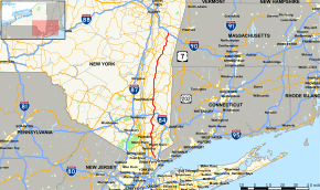
The Taconic State Parkway (often called the Taconic or the TSP and known administratively as New York State Route 987G or NY 987G), is a 104.12-mile (167.56 km) divided highway between Kensico Dam and Chatham, the longest parkway in the U.S. state of New York. It follows a generally northward route midway between the Hudson River and the Connecticut and Massachusetts state lines, along the Taconic Mountains. Its southernmost three miles are a surface road; from the junction with the Sprain Brook Parkway northward it is a limited-access highway. It has grade-separated interchanges from that point to its northern terminus; in the three northern counties there are also at-grade intersections, many with closed medians, allowing only right-in/right-out turns. It is open only to passenger vehicles, as with other parkways in New York, and maintained by the state Department of Transportation (NYSDOT), the fourth agency to have that responsibility.
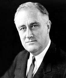
Franklin D. Roosevelt, who had long envisioned a scenic road through the eastern Hudson Valley, was instrumental in making it a reality as a way to provide access to existing and planned state parks in the region. Its winding, hilly route was designed by landscape architect Gilmore Clarke to offer scenic vistas of the Hudson Highlands, Catskills and Taconic regions. The bridges and now-closed service areas were designed to be aesthetically pleasing. It has been praised for the beauty of not only the surrounding landscape and views it offers, but the way the road itself integrates with and presents them.
It was completed in its present form in the early 1960s. In 2005 the entire highway, including its supporting structures, were listed on the National Register of Historic Places in recognition of its historic importance in the development of parkways in the 20th century, and Roosevelt's role in creating it. It is the second-longest continuous road listed on the Register after Virginia's Skyline Drive, and the longest limited-access highway.[note 1]
The parkway continues to provide access to several state parks, including one named for Roosevelt. It has also become an important regional artery, one of the primary routes to northern New England and upstate New York from New York City and Long Island. The southern sections, particularly in Westchester County, have become a commuter route into the city for residents who moved into towns that became suburbanized as a result of the parkway. The state and regional transportation planners have worked to adapt to this change since the 1940s.
Route description
The Taconic's character changes with its surroundings. In the busy suburbs of its first few miles, it is an arterial surface road, paralleling a commuter rail line through a small downtown. Soon after that it becomes a wide divided highway, with median strips and gentle turn radii similar to an Interstate Highway carrying much commuter traffic.
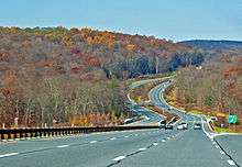
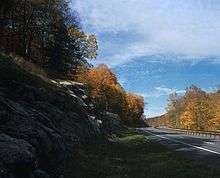
In the Hudson Highlands, it narrows again as it curves back and forth and climbs up and down quickly to its highest point. When the terrain levels out again, it widens and begins to assume its scenic character in a growing, exurban area with at-grade intersections. Its northernmost section, located on the ridges between the Hudson Valley and the mountains along the state borders to the east, offers mountain and hilltop vistas as the road itself continues to curve gently through bucolic surroundings. This winding route contributes to its 104.12-mile (167.56 km) length, which makes the parkway the state's longest.[3]
Westchester County
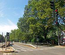
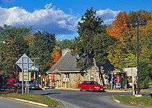
The Taconic begins at Kensico Circle, just south of Kensico Dam, in the town of Mount Pleasant, also the northern terminus of the Bronx River Parkway, at that point a surface road. The roadway here is narrow, with two lanes in either direction divided by a metal box beam median barrier. It curves northwest to a traffic light at Cleveland Street in the hamlet of Valhalla. The Valhalla station on Metro-North Railroad's Harlem Line is on the west side, with the downtown area on the east. It is the only densely developed community the road goes through rather than near.
After crossing under the stone arch bridge carrying Legion Drive over the parkway, the first of many such rustic overpasses, the Taconic begins a long section going past Gate of Heaven Cemetery and paralleling the railroad tracks past the small Mount Pleasant train station, built to allow access to the surrounding cemetery of that name. The road then crosses over the train line into a wooded area where the two roadways split wide apart, becoming onramps to the Sprain Brook Parkway.
At the merge, the Sprain Brook, a wider road with three lanes in each direction, a mostly cleared median strip and shoulders on either side, becomes the Taconic. A thousand feet (300 m) to the north, an elaborate three-level stack interchange allows access to the Saw Mill River Parkway northbound (and southbound from the southbound lanes). North of the interchange power lines and Saw Mill River Road (New York State Route 9A or NY 9A and NY 100) on the west parallel the parkway past undeveloped Graham Hills County Park. The next exit, at Bedford Road (NY 117), serves Pleasantville to the east. Just north of it a short fork allows traffic to divert to NY 9A and 100, which split away toward Briarcliff Manor.
The Taconic continues north through a minimally developed area of low hills, past another exit serving Pleasantville, and then across another town line into New Castle. Route 100 returns to parallel the highway on the west again, then joins NY 133 at the next exit, serving Ossining and Millwood. A half-mile north of that exit, northbound traffic can also exit, and southbound traffic enter, at Pines Bridge Road.
The roadways grow far apart over the next mile before coming together again at the NY 134 exit, as Turkey Mountain, one of the Manhattan Hills, looms ahead.[4] Just past it they enter Yorktown, the last town along the Taconic in Westchester County, and split again until they are 1500 feet (450 m) apart, with neighborhoods and houses between them, to the two bridges over New Croton Reservoir, part of the New York City water supply system. Once on the other side, in the town of Yorktown, they converge again to their previous width. The next exit, at Underhill Avenue, provides access to downtown Yorktown and the reservoir.
Past the Baldwin Road exit a half-mile north of Underhill, the Taconic curves westward along the south side of Mohansic Lake. When the road returns to a northerly course, an exit allows entrance to Franklin D. Roosevelt State Park. It is followed by the Crompond Road (U.S. Route 202 or US 202 and NY 35) exit, which serves Peekskill to the west as well as Yorktown. Just beyond it Bear Mountain Parkway, a legacy of the Taconic's original planned route and purpose, leaves to the west as the road drops into a wide valley carved by a tributary of the Hudson, the first place where the road begins to respond to the increasing relief of the landscape.
It passes through undeveloped woods, part of another local park, and under a foot bridge carrying a hiking trail. Curving northeast, the exits for NY 132 and US 6 (recently improved), with residences on either side of the parkway, herald Shrub Oak and Jefferson Valley. A short distance past that exit, the parkway crosses into Putnam County.
Putnam County
The road narrows shortly after the county line in the town of Putnam Valley, with the roadways reverting to two lanes and the shoulders replaced by soft curbs, in preparation for the rugged terrain of the next 12 miles (19 km). Curves become sharper, with the widest having a radius of 11,459 feet (3,493 m).[5] It remains generally level for the first two miles (3 km), past the Bryant Pond Road exit serving Mahopac. The land around the road is heavily wooded and less developed than it was in Westchester.
A mile (1.6 km) to the north, the road begins to descend 350 feet (110 m) in 1.1 mile (1.8 km) alongside a steep ridge, narrowing to less than a hundred feet (30 m), with a high stone retaining wall along the east side, to Peekskill Hollow Creek and the exit for the similarly named road, briefly entering the town of Carmel in the process.[6] It starts to climb again just past the exit, and a half-mile (1 km) to the north it goes into an S-curved section with both segments having extremely narrow radii. The Taconic moves to the east in the process, then resumes its roughly northward heading up the Roaring Creek valley into Clarence Fahnestock State Park. For the next 5.5 miles (8.9 km) it will cross this 14,000 acres (5,700 ha) protected area of the eastern Hudson Highlands, with no development visible from the highway.
Pudding Street, a mile into the park, is the first road to cross at grade since Mt. Pleasant. The roadways begin to separate as the parkway's ascent continues through heavily wooded terrain past rocky cliffs and outcrops between two lakes. Next to a now-closed overlook on the eastern side, with the two roadways 500 feet (150 m) apart in densely wooded country, signs on both roadways mark the Taconic's highest elevation, almost 1,200 feet (370 m) above sea level.[4]
A short distance beyond that, a stone bridge marks the NY 301 exit that serves as the main access for the state park and the bathing area and hiking trails at nearby Canopus Lake. The parkway begins to descend again, entering its last Putnam County town, Kent. It bends east again, and within two miles it crosses into Dutchess County.
Dutchess County
Continuing its easterly slant, the Taconic starts leveling out in Dutchess County, the largest county segment of any of the four counties along the road,[7] entering the town of East Fishkill. Just south of the Miller Hill Road exit, the first in the county, the road widens, with grassy slopes on its east side. At this point the hills further north are visible in the distance, and the valley to the west, between Hosner and Shenandoah mountains, opens up occasional scenic vistas to the west.

A grade crossing with a flashing overhead warning beacon was replaced in 2000 by a grade-separated exit, making the Appalachian Trail's crossing here less hazardous.[8] The Taconic levels off into a narrow section bearing due northeast along Hosner Mountain's steep west slope, with stone walls on either side. This ends after a mile with the Interstate 84 (I-84) interchange, the only full cloverleaf along the Taconic.[9]
North of the Interstate Highway, the parkway bends to the northwest and starts to assume the character it retains through most of Dutchess County, with a wider, intermittently cleared median and gentler turns (their radii reaching almost 23,000 feet (7,000 m), more than twice that of the widest curve in Putnam County[9]), taking it through the now lower hills. There are still no shoulders. A closed rest area sits in the median between I-84 and the NY 52 exit two miles further north.
The road then bends back toward the northeast, narrowing again through some wooded stretches over the next few miles to the Beekman Road (County Route 9 or CR 9) exit. This area, rural and agricultural when the highway was built, has become more developed in the last decades, with residential subdivisions and golf courses replacing the silos and haystacks as landmarks off the road.
A long curve back to the northwest again takes the Taconic to the first of its two interchanges with NY 82, at Arthursburg. Almost a mile to its north, the Arthursburg Road at-grade crossing has been closed, and a southbound off-ramp and on-ramp were built. The road bends back north into the town of LaGrange to the next exit a half-mile beyond, at Noxon Road (CR 21), a new exit accessible only to northbound traffic via an off-ramp.
The road widens through a wooded area and then narrows past another service area just before Todd Hill Road. The road drops to cross a creek, then rises again to the NY 55 exit, one of two roads serving the city of Poughkeepsie to the west, near Freedom Plains. Its slow undulation with the landscape continues past the now closed Skidmore Road grade crossing as it heads due north into the town of Pleasant Valley and the less developed half of Dutchess County.
The roadways separate widely (750 feet, or 215 m) again for a mile in the woods east of James Baird State Park. An entry road forks to the left from the northbound lane and crosses the southbound lane via an underpass with on/off ramp. The two roadways descend and come together again by the Mountain Road grade crossing.
It climbs a hill after the McDonnell Road crossing, then descends to the Rossway Road crossing. A quarter-mile (500 m) to the north, a dead-end road leaves the northbound lane for the nearby Taconic–Hereford Multiple Use Area. Several other local roads cross the parkway until it reaches one of its straightest stretches, which then curves to the first grade-separated exit in several miles, US 44, the other main route to Poughkeepsie, between Millbrook and Pleasant Valley.
The road passes through a much more wooded area as it makes a long curve into its next junction, the grade intersection at Hibernia Road. A bridge over Wappinger Creek 0.1 mile (150 m) to the north separates that grade crossing from the one with Hollow Road (CR 14) and takes the road into the town of Clinton. Another half-mile north, at the next exit, NY 115 has its eastern terminus while Salt Point Turnpike continues.
A slight western slant continues as the parkway traverses a landscape now thoroughly rural, with fields and woodlots alternating. Two more grade crossings, at Willow and Pumpkin lanes, follow through a long curve to the east and back. At Nine Partners Road, the Taconic is back on a northward heading as it slips east of the Stanford town line.

It begins to climb onto the high ground between the Hudson and the Taconics to the east. To the west there are occasional glimpses across the river valley to the Catskill Escarpment to the west. From here the parkway bends eastward again, entering the town of Milan and climbs slowly through generally wooded area, passing another grade crossing at Cold Spring Road. The next exit, at NY 199, is the last in Dutchess County. After another long bend east, the Taconic goes north again and crosses into Columbia County just past Roeliff Jansen Kill Multiple Use Area and the Jackson Corners Road (CR 2) exit.
Columbia County
The parkway terrain in Columbia is similar to that in Dutchess, with more views opening up in the north as the road levels out. The surrounding farms and woods get more extensive. After entering the county, the Taconic continues due north through the town of Gallatin through unbroken woods. It bends slightly to the intersection with CR 8 to pass the beach at Lake Taghkanic State Park, with the access road for the park leaving to the east at grade from the northbound lanes where the highway enters the Town of Taghkanic. Another half-mile to the north is the second interchange with NY 82.
North of that exit, the parkway bends to the northeast again, paralleling the orientation of the county as a whole. It crosses briefly into the town of Claverack, then back into Taghkanic before re-entering Claverack as it heads due east briefly, then north again into the NY 23 exit near the hamlet of Martindale. It bends from the northerly heading back to the northeast to cross into Ghent over the next three miles (5 km), where NY 217 comes to its eastern terminus at the exit with the Taconic.
Past a rise beyond that exit, there are scenic overlook parking areas on both sides of the highway with panoramic views west to the Catskills. At night the lights of Albany are visible to the northwest. The road curves again into the town of Austerlitz, where a diner and gas station off grade-separated Rigor Hill Road are accessible at grade.
The Taconic continues on a heading closer to the north from here for five more miles (9 km) to the NY 203 exit in the northwest corner of Austerlitz. It then crosses into Chatham, where signs warn drivers that the NY 295 exit is the last before the Thruway tolls at the end of the road. The grade intersections in the next few miles are open only to southbound traffic, primarily allowing commercial vehicles that have mistakenly ventured onto the parkway to exit. A small toll booth for exit B2 on the Berkshire Section of the New York State Thruway (I-90), marks the administrative end of the Taconic State Parkway, 104 miles (167 km) from Kensico Circle.
Scenery
Landscape architects such as Gilmore Clarke worked closely with engineers and construction crews during the Taconic's construction, often on site. Some features of the road's design address practical considerations and increase safety. Curves that climbed or descended were banked to increase vehicle traction and permit better drainage. Likewise the curves in undulating terrain are located to reduce blind spots at crests and keep the sharpest turns out of valleys. These also make sure that views of distant landscapes open up on downgrades and on long curves, when they are less distracting.[10]
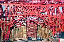
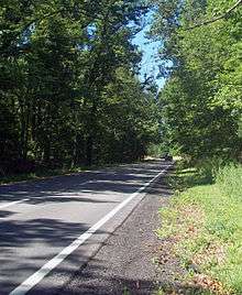
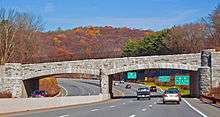
Closer to the road, on the northern sections in Columbia and Dutchess counties, the road was routed to showcase a nearby view of wooded hillside or a farm. Since trucks were not permitted on the road—for some time, this even included privately owned pickup trucks used solely for personal use—in many sections tree branches overhang the roadways, creating a park-like feel. The curve of the northbound AMVETS Memorial Bridge over Croton Reservoir echoes the surrounding hills. On the medians and berms, plantings were carefully planned to maintain continuity with the surrounding woods. On the descent into Peekskill Hollow in Putnam Valley, the trees and shrubs above the retaining wall on the east side were transplanted from the path of the highway, which retained the appearance of the local forest and saved money.[11] Overpasses, both carrying roads over the parkway and carrying it over roads, were faced in native stone.[10] The grade intersections, usually a feature engineers tried to avoid, helped keep local east–west routes open[12] and connect the parkway to the landscape it traversed.[13]
As a result, the Taconic has been the subject of much praise over the years not only for its vistas but for the way it harmonizes with the surrounding landscape. Sociologist Lewis Mumford, who often criticized the effect of superhighway construction on contemporary cities, always advised friends traveling up from New York to visit him at his house in Amenia that they should take the Taconic.[14] He described it as "a consummate work of art, fit to stand on a par with our loftiest creations".[15] The engineers, he said, had avoided "brutal assaults against the landscape". Albany-born novelist William Kennedy, whose family frequently drove the Taconic during his childhood to visit relatives further south, calls it "a 110-mile postcard. It's the most beautiful road I've ever known — in all seasons". "You can drive it with confidence", says automotive writer David E. Davis. "There are no bad surprises about the way the road is engineered."[16] Landscape architect Garret Eckbo called the Taconic "as lovely an integration of highway engineering and landscape architecture as one could hope to find". Commenting on this years later, architecture critic Matthew Gandy wrote:
Clarke's design for the Taconic State Parkway, for example, provides a vivid example of a new kind of mediation among nature, technology and society, with what appears to be a delicate balance between the new infrastructural project and an imaginary natural order. Implicit within this aesthetic dialectic is the notion of engineering as an art form that can in some way embellish or even improve upon nature: there is no radical disjuncture here but a sense of aesthetic progression and purity of form.[17]
In the late 20th and early 21st centuries, with sections of the road modified from its original design and the rest areas mostly gone, writers for The New York Times have variously described the Taconic as "a pleasure to use, evoking those bygone days when people went for a drive just for the fun of it"[15] and "unquestionably among the most scenic roadways in the Northeast, winding along the Hudson Valley with a painter's eye for landscape and a gearhead's idea of fun."[16] The Lonely Planet New York State guidebook calls it a "highway masterpiece".[18]
Engineering
The parkway's engineering principles evolved over the four decades it took to build, with northern sections reflecting improvements in construction technology and lessons learned from the early days of construction. Some aspects of the original road remained consistent from end to end.
The Westchester County sections were laid out by the county's parks commission based on the parkways they had already designed. Its engineers later worked on the design of the upper sections. In its early days, the Taconic State Parks Commission (TSPC) did not have enough money to hire a full engineering staff, with terrain that presented some major challenges. Its engineer, E.J. Howe, on loan from the state's Department of Public Works, frequently complained about the commission's directive that he plan a route only where it had the land or expected to buy it, instead of planning a route and then buying the land. He also began negotiations with landowners, and his position was eliminated from the commission's budget after three years.[19] His successor clashed with his superiors as well, and after he left in 1933 the commission relied on state DPW engineers for the rest of the construction.[20]
Most of the original parkway was surfaced in reinforced concrete. Officials favored it despite its higher initial cost as compared to asphalt since it was less likely to need repair over its 50-year lifespan and reflected more light at night, improving safety.[21] When the parkway reached Columbia County, asphalt was used instead due to its lower cost by that time. Asphalt was also used for repaving of segments to the south; today the original concrete remains only between the US 44 and northern NY 82 exits. From that point to the parkway's northern terminus, the asphalt is original.
The changes in the design of the northern Taconic also reflect higher speeds that mid-century automobiles were capable of, and improvements in construction technology. The track-equipped steam shovels that broke ground for the first section in Putnam County in 1931 were the most advanced excavators of the time. Over the next decade, the costs of moving a cubic yard dropped to almost half of what they had been in the early 1920s.[22] Later in the parkway's development, engineers began using aerial photographs to plan the route.[23]
The road's drainage system had some special features designed to avoid detracting from its scenic qualities. The roadway was crowned, with storm drain grates at the edge since there was no shoulder, to keep water from forming deep puddles that could cause accidents (these have been eliminated from modernized sections of the parkway in Westchester). The soft hand-fluted curbs also helped channel runoff to the basins, and in the median strips a central trench took water to underground pipes which drain into local streams.[21]
The median strips themselves were not part of the original design on the lower sections of the Taconic, save for sections like Fahnestock State Park where designers used them to enhance the scenic capabilities of the road and create recreational opportunities. As the road was extended north during the 1930s, it became clear that the wider medians improved safety without sacrificing beauty, and starting with the NY 52 exit in East Fishkill it was made a standard element of the parkway's design.[24]
History
The Taconic came into being as a result due to the increasing presence of the automobile in American society and the demand for more public parks near crowded cities. Two separate agencies, the Taconic State Park Commission (TSPC) and Westchester County Parks Commission (WCPC), were its initial constructors, building different segments. In time a state authority would take over from them both, and then 18 years later itself yield up to its current administrator, the state Department of Transportation.
It would take nearly four decades to complete from the initial parkway proposal by TSPC chair Franklin D. Roosevelt in 1925 to the opening of the last segment in 1963, due in part to a lengthy hiatus resulting from World War II. Construction technology and highway design standards changed during the construction of the road, changes whose effect is still visible to drivers today. Since its completion it has been renovated, particularly in Dutchess and Westchester counties, reflecting the change in its role from park access route and scenic drive to important regional transportation artery.
Background
Immigration and industrialization caused a major increase in New York City's population in the late 19th and early 20th centuries. In the summertime, many of these newer residents began looking for places to get away from the hot city and the densely populated tenements they lived in. The city's own parks and beaches were often overcrowded. Automobiles became more affordable, and by 1917 there were more cars than horses in the city. Drivers began taking to low-quality roads in search of parks outside the city, but were often disappointed after long drives to find that most of those parks were closed to nonresidents.[25]
In 1900, New York and New Jersey had jointly acquired the Palisades, the cliffs along the west side of the Hudson in both states, to protect them from further damage due to quarrying. Making it a park for city residents to visit on hot summer weekends had not been part of the plan, but it quickly became one. Many residents could not get to it because of insufficient ferry capacity. Its success as a park led to the establishment of the Palisades Interstate Park Commission and the construction of Palisades Interstate Parkway to allow nonstop drives through scenic and wooded areas through Palisades Park up to the Bear Mountain Bridge.[25][26]
During his successful campaign for the State Senate in 1910, Roosevelt had toured the district in a car, still not common in the area, the first candidate to do so. He became more interested in the possibilities of automobile touring ten years later, when paralysis resulting from polio cost him the effective use of his legs, frequently taking his friends on such trips around the region. During them, he began pondering the idea of a north–south parkway through the eastern Hudson Valley.[27]
In 1922, as part of its political reform efforts, the New York State Association (NYSA) published A State Park Plan For New York, the first such comprehensive plan for any state's parks. New York's few parks at that time had been managed by a loose combination of public and private interests, and all the land had been donated to the state since the legislature would not appropriate money for any park outside a city.[28]
The plan's author, NYSA secretary Robert Moses, combined the ideas of association researchers into a document that transformed park planning. It was primarily a statewide plan for acquiring and protecting other large tracts of natural resources not currently in public ownership through a $15 million bond issue, an amount of money far in excess of any previously proposed (equivalent to $212 million in contemporary dollars[29]). A subsequent revision proposed the coordination of state park management and development through various regional park commissions, centralized under a State Council of Parks (SCP), itself to be part of the Conservation Department. For citizens, it advocated the construction of parkways to make these areas accessible to nearby cities via automobile and that areas be developed not only for conservation but also for active outdoor recreation like golf, tennis and picnicking.[28][30]
Moses proposed to Governor Al Smith, whom he served as an aide, that the bond issue be put to voters. After some reluctance, Smith agreed and sent the legislature a formal message to that effect but said he would not send the legislation itself until 1924. He feared opposition to the high cost, but was surprised when reaction was uniformly positive.[31] The legislation creating the administrative structure of the state parks was drafted by Moses, who had been assured by Smith that he would be appointed to the position of executive director for both the SCP and the Long Island State Parks Commission. Seemingly innocuous phrases in the legislation gave the SCP director considerable power. The legislature passed the bill unanimously in 1924.[32] The bond issue passed overwhelmingly that fall.[30][33]
Taconic Parkway plan
Roosevelt was appointed chair of the newly created TSPC. It was expected to focus on the creation of a Tri-State Park along with Connecticut and Massachusetts, to protect and develop the mountainous area around the tripoint where the three states meet (today Taconic State Park). Other than that it had no obvious goals. The 1922 plan had not identified any areas in Columbia or Dutchess counties to protect as parks, and the area's major scenic resources, the Catskills and Taconics, were largely outside its borders.[34] At its third meeting, Roosevelt proposed the commission design and build a parkway along the following route:
Approximately midway between Albany Post Road and the Harlem River Valley and coming out on the west side of Shenandoah Valley, passing thence east of East Fishkill, east of Hopewell, east of Arthursburg, east of Billings, east of Moores Mill, east of Washington Hollow, east of Stanfordville, west of Bangall to the south end of Stissing Mountain, thence over the top of Stissing Mountain through Silvermalls and past Charlotte Lake, thence approximately in a straight line to Philmont and past Chatham, with the idea that at some point north of Chatham would be divide and one fork would lead northeast to Williamstown and the Mohawk Trail and the other fork northwest passing east of Troy, to the Saratoga Battlefield.[35]
Moses had already proposed an alternate route at the first meeting of the commission, which Roosevelt missed. He would have the parkway avoid the rugged terrain of central Putnam County and instead follow the Hudson from the Bear Mountain Bridge up to Cold Spring, where it would then go northeast to the Tri-State Park. That would allow it to pass through a scenic area along the river but created other issues for engineering and land acquisition. The two men lobbied their colleagues for their routes.[36]
Roosevelt eventually won, pointing to a new state highway planned to run north from the bridge (today's US 9W) and that a more direct route would better serve recreational traffic from the city. His was the plan initially adopted by the TSPC and approved by the SCP in July 1925, several months later. Moses relented, but reportedly said the parkway should extend only a few miles north of the city.[36] Roosevelt is reported to have said later the parkway would extend north through the Adirondacks to the Canada–US border.[37] The two men would clash regularly over the next few years over the Taconic Parkway.
Bronx River Parkway Extension plan
The WCPC had built 70 miles (113 km) of parkways on its own[38] by the time the bond issue passed, retaining the services of landscape architect Gilmore Clarke for the latter. One of its most successful had been a joint project with New York City, the Bronx River Parkway, which followed the river of that name north from Soundview in the Bronx 19 miles (31 km) to public picnic grounds at Kensico Dam.[39]
The road had first been proposed in 1895. In 1924 the parkway opened and was instantly popular. Its design was widely emulated on parkways in New York and elsewhere.[39]
The WCPC had begun considering another idea of Moses's, that the Bronx River Parkway could be extended north to the new Bear Mountain Bridge, at the time the only bridge over the river north of the city. Motorists could thus make a 125-mile (201 km) day trip from the city to the Hudson Highlands and back via the Palisades Parkway (which would soon connect directly into the city at the George Washington Bridge).[40]
Two routes were considered for the extension. A western one took it past Briarcliff Manor; an eastern alternative was closer to Pleasantville and Chappaqua. Clarke recommended the western one for its scenery and cheaper land. He also noted that while both crossed the Croton River, the eastern one did so at the reservoir's narrowest point, reducing the costs of a bridge.[41]
It was universally agreed by all the agencies involved — the SCP, TSPC and WCPC — that the Taconic Parkway should extend south of Roosevelt's route through Putnam County and connect to the Bronx River Parkway extension at the former's southern terminus. The TSPC would build from the Putnam County line onwards.[35]
Construction
- 1925–28, route planning and land acquisition
Throughout the late 1920s, both park commissions focused on land acquisition and planning. The WCPC was adequately funded with proceeds from the bond issue and other sources, and was able to accomplish both tasks with relative ease. That was not the case with the TSPC, for several reasons.
The greatest was the animosity between Moses and Roosevelt. The latter had hired his longtime associate Louis Howe as the TSPC's secretary at a salary of $5,000 ($69,000 in contemporary dollars[29]). Moses, as SCP head, was responsible for preparing the council's budget and submitting it to the Conservation commissioner. He told Roosevelt that if he wanted "a secretary and a valet" he would have to pay for it personally.[42]
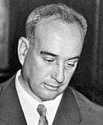
Roosevelt never forgave him for this remark, and Moses later said that this incident was the root of the antipathy between them that lasted into Roosevelt's later presidency. Moses, who also served as New York's Secretary of State for two years during this period, used his influence with the legislature and control of the parks budgeting process to keep the TSPC's finances low enough that it could barely maintain existing facilities under its jurisdiction, much less acquire right-of-way or hire staff.[42]
Other regions and their plans, particularly Moses's domain on Long Island, were well funded. He, and his political patron Smith, felt that the TSPC should focus not on the parkway but the Tri-State Park, which Moses and Smith believed Roosevelt's commission had neglected, along with the donated property that has since become Fahnestock State Park. Moses also wanted to make sure that money was available for the parkways he was building on Long Island.[42][43]
Roosevelt at one point wrote Smith an angry letter complaining that Moses had "skinned us alive" by allegedly lying to the governor and other officials about the TSPC.[43] By early 1928 Roosevelt told the governor that he and the other TSPC commissioners had no choice but to resign if they were to continue to be so poorly served.[42][44] Later that year the lack of funds, along with resistance from local property owners, led the commission to abandon Roosevelt's original hope of routing the parkway over Stissing Mountain.[45]
Smith dissuaded Roosevelt from doing so. The situation was resolved later that year, when Roosevelt was elected governor after Smith stepped down to be the Democratic nominee for president in the 1928 election. In that capacity Roosevelt could no longer serve on the TSPC but could make sure the parkway was built due to his final authority over the proposed state budget. He also rebuffed Smith's efforts to have him retain Moses as Secretary of State, although he could not remove him from the park posts.[42]
- 1929–31, completion of Bronx River Parkway extension
In 1929 construction began on the WCPC section, with the connector to the Taconic getting underway the following year.[46] In April 1931 steam shovels finally broke ground at Shrub Oak for the section built by the TSPC in Putnam County. Roosevelt and Moses both spoke at the ceremony, the former suggesting he still planned for the parkway to one day reach Canada.[47] Eight months later the two rivals were at the north portal of the triple-hinged steel suspension bridge built over the reservoir, at 750 feet (230 m) the longest of that type in the world at the time,[9] for the ribbon cutting ceremony. The next day, 20,000 cars took the new road from the city into the Manhattan Hills. Along the way were public picnic grounds in three areas, and 18 miles (29 km) of bridle paths in the median strip.[46][48]
- 1932–35, Putnam County
They could not yet continue into Putnam County. Ernest Fahnestock had donated the first 2,241 acres (907 ha) of the park named for his late brother. Further north, the TSPC had also acquired Lake Taghkanic and 172 acres (70 ha) around it for development when the parkway eventually reached it. But land prices were rising in Putnam County as a result of the parkway,[49] and the county's Board of Supervisors told the state's Department of Public Works (BPW) that it would not support the parkway since they believed the county had enough roads as it was.[45] As a result, the engineers were told to only survey property once it had been acquired, a policy that they found difficult to follow.
The stretch of road descending into Peekskill Hollow was very problematic. Roosevelt feared that route would take the parkway too far east. It offered a view into the valley as it descended, but to preserve existing rock outcrops it was necessary to route it so that it descended at an 8.5% grade and make the roadway so narrow that there was only a foot (30.5 cm) between the curb and the wall on either side.[50]
The engineering challenges it posed resulted in that stretch costing ten times as much to build as the four miles (6.4 km) to its south had. It was necessary to move 97,000 cubic yards (74,000 m3) of earth and replant 196 trees and 456 shrubs from the right-of-way to the edges. They were joined by 450 more shrubs on the slope above the road, primarily rhododendron and mountain laurel.[51] Roosevelt, still taking an interest in the parkway, forced changes in the stonework of the Peekskill Hollow Road overpass to be more consistent with local architectural traditions. The bridge also had to be re-engineered due to the swampy ground.[50]
Soil difficulties north of Mohansic Lake were making it difficult for the WSPC to complete its section as well. It was finished in late 1932, and paving began on the TSPC's section the following year. The first 2.4 miles (3.9 km) had to be completely redone when the concrete slabs froze in place over the winter due to inadequately built drainage. Bridle paths along the median in this section, to Route 301 and Fahnestock State Park, were opened in 1933. After it was paved with its initial layer, it was opened to the public temporarily on Fourth of July weekend in 1935. It was opened permanently several weeks later after the fine work was done.[52]
- 1935–39, southern Dutchess County
The TSPC took advantage of several New Deal programs that Roosevelt had established upon being elected President in 1932. Funds provided under the National Industrial Recovery Act were used to build the road, while Civilian Conservation Corps (CCC) workers based in camps at the commission's state parks improved the parks and landscaping along the highway. Roosevelt himself was no longer involved as actively as he had been in state office, but continued to make occasional suggestions, such as the location of picnic areas in Columbia County. He also took a widely publicized drive from his home in Hyde Park to the site of the 1939 New York World's Fair in 1938 that brought publicity to the new highway.[24]
With Roosevelt preoccupied by his presidential responsibilities, his successor as TSPC chair, Francis Masters Jr., cultivated relationships with area state legislators. Assemblyman D. Mallory Stephens of Putnam County, and Senator Charles Bontecou in Dutchess, became strong supporters of the parkway. They helped secure funding when a veto by governor Herbert Lehman in 1937 threatened to postpone paving for the next segment, to NY 52 in Dutchess County.[24]
That interchange marked a change in the parkway's design reflecting an evolution within the engineering community. Previously the parkway had been mostly undivided, with medians only in a few places where necessary. This, a practice of the WSPC, had helped save land acquisition costs. But increasingly medians proved to be safer and more scenic. The segment between routes 52 and 82 at Arthursburg was the first designed as a fully divided parkway, with a continuous median. For the rest of the Taconic's construction, the roadways would come together only when necessary, at bridges and grade intersections.[24]
Land acquisition had presented some problems, with some landowners attempting to profiteer and others reneging on earlier donation agreements since the price of land in the parkway's path had gone up.[53] The commissioners used their power of eminent domain sparingly,[49] despite Moses's recommendations to the contrary, preferring to negotiate with local landowners since they, too, were longtime residents of the region.[54] A 500-acre (200 ha) land donation from James Baird, an engineer whose firm had built the Lincoln Memorial in Washington, led to the creation of a state park named for him along the parkway in LaGrange.[24]
Farmers, some of whom had received grade crossings to ensure that they could cross the parkway to their lands,[49] nevertheless complained that they couldn't take their own families for a ride on the road, since they often owned pickup trucks as their primary vehicles, which were not allowed on the road as commercial vehicles until decades later, as privately licensed or "combination-plated" vehicles. Local governments also saw the parkway as offering little benefit to their transportation needs, since it avoided the settlements in the region and could not handle commercial vehicles. The commission did not help matters by aggressively opposing paralleling road projects, on the grounds that it would spoil the views from the highway.[38]
The next section of the Taconic, north to NY 55, nine miles (14.4 km) east of Poughkeepsie, opened in late 1939.[24] That year, Roosevelt wrote the commission with another suggestion, that an extension be built westward to Hyde Park.[27] The commission also acquired Lake Taghkanic, the next park it proposed for the parkway.
- 1941–49, the war years
The Poughkeepsie connection allowed traffic to access the new Mid-Hudson Bridge, making the Taconic a more vital link in the state road network. In 1940 traffic counts increased heavily, showing that the parkway was now being used for more than the weekend pleasure trips it was originally intended for. The TSPC erected two more service areas, Shenandoah north of Hosner Mountain Road, and Todd Hill Road, to accommodate the increased traffic.[55] The commission also closed (permanently, as it turned out) the bridle paths along the median strip in Putnam County, unsure about how it would pay for them.[52]
In 1941, two developments occurred with a major impact on the highway. Early that year, Assemblyman Stephens introduced a bill similar to the one Lehman had vetoed four years earlier. This time it passed, giving the TSPC not only the $3.6 million ($58 million in contemporary dollars[29]) to extend the parkway to Columbia County but putting the Westchester sections, including the entire Bronx River Parkway extension and the planned Bear Mountain Parkway, under the commission's jurisdiction. Later that year the U.S. entered World War II, putting a halt to actual construction for the duration.[55]
The War Department designated the Taconic a military highway, requiring it to be open for troop movements. It also deemed the Croton Reservoir bridge strategically important and had it protected by armed guards. The commission lowered the speed limit from 40 to 30 mph (65 to 50 km/h) to conserve fuel, limited maintenance to snow removal and mowing and kept streetlights off everywhere except the bridge throughout the war.[55]
Planning continued for the northern Dutchess stretch, to be built after the war. With the enforced break in construction, and its new authority over the entire road, the commission began to look at ways to improve what had already been built, especially in light of the road's growing role as a regional artery. The Hawthorne Circle, where the Taconic, Saw Mill River Parkway and NY 100 intersected, was the major problem. It had become a magnet for accidents and congestion. A 1944 study recommended it be replaced with a three-level grade-separated interchange.[56]
The study also suggested eliminating some of the more dangerous grade intersections in Westchester as well. Without the money to build new exits, the TSPC settled for larger stop signs on the intersecting roads. It would seek the money for the interchanges after the war.[56]
The road's northern terminus had still not been settled. In 1942 state highway commissioner H.O. Schermerhorn suggested it might be more useful if the road veered west north of Chatham towards Albany to connect to a proposed bridge over the Hudson there. The TSPC inspected the proposed route and found it would be very expensive to acquire and build, and in 1943 Schermerhorn agreed that the Taconic should continue on its planned course northwards.[56] Three years later, in 1946, the commission also considered the Hyde Park extension proposed by the recently deceased Roosevelt, but dropped it as construction was resuming with the end of the war.[27]
Paving had begun that year to Clinton Corners, but the commission became embroiled in controversy over Lake Taghkanic further north. In the two decades since the TSPC had bought the property, more cottages had been built along the lake. It would be necessary to condemn 110 of them to follow the proposed route 225 feet (69 m) west of the lake, similar to how the parkway had been built at Mohansic Lake to allow for a view from the road. The owners objected, and were able to persuade their state legislators to introduce a bill requiring a new parkway alignment at least 750 feet (230 m) west of the lake and prohibiting the commission from acquiring any property along it or constructing any of the road north of Route 199 until it had acquired a new route. Governor Thomas E. Dewey signed it into law in 1946 over Moses's objections, delaying planning for two years.[57]
Dewey also advocated the construction of a statewide "thruway" system of limited-access divided highways that would, unlike the parkways, be designed for buses and trucks as well as automobiles and serve commercial needs. Part of the system was a proposed "Berkshire Thruway" which would be the Taconic's northern terminus, even as the commission was studying a route through Rensselaer County to the north.[58]
State highway money was increasingly diverted to planning the thruway system. The proposed Berkshire Thruway terminus gave the TSPC renewed vigor in continuing construction, but meant that it had to abandon plans for a connection to the Tri-State Park, its original mandate. In October 1949, Dewey cut the chain on the section between routes 55 and 199.[58]
- 1950–63, Columbia County
As the designers and builders pushed north into Columbia County, connecting Lake Taghkanic State Park at last to the parkway, they took advantage of the more open and rolling terrain to improve the road's scenic possibilities. Medians averaged 100 feet (31 m) in width, and it was easier to include views of the distant Catskills. Curves were generally wider than they had been in Dutchess County. A service station was built in the median at the park, and a scenic overlook at CR 8.[59]
Dewey again presided at the opening of the link from Route 199 to 82 in October 1954. He expressed pride in having gotten the parkway out of Dutchess County at last under his tenure. He also called for parkway designers to straighten the roads out, and praised the Thruway, then under construction on the opposite side of the river. Moses, in his speech, recalled Roosevelt's original hope to build the parkway all the way to Canada, the idea he had opposed three decades before. It did not appear likely that this would happen in any event, between the likely end of the Taconic at the Berkshire section of the Thruway and the recently announced plan to build the Adirondack Northway from Albany to Canada as part of the new Interstate Highway System.[59]
Grading of the next section, to reach NY 23, had begun a month before the ceremony. When it was completed in summer 1956, paving was delayed because the money had not been released due to disagreement over whether to continue the use of concrete or asphalt. This was settled in favor of concrete and paving began in spring of 1957.[60]
Asphalt proved less expensive, and it was used again when the next, and last, section of the Taconic, to the Thruway, was paved in the early 1960s. During this time another governor, Nelson Rockefeller, proposed that management of the road be turned over to a new entity, the East Hudson Parkway Authority (EHPA), along with all the other Westchester parkways, since the debt the county had incurred building and maintaining them was becoming a financial burden to it. The new authority would oversee a $50 million rehabilitation program.[61]
The TSPC was opposed to the new plan. Its commissioners feared that their greatest work would pass to the control of an agency for which it would be just one of many responsibilities, and that it would be necessary to make the Taconic a toll road in order to pay for the improvements planned.[61] When the bill passed and the EHPA was created, with most of its members from Westchester, Columbia County residents feared the road would never be completed. The TSPC was allowed to operate the Taconic through 1962, by agreement with the EHPA, since the former's budget was already in place.[61]
When it took over, the EHPA established the toll gate at the Thruway as the northern limit of its jurisdiction, ending any plans that some of the TSPC commissioners had had of continuing at least to US 20 a short distance to the north. An opening ceremony celebrating the completion of the road after almost four decades was planned for November 25, 1963. It was canceled due to the assassination of President John F. Kennedy three days earlier.[60]
Improvements and reconstruction
- 1961–79, EHPA administration
As early as its 1941 study the TSPC had had documentary evidence that some sections of the parkway, particularly in Westchester, were already outmoded. After the war, it had had to put most of the money it was now competing with the interstate system for into finishing the road. It was able to make one improvement, eliminating the grade intersection at Underhill Road in 1954. Clarke designed a new bridge architecturally sympathetic to those built in the early 1930s.[62]

The TSPC had also planned to realign the road at Lake Mohansic and replace the grade intersection with an interchange. In 1962, while the commission was finishing the northern section of the Taconic, the EHPA began that project. The original parkway became the northbound roadway and a new southbound one was built. The EHPA's improvements made the road safer and more efficient for the commuters who now used it, but changed the character of the road, widening it and replacing its concrete pavement with asphalt and its wooden guardrails with steel ones that were allowed to rust in order to approximate the color of their predecessors.[63] In 1964, I-84 was built through Dutchess and Putnam counties, giving the middle of the Taconic a limited-access intersecting route that made it possible to access the Danbury and Newburgh areas via the parkway.[64]
Other EHPA improvements included the replacement of the Hawthorne Circle with an interchange and the construction of the new southbound bridge at Croton Reservoir. The 1,362-foot (415 m) steel truss bridge[63] was named the most beautiful medium-span low-clearance bridge of 1970 by the American Institute of Steel Construction.[65]
Moving north from Westchester, the authority sought to improve the Peekskill Hollow section, which had been so difficult to build initially. It had the highest accident rate on the Taconic, with 18 fatalities in 1965–66. The trees and cliffs kept the sun off the road, making it icy in wintertime. The EHPA's plan was to build a metal barrier in the middle of the road in 1967, and plan another southbound roadway as much as 1.5 miles (2.4 km) to the west.[66]
Residents of the area objected to the effect it would have on Fahnestock State Park. They also feared that the hamlet of Tompkins Corners, and other residents in the area, would become isolated in a large median strip. It would also be necessary to condemn a popular summer camp for city children that had been displaced to the area when the Thruway was routed through its original land in Orange County. Due to this opposition, the EHPA abandoned any plans for a realignment around Peekskill Hollow.[67]
In 1979, with Westchester's parkways adequately upgraded, the EHPA dissolved itself and turned control of all its roads, including the Taconic, over to the Department of Public Works' successor, the state Department of Transportation (NYSDOT). The new operator established the Westchester Parkways Commission for public input and planned a program to continue the rehabilitation and upkeep of the parkways.[68]
- 1979–present, DOT administration
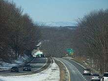
In 1980, the commuter-oriented Sprain Brook Parkway was completed to the Taconic, providing a higher-speed, signal-free means between it and the freeway portion of the Bronx River Parkway. DOT continued to remake the road in Westchester, where 90,000 vehicles used the parkway on an average day,[69] reconfiguring exits, widening the roadways and putting asphalt over the original concrete, to the point that most of the parkway in the county bore little resemblance to its original appearance. The Taconic was designated a State Scenic Byway in 1992, and a multidisciplinary Corridor Management Plan was drafted and implemented seven years later to ensure that future changes to the road preserved and improved safety with minimal impact on its scenic and historic character.[68][70]
The next year the parkway was inventoried for the Historic American Engineering Record.[71] In 1996 a sculptor in Austerlitz built a 19-foot (5.8 m) head of a woman he called "Mother Earth" on farmland adjacent to the parkway to promote his work.[72]
In the 21st century, DOT began addressing safety issues in Dutchess County, where traffic counts had increased by 7–11% annually since the 1970s.[69] A 2003 task force report recommended action on many of the grade intersections, closing some completely while closing just the medians on others. Only the Salt Point Turnpike (NY 115) junction was spared.[73]
There was some local controversy about the changes. Residents of some rural areas worried that the intersection closings would isolate them, and preservationists felt cell phone towers would detract from the scenic beauty along the parkway. Other residents welcomed the construction of noise barriers along sections that bordered near their homes.[74]
There are no plans currently to modify any of the grade intersections north of Route 199, where use of the parkway has not significantly increased.[75] Putnam County has called for the construction of an actual interchange at Pudding Street. The state had added turn lanes and widened the median so that a school bus would not block the road, but members of the county's Traffic Safety Board, including the sheriff, said that accidents were still too frequent.[76]
When the parkway was listed on the National Register in late 2005,[77] the entire right-of-way from Kensico Circle to the Thruway merge was included, creating a 7,067-acre (2,860 ha)[78] linear historic district. These 11 square miles (28 km2) make the parkway the third largest Register listing in the state.[note 2] The entire parkway, right-of-way and supporting buildings and structures were considered contributing except for the 15 miles (24 km) of rebuilt roadway between the former Hawthorne Circle and Crom Pond Road and 23 bridges in the southern three counties.[79]
The parkway got another state park in 2006, when another wealthy individual donated land. Donald Trump had bought 436 acres (176 ha) along the east side of the road near the Westchester–Putnam county line in 1998, intending to develop it into a hotel and golf course.[80] Local opposition was considerable, and he decided to donate the land to the state. It is now Donald J. Trump State Park, with separate parcels called Indian Hill and French Hill.[81]
In July 2009, Diane Schuler of West Babylon crashed her van head-on into an oncoming sport utility vehicle (SUV) while driving south in the northbound lanes [82] approximately 1.7 miles (2.7 km) north of the Pleasantville Road exit. Eight people, including Schuler and several children, were killed. The accident was the deadliest ever on the parkway, and the worst motor vehicle accident in Westchester County since 1934. Schuler was determined to have been driving under the influence of both alcohol and marijuana.[83]
The road, which has a lower accident rate than average for New York, was not considered to be at fault. Some changes were nevertheless made. Two large "Wrong Way" signs were installed on the ramp she drove down. Westchester County Executive Andrew Spano ordered that signage at onramps on the Taconic and other parkways in the county be checked to make sure "there can be no question of whether you're entering or exiting."[84] The state legislature passed Leandra's Law, making it a felony to drive while intoxicated with a passenger 16 or younger, partly as a result of the accident.[85]
According to data compiled by the National Highway Traffic Safety Administration, the Taconic was the second deadliest road in Dutchess County after US 9 between 1994 and 2008. New York State Police blamed travelers exceeding speed limits, wildlife crossings and trucks being directed onto the parkway by their GPS navigation devices. The state was planning to post more explicit signage making it clear that trucks are not allowed on parkways in New York.[86]
Major intersections
Intersections and interchanges were formerly numbered sequentially with a single letter prefix indicating the county, with exit numbers resetting at county lines.[87][88] Intersection numbers were posted with very small signs attached to the intersection sign, as opposed to on gore signs as on other controlled-access highways. Numbering is not necessarily sequential since some exits have been removed or added.[89][90]
Beginning in mid-2016, interchanges in the Westchester County portion of the road, which is completely limited-access, will be renumbered by mileage with the entire parkway expected to be numbered by the summer of 2017. At-grade intersections will not be numbered though their signage will be improved. The Taconic - which is the state's longest parkway - stands out for it lack of exit numbers.[91]
List of intersections
| County | Location | mi [1][92] | km | Old exit [87][88] | New exit [89][90] | Destinations | Notes |
|---|---|---|---|---|---|---|---|
| Westchester | Valhalla | 0.00 | 0.00 | - | Kensico Circle; north end of Bronx Parkway | ||
| 0.10 | 0.16 | ||||||
| 0.40 | 0.64 | W1 | |||||
| 0.50 | 0.80 | W2 | - | Legion Drive | Intersection replaced with overpass | ||
| 1.20 | 1.93 | W3 | Lakeview Avenue – Kensico Cemetery, Sharon Gardens | ||||
| 1.60 | 2.57 | W5 | Commerce Street | ||||
| Hawthorne | 2.40 | 3.86 | W6 | ||||
| 2.60 | 4.18 | Former traffic circle (South end of freeway section) | |||||
| 2.85 | 4.59 | 2 | Southbound exit and northbound entrance | ||||
| 3.10 | 4.99 | Northbound exit and southbound entrance | |||||
| 3.30 | 5.31 | 3 | Northbound exit and southbound entrance | ||||
| 3.80 | 6.12 | Southbound exit and northbound entrance | |||||
| Mount Pleasant | 4.00 | 6.44 | 4 | Northbound exit and entrance | |||
| Briarcliff Manor | 4.67 | 7.52 | 5 | Northbound exit and southbound entrance | |||
| 5.63 | 9.06 | W11 | 6 | Pleasantville Road (CR 40I) – Briarcliff Manor, Pleasantville | |||
| 7.00 | 11.27 | W13 | – | Chappaqua Road | Intersection replaced with overpass | ||
| Millwood | 8.30 | 13.36 | W14 | – | Campfire Road | Intersection eliminated | |
| 8.50 | 13.68 | 8 | |||||
| 9.80 | 15.77 | W15 | 9 | Pines Bridge Road (CR 1323) | Northbound exit and southbound entrance | ||
| Yorktown | 10.84 | 17.45 | W16 | 11 | Signed as exits 11A (east) and 11B (west) southbound | ||
| 12.00 | 19.31 | W17 | – | Illington Road | Intersection replaced with overpass | ||
| Croton Reservoir | 12.70– 12.90 | 20.44– 20.76 | AMVETS Memorial Bridge | ||||
| Yorktown Heights | 14.00 | 22.53 | W18 | 13 | |||
| 15.00 | 24.14 | W19 | 14 | Baldwin Road | |||
| 16.40 | 26.39 | W21 | 16 | Franklin D. Roosevelt State Park | |||
| Jefferson Valley | 17.14 | 27.58 | 17A | ||||
| Crompond | 17.36 | 27.94 | 17B | No northbound entrance | |||
| Shrub Oak | 19.76 | 31.80 | 19 | Northbound exit and southbound entrance | |||
| 20.13 | 32.40 | 20 | Northbound exit is signed with exit 19 | ||||
| North end of completely limited-access section | |||||||
| Putnam | Putnam Valley | 23.20 | 37.34 | P1 | 23 | Bryant Pond Road | Interchange |
| 24.30 | 39.11 | P2 | Bullet Hole Road | Former northbound intersection | |||
| 25.65 | 41.28 | P2A | 25 | Interchange | |||
| 28.10 | 45.22 | P4 | Pudding Street | ||||
| 28.40 | 45.71 | P51 | – | Wiccopee Road | Intersection eliminated | ||
| Fahnestock State Park | 31.14 | 50.11 | P61 | 31 | Interchange divided between 31A (east) and 31B (west) | ||
| Kent | 33.30 | 53.59 | P7 | Hortontown Hill Road | Right-in/right-out connections only | ||
| 33.90 | 54.56 | P8 | Knapp Road | Northbound intersection | |||
| Dutchess | Town of East Fishkill | 35.00 | 56.33 | D1 | 35 | Miller Hill Road | Interchange; location of Appalachian Trail crossing |
| Shenandoah | 36.92 | 59.42 | D21 | 37 | Site of former exit with Jackson Road;[88] Interchange divided between 37A (east) and 37B (west) | ||
| 37.50 | 60.35 | D3 | Hosner Mountain Road | Southbound entrance only | |||
| Hamlet of East Fishkill | 38.39 | 61.78 | 38 | Interchange | |||
| 40.10 | 64.53 | D4 | Right-in/right-out connections only | ||||
| Town of East Fishkill | 40.90 | 65.82 | D5 | Stormville Road | Intersection eliminated | ||
| 41.40 | 66.63 | D6 | 41 | Interchange | |||
| East Fishkill | D7 | Bogardus Lane | Intersection eliminated | ||||
| Hillside Lake | 43.69 | 70.31 | D8 | 43 | Interchange divided between 43A (east) and 43B (west) | ||
| Noxon | 44.40 | 71.45 | D9 | 45 | Southbound signature | ||
| 45 | Northbound signature/no Northbound entrance | ||||||
| Freedom Plains | 47.05 | 75.72 | D10 | 47 | Interchange divided between 47A (east) and 47B (west) | ||
| 47.55 | 76.52 | D11 | Skidmore Road | Intersection eliminated | |||
| Freedom Plains | 48.30 | 77.73 | 48 | James Baird State Park | Left exit northbound | ||
| 54.72 | 88.06 | D141 | 54 | Interchange | |||
| Town of Clinton Corners | 57.60 | 92.70 | D151 | Hibernia Road | Right-in/right-out connections only | ||
| Hibernia | 57.80 | 93.02 | D161 | Northbound intersection | |||
| Clinton Corners | 58.30 | 93.82 | D171 | 58 | |||
| 61.30 | 98.65 | D181 | Willow Lane | Southbound intersection | |||
| Stanford | 62.80 | 101.07 | D191 | Nine Partners Road | Right-in/right-out connections only | ||
| 64.60 | 103.96 | D201 | 64 | Interchange | |||
| Milan | 65.80 | 105.89 | D211 | Willowbrook Road | Right-in/right-out connections only | ||
| 66.40 | 106.86 | D221 | Cold Spring Road | Right-in/right-out connections only | |||
| 67.75 | 109.03 | D231 | 67 | Interchange | |||
| Lafayetteville | 69.30 | 111.53 | D241 | North Road | |||
| 70.30 | 113.14 | D251 | Wilbur Flats Road | ||||
| 70.98 | 114.23 | D261 | Ferris Lane | ||||
| Columbia | Gallatin | 72.24 | 116.26 | C11 | 72 | Interchange | |
| Gallatin–Taghkanic line | 77.69 | 125.03 | At-grade intersection | ||||
| Taghkanic | 79.72 | 128.30 | 80 | Interchange | |||
| Claverack | 87.77 | 141.25 | 88 | Interchange | |||
| Ghent | 91.34 | 147.00 | 91 | Interchange | |||
| Austerlitz | 99.25 | 159.73 | 99 | ||||
| Town of Chatham | 101.88 | 163.96 | 102 | ||||
| 102.12 | 164.35 | Rock City Road/Upper Cady Road | Southbound exit and Northbound entrance (all commercial vehicles must exit) | ||||
| 103.52 | 166.60 | Exit B2 Toll Barrier | |||||
| 104.12 | 167.56 | Exit B2 on I-90 / Thruway | |||||
1.000 mi = 1.609 km; 1.000 km = 0.621 mi
| |||||||
Notes
See also
- 2009 Taconic State Parkway crash
- National Register of Historic Places listings in Columbia County, New York
- National Register of Historic Places listings in Dutchess County, New York
- National Register of Historic Places listings in Putnam County, New York
- National Register of Historic Places listings in northern Westchester County, New York
Notes
- ↑ The next longest is the Baltimore–Washington Parkway, at 32 miles (51 km).
- ↑ The Adirondack Park and Hudson River Historic District are the larger two.
References
- 1 2 "2007 Traffic Data Report for New York State" (PDF). New York State Department of Transportation. July 25, 2008. Retrieved July 17, 2009.
- ↑ National Park Service (July 9, 2010). "National Register Information System". National Register of Historic Places. National Park Service.
- ↑ LaFrank, Kathleen (November 2002). "National Register of Historic Places nomination, Taconic State Parkway". New York State Office of Parks, Recreation and Historic Preservation. p. 89. Retrieved January 1, 2010. (Page numbers used here reflect those assigned by the JavaScript application used to read the document and not those used within it).
- 1 2 LaFrank, 4. "From the highest point in Putnam County, where it achieves an elevation of nearly 1,200 feet ..."
- ↑ LaFrank, p. 5.
- ↑ Oscawana Lake quadrangle (Map). 1:24,000. United States Geological Survey. Retrieved January 3, 2010.
- ↑ LaFrank, p. 3,
- ↑ "Excellence in Highway Design – 2002 Taconic State Parkway Interchange with Miller Hill Road, Town of East Fishkill, New York". Federal Highway Administration. April 28, 2003. Retrieved January 17, 2010.
- 1 2 3 LaFrank, p. 6.
- 1 2 LaFrank, 95–6.
- ↑ LaFrank, p. 66.
- ↑ LaFrank, p. 44.
- ↑ LaFrank, p. 47.
- ↑ Miller, Donald L. (2002). Lewis Mumford: A life. Grove Press. p. 480. ISBN 0-8021-3934-5. Retrieved December 31, 2009.
...and whenever he was in Leedsville Mumford would tell friends from New York City who were coming by car to visit him to take [the] Taconic State Parkway, a winding ribbon of road through the Hudson River Valley
- 1 2 Faber, Harold (August 14, 1987). "Metropolitan Baedeker; Savoring the Scenic Delights Along the Taconic State Parkway". The New York Times. Retrieved December 31, 2009.
- 1 2 Healy, Mark (July 5, 2002). "Driving; 'Just Drive,' Said the Road, And the Car Responded". The New York Times. Retrieved December 31, 2009.
- ↑ Gandy, Matthew (2003). Concrete and Clay: Reworking Nature in New York City. Cambridge, MA: MIT Press. p. 122. ISBN 0-262-57216-8. Retrieved December 31, 2009.
- ↑ Williams, China; Blond, Becca (2004). New York State (3rd ed.). Footscray, Victoria, Australia: Lonely Planet. p. 16. ISBN 1-74104-125-2. Retrieved December 28, 2009.
- ↑ LaFrank, pp. 58–59.
- ↑ LaFrank, p. 63.
- 1 2 LaFrank, p. 8.
- ↑ LaFrank, pp. 64–65.
- ↑ LaFrank, p. 58.
- 1 2 3 4 5 6 LaFrank, pp. 72–75.
- 1 2 Caro, Robert (1974). The Power Broker: Robert Moses and the Fall of New York. New York, NY: Vintage Books. pp. 143–45. ISBN 0394720245.
- ↑ LaFrank, 19–21.
- 1 2 3 LaFrank, 41.
- 1 2 Caro, 166–67.
- 1 2 3 Federal Reserve Bank of Minneapolis Community Development Project. "Consumer Price Index (estimate) 1800–". Federal Reserve Bank of Minneapolis. Retrieved October 21, 2016.
- 1 2 LaFrank, 23. "In 1924, the bond issue passed by more than a million votes, one of the largest majorities on record."
- ↑ Caro, 167–68.
- ↑ Caro, 172–77.
- ↑ Caro, 187. "The referendum had passed by nearly a million votes"
- ↑ LaFrank, 45.
- 1 2 LaFrank, p. 49.
- 1 2 LaFrank, 50.
- ↑ "Taconic State Park Region: A Presidential Pedigree" (PDF). The Preservationist. New York State Office of Parks, Recreation and Historic Preservation. 9 (1): 6. Spring 2005. Retrieved April 1, 2010.
- 1 2 LaFrank, p. 46.
- 1 2 LaFrank, 27–32.
- ↑ LaFrank, 35.
- ↑ LaFrank, 37
- 1 2 3 4 5 Caro, pp. 287–91.
- 1 2 LaFrank, pp. 42–43.
- ↑ LaFrank, p. 52.
- 1 2 LaFrank, p. 56.
- 1 2 LaFrank, p. 38.
- ↑ LaFrank, p. 65.
- ↑ Wilbur, Martin (June 22–28, 1988). "The Taconic: Gateway To A New Yorktown". North County News. Yorktown Heights, NY. Archived from the original on October 27, 2009. Retrieved April 1, 2010.
- 1 2 3 LaFrank, p. 54.
- 1 2 LaFrank, p. 62
- ↑ LaFrank, p. 66–67.
- 1 2 LaFrank, pp. 69–72.
- ↑ LaFrank, p. 55.
- ↑ LaFrank, p. 40.
- 1 2 3 LaFrank, p. 75.
- 1 2 3 LaFrank, pp. 77–78.
- ↑ LaFrank, pp. 77–82.
- 1 2 LaFrank, pp. 83–84.
- 1 2 LaFrank, p. 84–85.
- 1 2 LaFrank, pp. 86–87.
- 1 2 3 LaFrank, pp. 88–89.
- ↑ LaFrank, pp. 87–88.
- 1 2 LaFrank, p. 90.
- ↑ Anderson, Steve. "Interstate 84-New York Historic Overview". NYCRoads. Retrieved January 12, 2009.
- ↑ LaFrank, p. 7.
- ↑ LaFrank, p. 91.
- ↑ LaFrank, pp. 92–93.
- 1 2 LaFrank, p. 93.
- 1 2 "NYSDOT Taconic Task Force Report, Part 1". dutchess29.org. December 21, 2001. Retrieved January 9, 2010.
- ↑ "New York's Parkways". New York State Scenic Byways. New York State Department of Transportation. Retrieved April 1, 2010.
- ↑ "Taconic State Parkway, Poughkeepsie vicinity, Dutchess County, NY". Historic American Engineering Record. Library of Congress. 1999. Retrieved January 10, 2010.
- ↑ Hu, Winnie (June 3, 2001). "What's With the 19-Foot Head? A Sculptor Is Counting on Drivers to Ask". The New York Times. Retrieved January 9, 2010.
- ↑ "New York State Department Of Transportation Releases Phase 2 Of Aggressive Taconic State Parkway Recommendations" (Press release). New York State Department of Transportation. June 3, 2002.
- ↑ Gottlieb, Jane (April 22, 2001). "Transportation; The Taconic Parkway: A Road in Transition". The New York Times. Retrieved January 9, 2010.
- ↑ "NYSDOT Taconic Task Force Report, Part 2". dutchess29.org. June 2, 2002. Retrieved January 9, 2010.
- ↑ "Traffic Safety Board Calls for Upgrade of Pudding Street Interchange at Taconic State Parkway". Putnam County News and Recorder. Cold Spring, NY. February 25, 2004. Retrieved January 9, 2010.
- ↑ "National Register of Historic Places Listings". National Park Service. December 12, 2005. Retrieved April 1, 2010.
- ↑ LaFrank, p. 97.
- ↑ LaFrank, pp. 11–15.
- ↑ Vizard, Mary McAleer (June 21, 1998). "More Golf Courses Coming, 3, Maybe 4, From Trump". The New York Times. Retrieved November 6, 2010.
- ↑ Brenner, Elsa (April 23, 2006). "The Ultimate in Luxury Parks". The New York Times. Retrieved January 9, 2010.
- ↑ "Anatomy of a Tragic Accident". The New York Times. July 27, 2009. Retrieved October 21, 2011.
- ↑ Baker, Al; Foderaro, Lisa (August 4, 2009). "Tests Show Driver Was Drunk in Parkway Crash That Killed 8". The New York Times. Retrieved January 9, 2010.
- ↑ Foderaro, Lisa W. (August 17, 2009). "2009 Traffic Meets 1920s Design on Road Where Crash Killed 8". The New York Times. Retrieved January 9, 2010.
- ↑ "Senate Passes Leandra's Law" (Press release). State Sen. Frank Padavan. December 29, 2009. Retrieved January 9, 2010.
- ↑ Stewart, Emily (December 29, 2009). "Route 9 deemed deadliest road in Dutchess". Poughkeepsie Journal. Retrieved January 9, 2010.
- 1 2 New York with Sight-Seeing Guide (Map) (1962 ed.). Cartography by General Drafting. Esso. 1962.
- 1 2 3 New York with Special Maps of Putnam–Rockland–Westchester Counties and Finger Lakes Region (Map) (1958 ed.). Cartography by General Drafting. Esso. 1958.
- 1 2 "Taconic State Parkway Signs Stage 1 NYS 987G (S.H. 9480) Putnam and Westchester Counties". New York State Department of Transportation. Retrieved September 23, 2015.
- 1 2 "Taconic State Parkway Signs Stage 2 NYS 987G (S.H. 9481, S.H. 9482, S.H. 9483) Putnam, Dutchess & Columbia Counties". New York State Department of Transportation. Retrieved November 16, 2016.
- ↑ Coyne, Matt (September 4, 2016). "Taconic State Parkway to get exit numbers". The Journal News. Retrieved September 6, 2016.
- ↑ Google (December 29, 2015). "Taconic State Parkway" (Map). Google Maps. Google. Retrieved December 29, 2015.
External links
| Wikimedia Commons has media related to Taconic State Parkway. |
- Taconic State Parkway at Alps' Roads • New York State Highway Termini
- Historic American Buildings Survey (HABS) No. NY-6326, "Briarcliff Wells Service Station, Mount Pleasant, Westchester County, NY"
- Historic American Engineering Record (HAER) No. NY-316, "Taconic State Parkway, Poughkeepsie vicinity, Dutchess County, NY"
- nycroads.com - Taconic State Parkway
- gribblenation.net - Taconic State Parkway
| Topics |  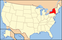 | |
|---|---|---|
| Lists by county |
| |
| Lists by city | ||
| Other lists | ||
| ||