New York State Route 85
| ||||
|---|---|---|---|---|
|
Map of Albany County in eastern New York with NY 85 highlighted in red | ||||
| Route information | ||||
| Maintained by NYSDOT | ||||
| Length: | 26.49 mi[1] (42.63 km) | |||
| Existed: | 1930[2] – present | |||
| Major junctions | ||||
| West end: |
| |||
|
| ||||
| East end: |
| |||
| Location | ||||
| Counties: | Albany | |||
| Highway system | ||||
| ||||


New York State Route 85 (NY 85) is a state highway in Albany County, New York, in the United States. It is 26.49 miles (42.63 km) in length and runs from CR 353 in Rensselaerville to Interstate 90 (I-90) exit 4 in Albany. It also has a loop route, NY 85A, which connects NY 85 to the village of Voorheesville. The portion of NY 85 north of NY 140 to the Bethlehem–Albany town/city line is known as the Slingerlands Bypass. From there north to I-90, the road is a limited-access, four-lane highway named the Crosstown Arterial.
Route description
NY 85 begins at the north end of the County Route 353 (CR 353; Delaware Turnpike) bridge over the Ten Mile Creek in the hamlet of Rensselaerville. In the center of the hamlet, NY 85 turns north at the intersection with CR 351 (Medusa Road), NY 85 proceeds northward along Delaware Turnpike, a two-lane residential road through the town of Rensselaerville. The route soon becomes a woods road, turning east and passing the southern terminus of CR 6. NY 85 bends northeast through Rensselaerville, crossing through valleys until Stevens Road, where it bends southeast and soon east into the town of Westerlo. Still known as Delaware Turnpike, NY 85 continues east through the valleys past a junction with CR 408.[3]
East of CR 408, NY 85 winds south of Onderdonk Lake, soon crossing a junction with CR 1 (Switzkill Road). Bending northward through Westerlo, NY 85 remains a two-lane rural road, soon reaching a junction with the western terminus of NY 143. NY 85 continues northeast from NY 143, becoming more residential as it approaches a junction with CR 14 (Joslyn School Road). Crossing into the town of Berne, NY 85 meets a junction with CR 11 (Cass Hill Road) west of the hamlet of Reidsville. The route then bends northward at this junction, bypassing the hamlet and soon reaching the northern terminus of CR 11 (North Road) nearby.[3]
After CR 11, NY 85 continues northward through Berne, bending northeast into a junction with NY 443 (Helderberg Trail). NY 443 and NY 85 become concurrent, proceeding eastward and south of Helderberg Lake as Delaware Turnpike. NY 85 and NY 443 continue winding eastward, crossing into the town of New Scotland, crossing through the Letter-S, a hill named for a former S-bend alignment of Route 85 that is preserved in two town roads of similar names. Climbing down the hill, the routes bend southward, reaching a junction with New Scotland Road. At this junction, NY 443 continues southeast on Delaware Turnpike while NY 85 turns east on New Scotland. Stlll a two-lane road through New Scotland, NY 85 passes multiple residences before making a large curve to the north.[3]

The route bends northeast and enters the area of New Salem Hill, where it intersects with the eastern terminus of NY 157 (Thacher Park Road). Continuing north, NY 85 soon bends southeast and enters the hamlet of New Salem, where it intersects with the western terminus of NY 85A (New Salem Road). Through New Salem, NY 85 is a two-lane residential street, soon leaving the hamlet after Mountain View Estates Road. Running northeast through New Scotland, NY 85 remains a two-lane residential road, crossing under CSX railroad tracks before reaching the hamlet of New Scotland. The route runs northeast through the hamlet, becoming a two-lane residential and commercial mix and intersects with CR 308 (New Scotland South Road).[3]
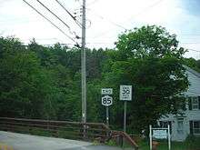
NY 85 quickly crosses the eastern terminus of NY 85A (Maple Road), bending southeast through New Scotland. Leaving the namesake hamlet, NY 85 continues southeast until reaching the town of Bethlehem. Through Bethlehem, NY 85 reaches the hamlet of Slingerlands, becoming a two-lane residential street and crossing the eastern terminus of CR 306 (Font Grove Road). Passing a junction with Kenwood Avenue, NY 85 crosses through the commercial center of Slingerlands, soon turning northeast into another residential portion of Slingerlands. Near the northern end of the hamlet, the route enters a roundabout with NY 140 (Cherry Avenue Extension).[3]
NY 85 turns northwest at the roundabout, bending into another one with Vista Boulevard. Continuing northeast, NY 85 reaches a third roundabout, which connects to New Scotland Road and the hamlet of Karlsfeld. After crossing another roundabout, this time with Blessing Road, NY 85 crosses through the Normanskill section of Bethlehem, crossing over the New York State Thruway (I-87). Just after the overpass, NY 85 widens from a two lane road to a four lane divided controlled-access highway, crossing into the city of Albany and passing a ramp for Krumkill Road. Crossing over Buckingham Road, NY 85 interchanges with the local street, soon reaching an interchange with Cortland Street, which connects to US 20 (Western Avenue).[3]
Almost immediately after US 20, NY 85 continues past another interchange, serving Washington Avenue and the W. Averell Harriman State Office Building Campus. Just north of this interchange, Route 85 ends at trumpet interchange with I-90.[3]
History
Origins
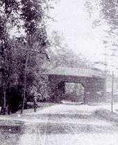
The path of modern NY 85 west of Slingerlands roughly follows that of the Albany, Rensselaerville, and Schoharie Plank Road, a plank road established to connect the city of Albany with the town of Schoharie by way of passing through Rensselaerville. The Albany, Schoharie, and Rensselaerville Plank Road Company was organized on October 10, 1849, with Lansing Pruyn as president.[4] On March 25, 1850, the company was given a 30-year charter; and the road from Lydius Street in Albany (today Madison Avenue) to the hamlet of New Salem—now New Scotland Avenue in the city of Albany and New Scotland Road in Bethlehem and New Scotland—and the portion of the road from Bernville to Gallupville were planked with wooden boards.[5] Portions of the plank road were already long established roads, such as the Beaverdam (or Beaver Dam) Road in western Albany County near New Salem, which had already existed for quite some time prior to moving to an easier grade around New Salem in 1806.[6] The plank road/turnpike spurred the development of many places along its path, such as a hotel at what would evolve into the hamlet of Hurstville and a post office at what would become the hamlet of Slingerlands.[5][7]
In 1854 the state authorized the fiscally unsound plank road company to abandon or sell portions of the road and to turn other sections into a turnpike and charge tolls. The section from New Salem east to the hamlet of New Scotland subsequently had its planks removed and the portion from Bernville to Gallupville was also abandoned.[5][8] In 1881 the charter was renewed for another 30 years.[5] In 1896 the turnpike company opposed the construction of a railroad that would have been in direct competition to the turnpike from Albany to Schoharie.[9]
Designation
In 1908, the New York State Legislature created Route 7, an unsigned legislative route extending from Binghamton to Albany via Oneonta and Schoharie. Route 7 entered the town of New Scotland on what is now NY 157 and followed it to its eastern end at modern NY 85. At this point, the route turned onto the old Albany–Schoharie plank road and continued east to Albany on New Scotland Road and New Scotland Avenue.[10][11] The section of legislative Route 7 east of modern NY 157 was not assigned a posted designation until the 1930 renumbering of state highways in New York when it became part of NY 85, which initially extended from NY 81 in the hamlet of Oak Hill in the town of Durham to US 20 in Albany.[2]
When it was first assigned, the route followed Makley and Siebert Roads north from Oak Hill to Medusa, then continued northeast to Westerlo on CR 351, CR 402, CR 404, and CR 401. Past Westerlo, NY 85 was routed on what is now NY 143 to the Delaware Turnpike near Reidsville, where it joined its current alignment. Northeast of Slingerlands, NY 85 followed New Scotland Avenue into downtown Albany, where it terminated at US 20.[2] The portion of the route between Medusa and Reidsville was realigned c. 1936 to serve the hamlet of Rensselaerville. Instead of heading east from Medusa, NY 85 was rerouted to follow CR 352, CR 360, CR 359, and CR 353 north to Rensselaerville, where it met its modern routing.[12][13] NY 85 was truncated to Rensselaerville c. 1938.[14][15]
Construction on the Slingerlands Bypass, a new highway bypassing the hamlet of Slingerlands, began in the early 1960s. The first section of the bypass from Washington Avenue to Buckingham Drive (the Krumkill Road exit) was completed by 1964.[16][17] The remainder of the highway was open by 1968 as a realignment of NY 85.[18] Between Blessing Road and the Albany city line, the bypass was constructed as a two-lane highway. This section was originally planned to be four lanes wide as well, but was constructed with only two lanes due to community activism by an anti-sprawl group known as the Bethlehem Lincoln Republicans in the early 1960s. The old alignment of NY 85 along New Scotland Road from where NY 85 turns onto the bypass to the Albany city line (a distance of 0.38 miles or 0.61 kilometres as of 2008) is now designated as NY 910E, an unsigned reference route.[1]
A four-lane extension of the bypass was constructed in 2007 between NY 140 and Maher Road. Four roundabouts were built, the southernmost where NY 85 currently meets NY 140 at Cherry Avenue Extension. After the roadway opened to traffic on November 7, 2007, NY 85 was rerouted onto the newly constructed portion of the bypass while the section of New Scotland Road between NY 140 and Maher Road became part of an extended NY 910E. The new highway, four lanes divided, meets the existing highway portion of the bypass at the same Maher Road, at the third roundabout.
NY 85 was once proposed to be extended to the unbuilt I-687.[19]
NY 85A

NY 85A (5.54 miles or 8.92 kilometres) is an alternate route of NY 85 in New Scotland, accessing Voorheesville.[1] It was assigned c. 1932.[20][21]
Major intersections
The entire route is in Albany County.
| Location | mi[1] | km | Destinations | Notes | |||
|---|---|---|---|---|---|---|---|
| Rensselaerville | 0.00 | 0.00 | |||||
| Westerlo | 6.51 | 10.48 | Western terminus of NY 143 | ||||
| Berne | 10.18 | 16.38 | Western terminus of NY 85 / NY 443 overlap | ||||
| New Scotland | 12.20 | 19.63 | Eastern terminus of NY 85 / NY 443 overlap | ||||
| 14.43 | 23.22 | Eastern terminus of NY 157 | |||||
| 15.33 | 24.67 | Hamlet of New Salem; western terminus of NY 85A | |||||
| 18.89 | 30.40 | Eastern terminus of NY 85A | |||||
| Bethlehem | 21.69 | 34.91 | Roundabout; southern terminus of NY 140 | ||||
| 22.22 | 35.76 | Maher Road | Roundabout | ||||
| West end of freeway section | |||||||
| Albany | 24.55 | 39.51 | Krumkill Road | ||||
| 25.33 | 40.76 | Access via Ormond Street eastbound and Daytona Street westbound | |||||
| 25.37 | 40.83 | Brevator Street | Serves Harriman State Office Complex | ||||
| State Offices | Exit connects to outer complex loop eastbound and inner loop westbound | ||||||
| 26.05 | 41.92 | Lincoln Avenue / Washington Avenue | Access to Lincoln Avenue eastbound and to Washington Avenue and complex westbound | ||||
| 26.49 | 42.63 | Exit 4 (I-90) | |||||
1.000 mi = 1.609 km; 1.000 km = 0.621 mi
| |||||||
See also
.svg.png) New York Roads portal
New York Roads portal
References
- 1 2 3 4 "2008 Traffic Volume Report for New York State" (PDF). New York State Department of Transportation. June 16, 2009. pp. 139–140. Retrieved January 31, 2010.
- 1 2 3 Automobile Legal Association (ALA) Automobile Green Book, 1930–31 and 1931–32 editions, (Scarborough Motor Guide Co., Boston, 1930 and 1931). The 1930–31 edition shows New York state routes prior to the 1930 renumbering
- 1 2 3 4 5 6 7 Microsoft; Nokia (February 10, 2013). "overview map of NY 85" (Map). Bing Maps. Microsoft. Retrieved February 10, 2013.
- ↑ Reynolds, Cuyler (1906). Albany Chronicles: A History of the City Arranged Chronically. J.B. Lyon Company. p. 563. Retrieved June 25, 2010.
- 1 2 3 4 Howell, George Rogers; Tenney, Jonathan (1886). Bi-Centennial History of Albany: History of the County of Albany, N.Y., from 1609 to 1886. W.W. Munsell & Co. pp. 790–791. Retrieved June 25, 2010.
- ↑ Howell, George; Tenney, Jonathan (1886). Bi-Centennial History of Albany: History of the County of Albany from 1609-1886; Volume II. W.W. Munsell and Company. p. 901. Retrieved March 9, 2010.
- ↑ "Hotel Bethlehem". Town of Bethlehem, New York. Retrieved June 12, 2010.
- ↑ Laws of the State of New York Passed at the Seventy-Seventh Session of the Legislature, Begun the Third Day of January, and Ended the Seventeenth Day of April, 1854, at the City of Albany. Banks, Gould and Company. 1854. pp. 648–649. Retrieved March 10, 2010.
- ↑ "An Albany and Schoharie Road". The New York Times. January 7, 1896. Retrieved June 25, 2010.
- ↑ State of New York Department of Highways (1909). The Highway Law. Albany, New York: J. B. Lyon Company. p. 57. Retrieved June 7, 2010.
- ↑ New York State Department of Highways (1920). Report of the State Commissioner of Highways. Albany, New York: J. B. Lyon Company. pp. 513–515. Retrieved June 7, 2010.
- ↑ Road Map & Historical Guide – New York (Map). Cartography by Rand McNally and Company. Sun Oil Company. 1935.
- ↑ New York (Map). Cartography by General Drafting. Standard Oil Company. 1936.
- ↑ Thibodeau, William A. (1938). The ALA Green Book (1938–39 ed.). Automobile Legal Association.
- ↑ New York Road Map for 1938 (Map). Cartography by General Drafting. Esso. 1938.
- ↑ New York and Metropolitan New York (Map). Cartography by Rand McNally and Company. Sinclair Oil Corporation. 1962.
- ↑ New York and Metropolitan New York (Map). Cartography by Rand McNally and Company. Sinclair Oil Corporation. 1964.
- ↑ New York (Map) (1969–70 ed.). Cartography by General Drafting. Esso. 1968.
- ↑ "State Bids U.S. Delete Interstate 687 Approval". Schenectady Gazette. October 15, 1973. p. 26. Retrieved August 27, 2010.
- ↑ New York (Map). Cartography by H.M. Gousha Company. Kendall Refining Company. 1931.
- ↑ Texaco Road Map – New York (Map). Cartography by Rand McNally and Company. Texas Oil Company. 1932.
External links
| Wikimedia Commons has media related to New York State Route 85. |
- New York State Route 85 at Alps' Roads • New York Routes • New York State Highway Termini • Upstate New York Roads
- Capital Highways – New York 85