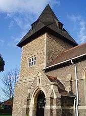
Newbold Verdon
Newbold Verdon is a village and civil parish in the county of Leicestershire, England. The parish includes Newbold Heath to the north and Brascote to the south. Originally an agricultural centre Newbold Verdon grew in size during the 1850s with the expansion of coal mining in the area. That industry has now ceased leaving Newbold Verdon as primarily a commuter village. The 2001 census recorded a population of 3,193,[1] reducing to 3,012 at the 2011 census.
Etymology
The Domesday Book records the settlement as Niwebold meaning 'New Build'. It acquired the suffix Verdon from Nicholas de Verdon who owned the manor in 1226. While the civil parish is Newbold Verdon the ecclesiastical parish retains the form Newbold de Verdun.[2] Nicholas's descendant William de Ferrers was born in Newbold in 1332 or 1333.
History
In the year of 1428 the village was quarantined due to an outbreak of cholera, however this was short-lived as the quarantine was lifted soon after the outbreak was found to be non-serious.
On Sunday 22 March 2015, the funeral cortège of King Richard III passed through Market Bosworth, Newbold Verdon and Desford en route to his interment in Leicester Cathedral.
 |
Barlestone | Newbold Heath | Merry Lees |  |
| Market Bosworth | |
Desford | ||
| ||||
| | ||||
| Cadeby | Brascote | Peckleton |

Education
The local primary school is in Dragon Lane.
Churches
- St. James's Church (1209)
- A Methodist chapel
- A Baptist church (1833)
The Bright Hour at the Baptist Church has been running for many years along with the more recently started Grandtots Group.
Public houses
There are three pubs: The Swan (formerly the Old White Swan), the Jubilee and the Windmill (which is in Brascote) plus a working men's club.
References
External links
| Wikimedia Commons has media related to Newbold Verdon. |
- Newbold Verdon in the Domesday Book
- Village website
- Newbold Verdon Parish
- Newbold Verdon library
- St. James Church Hall
- Newbold Verdon Baptist Church Bright Hour
- The Churches of Newbold Verdon
Coordinates: 52°37′47″N 1°20′31″W / 52.629646°N 1.342076°W