Njeezhoor
| Njeezhoor ഞീഴൂർ Neezhoor | |
|---|---|
| village | |
|
VBSN Highschool | |
| Coordinates: 9°47′30″N 76°31′35″E / 9.79167°N 76.52639°ECoordinates: 9°47′30″N 76°31′35″E / 9.79167°N 76.52639°E | |
| Country |
|
| State | Kerala |
| District | Kottayam |
| Languages | |
| • Official | Malayalam, English |
| Time zone | IST (UTC+5:30) |
| PIN | 686612 |
| Telephone code | 91-4829-26XXXX |
| Vehicle registration | KL-67[1] |
| Nearest city | Kottayam |
| Literacy | 95% |
| Climate | Tropical (Köppen) |


Njeezhoor is a village in Kottayam district in the state of Kerala, India.[2] Njeezhoor is also spelled as Neezhoor. Njeezhoor is situated at the northern end of Kottayam (30 km).Distance to Cochin is only 45 km. The nearest railhead is piravom road Railway Station (12 km). Even though it’s a remote village in Kerala, the population has 98% Literacy, Good Educational institutions, cellular phone coverage, Telephone exchange, internet facilities, good transportation systems, irrigation systems etc. Njeezhoor grama panchyat has been awarded two time "The best panchyat in Kottayam district".
Demographics
As of 2001 India census, Njeezhoor had a population of 18111 with 9127 males and 8984 females.[2]
Geography
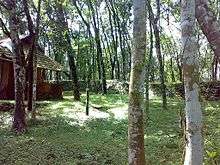
Geographically, Kerala can be divided into three climatically distinct regions: the eastern highlands (rugged and cool mountainous terrain),the central midlands (rolling hills), and the western lowlands (coastal plains). Neezhoor comes under the central midlands. Some of the areas of neezhoor is included under western ghats.
Climate
With 120–140 rainy days per year, Neezhoor has a wet and maritime tropical climate influenced by the seasonal heavy rains of the Southwest Summer Monsoon Neezhoor's rainfall averages 3,107 mm annually; Mean annual temperatures range from 18.0–35.0 °C .Throughout the year the climate is cool and pleasant.
Agriculture
The main agriculture is rubber tree cultivation. Other than rubber, rice is cultivated. But most of the paddy fields are now transformed into lands for construction works. Tapioca, cloves, nutmeg, pepper,bitterguard, cucumber, ginger, etc. are widely cultivated. Coconut trees are also widely grown.
Education
Educational institutions-
1.IHRD Science College,[3]
2.St.Kuriakose CBSE public school.[4]
3.Viswabharathy Higher Secondary School,
4.Infant Jesus School,
5.Viswabharathy English medium School
6.NSS HS Kattamapack,
7.Govt. LPS Kattampack,
8.Govt. UPS Vadakkenirappu
9.CMS.LP Vilayamcode etc.
After HSE, students move to other places in kerala or Metros in India or Abroad for higher education.
Politics
Neezhoor panchyat hosts two major political alliances: the United Democratic Front (UDF—led by the Indian National Congress) and the Left Democratic Front (LDF—led by the CPI/CPI(M)). Last time it was the LDF that ruled the Panchayath. In the recent election, UDF became the ruling coalition.
Temples
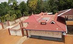

Pattupurackal bhagavathy temple kattampack
Njeezhoor Sree Krishna Swamy Temple
Demographics
98% of the people are educated. Only a few number of young people are diverted to agriculture. Most of the people are employed in Arab countries, United States, United Kingdom, Australia and Metros in India. Most of the people come under middle class. Majority of people are Hindu and Syrian Catholics. Social respect can be seen among the people.
References
- ↑ kerala rto
- 1 2 "Census of India : Villages with population 5000 & above". Archived from the original on December 8, 2008. Retrieved 2008-12-10.
|first1=missing|last1=in Authors list (help) - ↑ IHRD Science College website
- ↑ St.Kuriakose public school
External links
| Wikimedia Commons has media related to Njeezhoor. |