Noosaville, Queensland
| Noosaville Noosa, Queensland | |||||||||||||
|---|---|---|---|---|---|---|---|---|---|---|---|---|---|
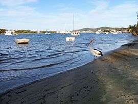 A pelican on Noosa River, Noosaville. | |||||||||||||
| Population | 6,528 (2006 census)[1] | ||||||||||||
| • Density | 510.0/km2 (1,321/sq mi) | ||||||||||||
| Postcode(s) | 4566 | ||||||||||||
| Area | 12.8 km2 (4.9 sq mi) | ||||||||||||
| Location | 4 km (2 mi) SW of Noosa Heads | ||||||||||||
| LGA(s) | Shire of Noosa | ||||||||||||
| State electorate(s) | Noosa | ||||||||||||
| Federal Division(s) | Wide Bay | ||||||||||||
| |||||||||||||
Coordinates: 26°24′54″S 153°03′14″E / 26.415°S 153.054°E

Noosa Waters, Noosaville.
Noosaville is a suburb in Noosa, Queensland, Australia, within the local government area of Shire of Noosa (between 2008 and 2013 it was within Sunshine Coast Region).
Geography
Noosaville includes Lake Weyba. "Weyba" is believed to mean "place of stingrays" or "place of flying squirrels".[2][3] Noosaville also contains a development with canals called Noosa Waters. It is a thriving community which includes many holiday apartments, parklands, nature reserves and shopping facilities such as Noosa Civic, a major shopping centre which serves the Noosa district.
Heritage listings
Noosaville has a number of heritage-listed sites, including:
- Russell Street: Noosa River Caravan Park[4]
References
- ↑ Australian Bureau of Statistics (25 October 2007). "Noosaville (Noosa Shire) (State Suburb)". 2006 Census QuickStats. Retrieved 19 March 2008.
- ↑ Noosa Community Guide 2005 Part D 19 December 2006
- ↑ South East Queensland - Place Names 19 December 2006
- ↑ "Noosa River Caravan Park (entry 602706)". Queensland Heritage Register. Queensland Heritage Council. Retrieved 14 July 2013.
External links
| Wikimedia Commons has media related to Noosaville, Queensland. |
This article is issued from Wikipedia - version of the 10/23/2015. The text is available under the Creative Commons Attribution/Share Alike but additional terms may apply for the media files.