Norman Clyde Peak
| Norman Clyde Peak | |
|---|---|
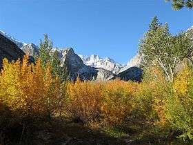 Norman Clyde Peak from the northeast, seen over the autumn colors on Big Pine Creek near Glacier Lodge, October 2007. | |
| Highest point | |
| Elevation | 13,861 ft (4,225 m) NAVD 88[1] |
| Prominence | 272 ft (83 m) [1] |
| Parent peak | Middle Palisade[2] |
| Listing | |
| Coordinates | 37°04′30″N 118°28′22″W / 37.0749337°N 118.4728815°WCoordinates: 37°04′30″N 118°28′22″W / 37.0749337°N 118.4728815°W [5] |
| Geography | |
| Location | Fresno and Inyo counties, California, U.S. |
| Parent range | Sierra Nevada |
| Topo map | USGS Split Mountain |
| Climbing | |
| First ascent | 1930 by Norman Clyde[6] |
| Easiest route | Exposed climb, class 4[3] |
Norman Clyde Peak, standing 13,861 feet (4,225 m) tall, is in natural company among the high peaks of the Palisades region of the Sierra Nevada in California. It raises on the main ridge of the Palisades', between Middle Palisade and Palisade Crest. Norman Clyde Glacier on its north face, and Middle Palisade Glacier on its east both feed the headwaters of the South Fork of Big Pine Creek. It is named posthumously for mountaineer Norman Clyde, who first climbed it by way of the Norman Clyde Glacier in 1930.[6]
See also
References
- 1 2 "Norman Clyde Peak, California". Peakbagger.com. Retrieved 2012-12-18.
- ↑ "Key Col for Norman Clyde Peak". Peakbagger.com. Retrieved 2016-03-23.
- 1 2 "Sierra Peaks Section List" (PDF). Angeles Chapter, Sierra Club. Retrieved 2009-08-09.
- ↑ "Western States Climbers List". Climber.org. Retrieved 2016-03-22.
- ↑ "Norman Clyde Peak". Geographic Names Information System. United States Geological Survey. Retrieved 2009-01-25.
- 1 2 Roper, Steve (1976). The Climber's Guide to the High Sierra. San Francisco: Sierra Club Books. p. 351. ISBN 9780871561473.
This article is issued from Wikipedia - version of the 3/25/2016. The text is available under the Creative Commons Attribution/Share Alike but additional terms may apply for the media files.