North Fork Stanislaus River
| North Fork Stanislaus River | |
|---|---|
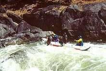 Rafters on the North Fork | |
| Basin | |
| Main source |
Confluence of Silver Creek and Duck Creek 6,716 ft (2,047 m) 38°30′54″N 119°54′52″W / 38.51500°N 119.91444°W[1] |
| River mouth |
Stanislaus River 1,230 ft (370 m) 38°09′15″N 120°21′27″W / 38.15417°N 120.35750°WCoordinates: 38°09′15″N 120°21′27″W / 38.15417°N 120.35750°W[1] |
| Progression | Stanislaus—San Joaquin |
| Basin size | 196 sq mi (510 km2)[2] |
| Physical characteristics | |
| Length | 31.2 mi (50.2 km) |
| Discharge |
|
The North Fork Stanislaus River is a 31.2-mile (50.2 km)[4] tributary of the Stanislaus River in the central Sierra Nevada and Stanislaus National Forest of eastern California.
Geography
The river flows southwest from Alpine County, through Calaveras County, to Tuolumne County.[1]
The river begins at the confluence of Silver Creek and Duck Creek near the western edge of the Carson-Iceberg Wilderness in the Sierra Nevada. From there it flows southwest through a canyon to its confluence with the Middle Fork Stanislaus River near Forest Meadows, which forms the Stanislaus River. The river drains a mountainous, rugged watershed of about 196 square miles (510 km2).[2]
Hydroelectricity infrastructure
Since the 1980s, the river basin has been extensively developed for hydropower generation. Water from the North Fork is stored in Alpine, Utica, Union and New Spicer Meadows Reservoirs, which regulate the water supply for McKays Point Diversion Dam, located lower down on the North Fork.[5] From McKays Point water is diverted to the Collierville Powerhouse, which can generate up to 253 megawatts.[6]
See also
- Dams on the Stanislaus River
- List of rivers of California
- Rivers of the Sierra Nevada (U.S.)
- Stanislaus River topics
References
- 1 2 3 "North Fork Stanislaus River". Geographic Names Information System. United States Geological Survey. 1981-01-19. Retrieved 2013-10-20.
- 1 2 "USGS Gage #11295300 on the North Fork Stanislaus River below Beaver Creek near Hathaway Pines, CA" (PDF). National Water Information System. U.S. Geological Survey. 1990–2012. Retrieved 2013-10-20.
- ↑ "USGS Gage #11294500 on the North Fork Stanislaus River near Avery, CA" (PDF). National Water Information System. U.S. Geological Survey. 1912–2012. Retrieved 2013-10-20.
- ↑ USGS Topo Maps for United States (Map). Cartography by United States Geological Survey. ACME Mapper. Retrieved 2013-10-20.
- ↑ "North Fork Stanislaus River Hydroelectric Development Project and Upper Utica Project". Northern California Power Agency. Retrieved 2013-10-20.
- ↑ "Collierville Powerhouse". Energy Justice Network. Retrieved 2013-10-20.