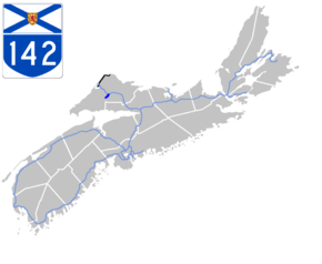
Nova Scotia Highway 142
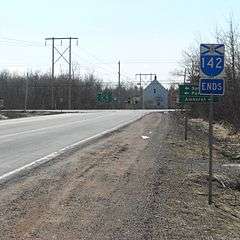
Nova Scotia Route 142 near its terminus in Springhill, Nova Scotia.
| ||||
|---|---|---|---|---|
 | ||||
| Route information | ||||
| Maintained by Nova Scotia Department of Transportation and Infrastructure Renewal | ||||
| Length: | 6 km (4 mi) | |||
| Major junctions | ||||
| South end: |
| |||
| North end: |
| |||
| Highway system | ||||
|
Provincial highways in Nova Scotia
| ||||

Highway 142 is a 2-lane limited-access road in Cumberland County, Nova Scotia, Canada. It links Highway 104 at Exit 5 in Salt Springs Station to the town of Springhill. The 6-kilometre highway crosses the Canadian National Railway main line about 4.5 kilometres outside Springhill. There are several logging roads that have access onto the highway.
The highway was built in the late 1960s as part of a political promise to Springhill residents who were upset that their town was bypassed by the new Trans-Canada Highway alignment on Highway 104; this being less than a decade after the town's economy had been hit by the Springhill Mining Disaster of 1958 which resulted in the closure of local coal mining.
This article is issued from Wikipedia - version of the 12/14/2015. The text is available under the Creative Commons Attribution/Share Alike but additional terms may apply for the media files.