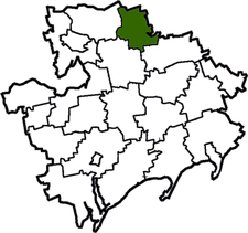
Novomykolaivka Raion
| Novomykolaivskyi Raion Новомиколаївський район | |||
|---|---|---|---|
| Raion | |||
| |||
 | |||
| Coordinates: 47°53′39.11″N 35°54′47.4″E / 47.8941972°N 35.913167°ECoordinates: 47°53′39.11″N 35°54′47.4″E / 47.8941972°N 35.913167°E | |||
| Country |
| ||
| Region | Zaporizhia Oblast | ||
| Established | 1923 | ||
| Admin. center | Novomykolaivka | ||
| Subdivisions |
List
| ||
| Government | |||
| • Governor | Oleksandr Manuylov | ||
| Area | |||
| • Total | 915 km2 (353 sq mi) | ||
| Population (2013) | |||
| • Total |
| ||
| Time zone | EET (UTC+2) | ||
| • Summer (DST) | EEST (UTC+3) | ||
| Postal index | 70100—70153 | ||
| Area code | +380 6144 | ||
| Website | http://www.nmrda.gov.ua | ||
Novomykolaivka Raion (Ukrainian: Новомиколаївський район) is one of the 20 raions (districts) of Zaporizhia Oblast in southern Ukraine. The administrative center of the region is the urban-type settlement of Novomykolaivka. Population: 16,656 (2013 est.)[1]
References
- ↑ "Чисельність наявного населення України (Actual population of Ukraine)" (in Ukrainian). State Statistics Service of Ukraine. Retrieved 21 January 2015.
| Raions | |||||||
|---|---|---|---|---|---|---|---|
| Cities |
| ||||||
| |||||||
This article is issued from Wikipedia - version of the 9/30/2016. The text is available under the Creative Commons Attribution/Share Alike but additional terms may apply for the media files.