Oakland Southwest Airport
| Oakland Southwest Airport | |||||||||||
|---|---|---|---|---|---|---|---|---|---|---|---|
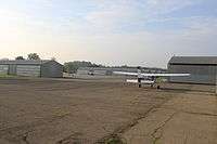
 Airport entrance | |||||||||||
| IATA: none – ICAO: none – FAA LID: Y47 | |||||||||||
| Summary | |||||||||||
| Airport type | Public | ||||||||||
| Owner | Oakland County | ||||||||||
| Serves | New Hudson, Michigan | ||||||||||
| Elevation AMSL | 926 ft / 282 m | ||||||||||
| Coordinates | 42°30′11″N 083°37′25″W / 42.50306°N 83.62361°W | ||||||||||
| Website | www.OakGov.com/... | ||||||||||
| Map | |||||||||||
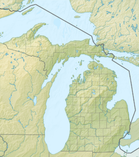 Y47  Y47 Location of airport in Michigan/United States | |||||||||||
| Runways | |||||||||||
| |||||||||||
| Statistics (2008) | |||||||||||
| |||||||||||
Oakland Southwest Airport (FAA LID: Y47) is a county owned public use airport in Oakland County, Michigan, United States. It is located one nautical mile (1.85 km) southwest of the central business district of New Hudson.[1] The airport is uncontrolled, and is used for general aviation purposes.
It is included in the Federal Aviation Administration (FAA) National Plan of Integrated Airport Systems for 2017–2021, in which it is categorized as a local reliever airport facility.[2]
History
The airport opened in 1946 and was formerly known as New Hudson Airport. It was acquired by Oakland County in August 2003.[3]
Facilities and aircraft
Oakland Southwest Airport covers an area of 67 acres (27 ha) at an elevation of 926 feet (282 m) above mean sea level. It has one runway designated 08-26 with an asphalt surface measuring 3,128 by 40 feet (953 x 12 m).[1]
For the 12-month period ending December 31, 2008, the airport had 9,780 general aviation aircraft operations, an average of 26 per day. At that time there were 60 aircraft based at this airport: 93% single-engine, 5% multi-engine and 2% glider.[1]
References
- 1 2 3 4 FAA Airport Master Record for Y47 (Form 5010 PDF). Federal Aviation Administration. Effective 29 July 2010.
- ↑ "List of NPIAS Airports" (PDF). FAA.gov. Federal Aviation Administration. 21 October 2016. Retrieved 25 November 2016.
- ↑ "Oakland/Southwest Airport". Oakland County, Michigan. Retrieved 13 October 2010.
External links
- Aerial photo as of 10 April 2002 from USGS The National Map
- FAA Terminal Procedures for Y47, effective December 8, 2016
- Resources for this airport:
- FAA airport information for Y47
- AirNav airport information for Y47
- FlightAware airport information and live flight tracker
- SkyVector aeronautical chart for Y47