Oakura
| Oakura | |
|---|---|
 Oakura | |
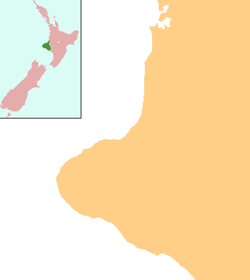
| Coordinates: 39°7′3″S 173°57′16″E / 39.11750°S 173.95444°E | |
| Country | New Zealand |
| Region | Taranaki |
| District | New Plymouth District |
| Population (2013) | |
| • Total | 1,380 |
Oakura is a small township in New Plymouth District, Taranaki, in the western North Island of New Zealand. It is located on State Highway 45, 15 kilometres south-west of New Plymouth. Okato is 12 km further south-west. The Oakura River flows past the town and into the North Taranaki Bight. To the south is the Kaitake Range, part of Egmont National Park.[1][2]
The population of Oakura was 1,380 in the 2013 Census, an increase of 21 from 2006.[3]
The Oakura Messenger (TOM) is a monthly publication delivered to all letterboxes in the area. It began in October 2000.[4]
On 5 July 2007 the town was hit by a tornado, which damaged 60 houses.[5]
Oakura is well known for its beach—Oakura Beach. One of only three beaches along the west coast of New Zealand which is north facing, in 2007 it became one of the first Blue Flag accredited beaches in Oceania. Only two others—Fitzroy and East End beach in nearby New Plymouth—received the same award that year. As of 2010, Oakura Beach has retained its blue flag status.[6]
The Oakura River (and therefore Oakura township itself) was named after the female ancestor Akura-matapū of the Kurahaupō waka. Oakura-matapu was the original name of the river, and it literally means "Belonging to Akura-matapū". Akura was married to Okorotua. Ngāti Tairi hapū holds mana whenua in Oakura. Ngāti Tairi belongs to the larger descent group of Ngā Mahanga a Tairi. Ngāti Tairi and Ngā Māhanga a Tairi are a part of the tribe Taranaki. Ngāti Tairi retain their take ahi-kā (rights of ownership) through the marae Oakura Pā beside the southern side of the Oakura River. People have been living in the area of Oakura for hundreds of years.
When war broke out in 1860, Ngāti Tairi as part of Nga Mahanga and Taranaki joined in the offensives against the British. The nearby Tapuae ridge (north of Oakura) was a continual site of conflict. On 4 May 1863 a party of about 40 Māori warriors ambushed a small military party on a coastal road west of the town, killing nine of the 10 soldiers. The revenge attack on the military party, escorting a British defaulter to New Plymouth for trial, reignited hostilities in the Taranaki War.[7][8]
Amenities and Services
South Road (better known as Surf Highway 45) is Oakura's main street and most local businesses and services are situated around here.
Features and Attractions
Apart from its well known beach, Oakura's main attraction is Butlers Reef - a bar and music venue that has showcased many well known New Zealand and international acts, including Dave Dobbyn, Trinity Roots, Gin Wigmore, Katchafire, Supergroove and Jimmy Barnes.
Other places of interest include the township's three parks - Matekai, Corbett and the Shearer Reserve. Also, within five minutes drive south west is Lucy's Gully, a popular beauty spot in the Kaitake ranges that hit the national headlines in 2005 when the body of murdered German tourist Birgit Brauer was discovered there.[9]
Koru Pā is a historic reserve situated 3 km south-east of Oakura township. Thought to be one of the first Māori settlements in Taranaki, Māori tradition recognises that it may have been built as early as 1000AD by Nga Mahanga a Tairi, a hapū of the Taranaki iwi.[10]
Ringcraft Moana is a manufacturing jewellery business with showroom, garden and a large pearl collection of abalone pearls.[11] The Wavehaven, on Surf Highway 45 just south of Oakura, offers accommodation and access to surfing beaches.[12]
Once a year Oakura's artists are opening up their studios to the public in a two weekend event. The Oakura Arts Trail can be found online [13]
Education
Oakura School is a coeducational full primary (years 1-8) school with a decile rating of 10[14] and a roll of 349 students as of July 2016.[15] The school was founded in 1866.[16]
Oakura PlayCentre is a registered Early Childhood Facility that caters to children from ages 0 - 6 years. It is licensed for 3 mornings a week; Mondays, Wednesdays and Fridays. Playcentre philosophy is based on child-initiated play and recognises the parents as the first and best educators of their own children. Playcentre families receive a unique early childhood experience with opportunities for whānau/families to learn together.
Notable residents
- Ruhira Matekai (also known as Lucy Stevens) was a well-known Māori woman who lived in Oakura in the 19th century. Lucy's Gully and Matekai Park are named after her.[17]
- Professional surfer Paige Hareb is from Oakura.[18]
References
- ↑ Peter Dowling (editor) (2004). Reed New Zealand Atlas. Reed Books. pp. map 34. ISBN 0-7900-0952-8.
- ↑ Roger Smith, GeographX (2005). The Geographic Atlas of New Zealand. Robbie Burton. pp. map 84. ISBN 1-877333-20-4.
- ↑ 2013 Census QuickStats about a place:Oakura
- ↑ "History". The Oakura Messenger. Archived from the original on 7 June 2007. Retrieved 2008-07-04.
- ↑ Dye, Stuart (7 July 2007). "Tornado victim: 'I thought we were going to die'". The New Zealand Herald. Retrieved 1 November 2011.
- ↑ "Blue Flag Beaches". Blue Flag. Retrieved 2011-01-23.
- ↑ Belich, James (1986). The New Zealand Wars and the Victorian Interpretation of Racial Conflict (1st ed.). Auckland: Penguin. p. 119. ISBN 0-14-011162-X.
- ↑ James Cowan, The New Zealand Wars: A History of the Maori Campaigns and the Pioneering Period: Vol I, Chapter 25, 1922
- ↑ "Police Media Release". New Zealand Police. Retrieved 2009-12-31.
- ↑ "Historic Koru Pa". Department of Conservation. Retrieved 2010-01-06.
- ↑ "New Zealand pearls". Ringcraft Moana. Retrieved 2012-09-11.
- ↑ "About" Thewavehaven.co.nz. Retrieved 4 January 2014.
- ↑ |title=Oakuraarts.co.nz
- ↑ Te Kete Ipurangi schools database: Oakura School
- ↑ "Directory of Schools - as at 2 August 2016". New Zealand Ministry of Education. Retrieved 2016-08-16.
- ↑ 125th jubilee of Oakura School and districts, 1866-1991 : souvenir booklet. 1991.
- ↑ "Lucy's Gully". Retrieved 2009-12-31.
- ↑ "NZ teen makes surfing history". Stuff.co.nz. Retrieved 4 January 2014.
Further reading
General historical works
- "110th jubilee of Oakura School and districts, 1866-1976". New Plymouth, [N.Z.]: Taranaki Newspapers. 1976.
- "125th jubilee of Oakura School and districts, 1866-1991: souvenir booklet". New Plymouth, [N.Z.]: Original Print. 1991.
- New Plymouth Genealogical Group (1974). "Cemetery and memorial transcriptions : Stratford, Omata, Oakura". New Plymouth, [N.Z.]: New Plymouth Genealogical Group.
Clubs and organisations
- Some of the records concerning the early days of the Oakura Library are held within "Puke Ariki". in New Plymouth. See "Oakura Library (B202)". Retrieved 2008-02-02.
Environment
- Franks, John A. (1980). "Oakura Stream Catchment: water and land use". Stratford, [N.Z.]: Taranaki Catchment Commission.
Māori
- New Zealand Native Land Court (1994). "Important judgments delivered in the Compensation Court and Native Land Court 1866-1879". n.p.: Southern Reprints.
- This is a reprint of a title published in Auckland: under the direction of the Chief Judge, Native Land Court by H. Brett, 1879.
- Prickett, Nigel (1980). "Maori fortifications of the Omata and Oakura Districts, Taranaki". Auckland, [N.Z.]: Auckland Institute & Museum.
New Zealand Wars
- Great Britain War Office Topographical Depot (1864). "Rough eye sketch of ground reconnoitred for position for guns on north bank of Oakura River in front of rebel position Kaitake Ranges, Province of Taranaki, New Zealand [cartographic material]: shewing route followed in reconnaissance : transmitted with D.Qr.Mr. General's report and journal, July 7th 1863". London, [U.K.]: Topographical Depot of the War Office.
- This is Plate 5 from Journals of the Deputy Quartermaster General in New Zealand, 1864. An electronic copy is available from the National Library of New Zealand.
Maps
- New Zealand Department of Lands & Survey (1907). "Town of Oakura, Wairau Survey Dist. [Scale = 1:4 752 (1/13.3 in. to the mile)]". Wellington, [N.Z.]: New Zealand Department of Lands & Survey.
- New Zealand Department of Lands & Survey (1927). "Town of Oakura, Wairau Survey Dist. [Scale = 1:4 752 (1/13.3 in. to the mile)]". Wellington, [N.Z.]: New Zealand Department of Lands & Survey.
People
- The papers of Edward Leslie Hughes are held within "Puke Ariki". in New Plymouth. Within this collection is a manuscript concerning the history of Oakura. See "HUGHES, Edward Leslie (A400)". Retrieved 2008-02-02.
- Some of the papers of Percy Smith are held within "Puke Ariki". in New Plymouth. Within this collection is a Taranaki Military Settlers' Land Order, allocating Smith land in the Oakura area. See "SMITH, Stephenson Percy, 1840-1922 (B896)". Retrieved 2008-02-02.
- The papers of Marc Frederic Voullaire are held within "Puke Ariki". in New Plymouth. Within this collection is material concerning the history of the Taranaki dairy industry, the location of the mission station of the Lutheran missionary, Johann Riemenschneider.. See "VOULLAIRE, Marc Frederic, 1885-1964 (B900)". Retrieved 2008-02-02.
Schools
- "110th jubilee of Oakura School and districts, 1866-1976". New Plymouth, [N.Z.]: Taranaki Newspapers. 1976.
- "125th jubilee of Oakura School and districts, 1866-1991: souvenir booklet". New Plymouth, [N.Z.]: Original Print. 1991.
- "Oakura, Koru and Kirihau Schools 80th jubilee thanksgiving service, Oakura Public Hall, Sunday 19th May [1957]". n.p.: n.p. n.d.
- Raill, Norman; Price, C.K.; Clegg, C.P. (1957). "Oakura, Koru and Kirihau Schools combined jubilee, 1876-1956: jubilee celebrations, May 18th, 19th and 20th, 1957: eighty years of progress". New Plymouth, [N.Z.]: Avery Press.
External links
Coordinates: 39°07′S 173°57′E / 39.117°S 173.950°E