Oasis, Nevada
| Oasis, Nevada | |
|---|---|
| Census-designated place | |
 | |
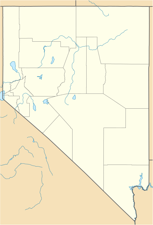 Oasis Location within the state of Nevada | |
| Coordinates: 41°01′43″N 114°29′13″W / 41.02861°N 114.48694°WCoordinates: 41°01′43″N 114°29′13″W / 41.02861°N 114.48694°W | |
| Country | United States |
| State | Nevada |
| County | Elko |
| Area | |
| • Total | 0.89 sq mi (2.31 km2) |
| • Land | 0.89 sq mi (2.31 km2) |
| • Water | 0.0 sq mi (0.0 km2) |
| Elevation | 5,870 ft (1,790 m) |
| Population (2010) | |
| • Total | 29 |
| • Density | 33/sq mi (12.6/km2) |
| Time zone | Pacific (PST) (UTC-8) |
| • Summer (DST) | PDT (UTC-7) |
| ZIP code | 89835 |
| FIPS code | 32-52200 |
| GNIS feature ID | 845590 |
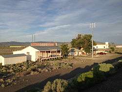
Oasis is an unincorporated community and census-designated place (CDP) located in eastern Elko County, Nevada, United States, at the junction of State Route 233 and Interstate 80, 31 miles (50 km) northwest of the Utah border and 77 miles (124 km) east of Elko. As of the 2010 census it had a population of 29.[1] Oasis is a high desert community located in the Goshute Valley between the Pequop Mountains and the Toano Range at an elevation of approximately 5,870 feet (1,790 m).
The community is part of the Elko Micropolitan Statistical Area.
State offices
- Nevada Department of Forestry[2]
- Nevada Department of Transportation, Pequop Maintenance Station[2]
References
- ↑ "Geographic Identifiers: 2010 Demographic Profile Data (G001): Oasis CDP, Nevada". U.S. Census Bureau, American Factfinder. Retrieved February 16, 2016.
- 1 2 "Misc Government in Oasis, Nevada (nv)". Retrieved 2009-12-07.
Municipalities and communities of Elko County, Nevada, United States | ||
|---|---|---|
| Cities | 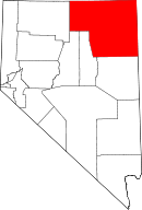 | |
| CDPs | ||
| Other unincorporated communities | ||
| Indian reservation | ||
| Ghost towns | ||
This article is issued from Wikipedia - version of the 2/16/2016. The text is available under the Creative Commons Attribution/Share Alike but additional terms may apply for the media files.