Ocotillo, California
| Ocotillo | |
|---|---|
| census-designated place | |
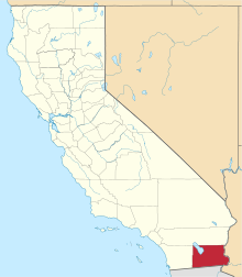
 Location in Imperial County and the state of California | |
 Ocotillo Location in the United States | |
| Coordinates: 32°44′19″N 115°59′39″W / 32.73861°N 115.99417°WCoordinates: 32°44′19″N 115°59′39″W / 32.73861°N 115.99417°W[1] | |
| Country |
|
| State |
|
| County | Imperial |
| Area[2] | |
| • Total | 8.857 sq mi (22.941 km2) |
| • Land | 8.857 sq mi (22.941 km2) |
| • Water | 0 sq mi (0 km2) 0% |
| Elevation[1] | 377 ft (115 m) |
| Population (2010) | |
| • Total | 266 |
| • Density | 30/sq mi (12/km2) |
| Time zone | Pacific (PST) (UTC-8) |
| • Summer (DST) | PDT (UTC-7) |
| ZIP code | 92259 |
| Area codes | 442/760 |
| FIPS code | 06-53378 |
| GNIS feature IDs | 1656587, 1656587 |
Ocotillo is a census-designated place (CDP) in Imperial County, California. Ocotillo is located 26 miles (42 km) west of El Centro,[3] The population was 266 at the 2010 census, down from 296 at the 2000 census. It is part of the El Centro, California Metropolitan Statistical Area.
Ocotillo was devastated by floods from Hurricane Kathleen in 1976; 3 people died. A documentary about the Ocotillo disaster can be seen on YouTube, search "Hurricane Kathleen" or "The Ocotillo Flood of 1976". There are several cafes, a small market and a saloon that serves some food (Lazy Lizard Saloon). There is a new Desert Museum with displays about the desert terrain, flora, etc. and artifacts from the Kumeyaay culture that inhabited the area. It is located on the south side of freeway I-8.
Geography
According to the United States Census Bureau, the CDP has a total area of 8.9 square miles (23 km2), all of it land. According to the United States Census Bureau
Geology
According to the United States Census Bureau The mountains nearby grew a little taller as a result of a series of minor earthquakes on 15 June 2010 which seems to be a result of 7.2 Richter Scale earthquake in Baja California (Mexico) back in April 2010. NOAA has predicted this area to flood in January 2016 due to increased rainfall from El Nino.
History
Ocotillo is located on a site that originally sat on the edge of ancient Lake Cahuilla and is the traditional territory of the Kumeyaay. The town originated as a retirement community.[3] The post office was opened in 1957.[3] In March 2012, a museum, the Imperial Valley Desert Museum opened in Ocotillo after many years of fundraising and construction.[4]
Demographics
2010
The 2010 United States Census[5] reported that Ocotillo had a population of 266. The population density was 30.0 people per square mile (11.6/km²). The racial makeup of Ocotillo was 242 (91.0%) White, 1 (0.4%) African American, 1 (0.4%) Native American, 2 (0.8%) Asian, 0 (0.0%) Pacific Islander, 17 (6.4%) from other races, and 3 (1.1%) from two or more races. Hispanic or Latino of any race were 61 persons (22.9%).
The Census reported that 266 people (100% of the population) lived in households, 0 (0%) lived in non-institutionalized group quarters, and 0 (0%) were institutionalized.
There were 138 households, out of which 24 (17.4%) had children under the age of 18 living in them, 50 (36.2%) were opposite-sex married couples living together, 13 (9.4%) had a female householder with no husband present, 5 (3.6%) had a male householder with no wife present. There were 3 (2.2%) unmarried opposite-sex partnerships, and 2 (1.4%) same-sex married couples or partnerships. 60 households (43.5%) were made up of individuals and 25 (18.1%) had someone living alone who was 65 years of age or older. The average household size was 1.93. There were 68 families (49.3% of all households); the average family size was 2.60.
The population was spread out with 44 people (16.5%) under the age of 18, 9 people (3.4%) aged 18 to 24, 33 people (12.4%) aged 25 to 44, 109 people (41.0%) aged 45 to 64, and 71 people (26.7%) who were 65 years of age or older. The median age was 56.1 years. For every 100 females there were 111.1 males. For every 100 females age 18 and over, there were 113.5 males.
There were 323 housing units at an average density of 36.5 per square mile (14.1/km²), of which 98 (71.0%) were owner-occupied, and 40 (29.0%) were occupied by renters. The homeowner vacancy rate was 2.8%; the rental vacancy rate was 14.9%. 189 people (71.1% of the population) lived in owner-occupied housing units and 77 people (28.9%) lived in rental housing units.
2000
As of the census[6] of 2000, there were 296 people, 145 households, and 79 families residing in the CDP. The population density was 33.3 people per square mile (12.9/km²). There were 253 housing units at an average density of 28.5 per square mile (11.0/km²). The racial makeup of the CDP was 87.8% White, 0.7% Black or African American, 1.7% Native American, 0.3% Asian, 0.3% Pacific Islander, 4.4% from other races, and 4.7% from two or more races. 19.9% of the population were Hispanic or Latino of any race.
There were 145 households out of which 22.8% had children under the age of 18 living with them, 44.8% were married couples living together, 8.3% had a female householder with no husband present, and 45.5% were non-families. 42.1% of all households were made up of individuals and 22.1% had someone living alone who was 65 years of age or older. The average household size was 2.0 and the average family size was 2.8.
In the CDP the population was spread out with 21.6% under the age of 18, 3.7% from 18 to 24, 18.9% from 25 to 44, 32.1% from 45 to 64, and 23.6% who were 65 years of age or older. The median age was 48 years. For every 100 females there were 112.9 males. For every 100 females age 18 and over, there were 100.0 males.
The median income for a household in the CDP was $23,438, and the median income for a family was $43,125. Males had a median income of $24,196 versus $55,556 for females. The per capita income for the CDP was $14,849. None of the families and 16.6% of the population were living below the poverty line, including no under eighteens and 26.2% of those over 64.
Government
In the California State Legislature, Ocotillo is in the 40th Senate District, represented by Democrat Ben Hueso,[7] and the 56th Assembly District, represented by Democrat Eduardo Garcia.[8]
In the United States House of Representatives, Ocotillo is in California's 51st congressional district, represented by Democrat Juan Vargas.[9]
See also
References
- 1 2 "Ocotillo". Geographic Names Information System. United States Geological Survey.
- ↑ "2010 Census U.S. Gazetteer Files – Places – California". United States Census Bureau.
- 1 2 3 Durham, David L. (1998). California's Geographic Names: A Gazetteer of Historic and Modern Names of the State. Clovis, Calif.: Word Dancer Press. p. 1450. ISBN 1-884995-14-4.
- ↑ "Imperial Valley Desert Museum website". Retrieved 30 April 2013.
- ↑ "2010 Census Interactive Population Search: CA - Ocotillo CDP". U.S. Census Bureau. Retrieved July 12, 2014.
- ↑ "American FactFinder". United States Census Bureau. Retrieved 2008-01-31.
- ↑ "Senators". State of California. Retrieved April 11, 2013.
- ↑ "Members Assembly". State of California. Retrieved April 11, 2013.
- ↑ "California's 51st Congressional District - Representatives & District Map". Civic Impulse, LLC. Retrieved April 11, 2013.