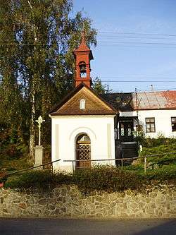
Olšany (Vyškov District)
| Olšany | |||
|---|---|---|---|
| Municipality | |||
 | |||
| |||
 Olšany | |||
| Coordinates: 49°15′16″N 16°51′34″E / 49.25444°N 16.85944°ECoordinates: 49°15′16″N 16°51′34″E / 49.25444°N 16.85944°E | |||
| Country |
| ||
| Region | South Moravian | ||
| District | Vyškov | ||
| Area | |||
| • Total | 18.7 km2 (7.2 sq mi) | ||
| Elevation | 418 m (1,371 ft) | ||
| Population (1.1.2012) | |||
| • Total | 536 | ||
| • Density | 29/km2 (74/sq mi) | ||
| Postal code | 683 02 | ||
| Website | http://www.olsany.org/cz/default.htm | ||
Olšany is a village and municipality (obec) in Vyškov District in the South Moravian Region of the Czech Republic.
The municipality covers an area of 18.7 square kilometres (7.2 sq mi), and has a population of 460 (as at 3 July 2006).
Olšany lies approximately 10 kilometres (6 mi) west of Vyškov, 19 km (12 mi) east of Brno, and 199 km (124 mi) south-east of Prague.
References
| Wikimedia Commons has media related to Olšany (Vyškov District). |
This article is issued from Wikipedia - version of the 4/8/2016. The text is available under the Creative Commons Attribution/Share Alike but additional terms may apply for the media files.