Oliveira do Bairro
| Oliveira do Bairro | |||
|---|---|---|---|
| Municipality | |||
| |||
 | |||
| Coordinates: 40°31′N 8°30′W / 40.517°N 8.500°WCoordinates: 40°31′N 8°30′W / 40.517°N 8.500°W | |||
| Country |
| ||
| Region | Centro | ||
| Subregion | Baixo Vouga | ||
| Intermunic. comm. | Região de Aveiro | ||
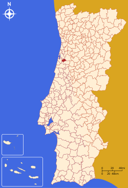
| District | Aveiro | ||
| Parishes | 4 | ||
| Government | |||
| • President | Mário Oliveira (PSD) | ||
| Area | |||
| • Total | 87.32 km2 (33.71 sq mi) | ||
| Population (2011) | |||
| • Total | 23,028 | ||
| • Density | 260/km2 (680/sq mi) | ||
| Time zone | WET/WEST (UTC+0/+1) | ||
| Website | http://www.cm-olb.pt/ | ||


Oliveira do Bairro (Portuguese pronunciation: [oliˈvɐjɾɐ ðu ˈβajʁu]) is a town and a municipality in the district of Aveiro in Portugal. The population in 2011 was 47,729,[1] in an area of 335.27 km².[2] It had 16,994 eligible voters in 2006. The town itself had a population of 3,077 in 2001.[3]
The municipality is in the Bairrada area. The present Mayor is Mário João da Silva Oliveira, elected by the Social Democratic Party. The municipal holiday is Ascension Day.
Demographics
| Inhabitants (1801–2011) | |||||||||
|---|---|---|---|---|---|---|---|---|---|
| 1801 | 1849 | 1900 | 1930 | 1960 | 1981 | 1991 | 2001 | 2004 | 2011 |
| 1939 | 5086 | 9540 | 14362 | 16699 | 17517 | 18660 | 21164 | 22365 | 23028 |
Parishes
Administratively, the municipality is divided into 4 civil parishes (freguesias):[4]
- Bustos, Troviscal e Mamarrosa
- Oiã
- Oliveira do Bairro
- Palhaça
Cultural institutions
- União Filarmónica do Troviscal, Troviscal - Aveiro, conducted by André Granjo
Twinning cities
Oliveira do Bairro is twinned with two cities: Lamballe, France and Benguela, Angola
References
- ↑ Instituto Nacional de Estatística
- ↑ Direção-Geral do Território
- ↑ UMA POPULAÇÃO QUE SE URBANIZA, Uma avaliação recente - Cidades, 2004 Nuno Pires Soares, Instituto Geográfico Português (Geographic Institute of Portugal)
- ↑ Diário da República. "Law nr. 11-A/2013, pages 552 84-85" (pdf) (in Portuguese). Retrieved 29 July 2014.
External links
This article is issued from Wikipedia - version of the 1/25/2016. The text is available under the Creative Commons Attribution/Share Alike but additional terms may apply for the media files.