Palu River
| Palu River | |
|---|---|
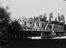 Bridge over Palu river (1930-1936) | |
| Country | Indonesia |
| Basin | |
| Main source | Sulawesi |
| River mouth |
at Kota Palu into Makassar Strait Sea level |
| Basin size | 2,694 km2 (1,040 sq mi)[1] |
| Physical characteristics | |
| Discharge |
|
| Features | |
| Tributaries |
|
Palu River (indon. Sungai Palu) is a river in Sulawesi, Indonesia.[2] 41% of the basin area is covered by the protected tropical montane forest of the Lore Lindu National Park.[3]
See also
References
- ↑ "The impact of the warm phase of ENSO (El Nĩno Southern Oscillation) events on water resource availability of tropical catchments in Central Sulawesi, Indonesia" (PDF). Advances in Geosciences. 2006. Retrieved 2013-09-21.
- ↑ Rand McNally, The New International Atlas, 1993.
- ↑ "The Impact of El Niño Southern Oscillation Events on Water Resource Availability in Central Sulawesi, Indonesia" (PDF). Constanze Leemhuis. 2005. Retrieved 2013-09-21.
Coordinates: 0°52′00″S 119°51′28″E / 0.86667°S 119.85778°E
This article is issued from Wikipedia - version of the 6/23/2016. The text is available under the Creative Commons Attribution/Share Alike but additional terms may apply for the media files.