Panchkhal
| Panchkhal पाँचखाल | |
|---|---|
| Municipality | |
|
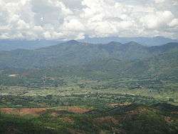
A view of Panchkhal Valley from its southern corner | |
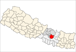
 Panchkhal Location in Nepal | |
| Coordinates: 27°39′N 85°37′E / 27.650°N 85.617°ECoordinates: 27°39′N 85°37′E / 27.650°N 85.617°E | |
| Country | Nepal |
| Zone | Bagmati Zone |
| District | Kabhrepalanchok District |
| Population (1991) | |
| • Total | 9,481 |
| Time zone | NST (UTC+5:45) |
| Postal code | 45212 [1] |
| Area code(s) | 011 |
| Website |
ddckavre |
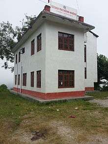
Panchkhal Municipality Office
Panchkhal is a Municipality in Kabhrepalanchok District in the Bagmati Zone of central Nepal. At the time of the 1991 Nepal census it had a population of 9481 in 1657 individual households.[2] This place is situated in Bagmati, Central, Nepal, its geographical coordinates are 27° 39' 0" North, 85° 37' 0" East and its original name (with diacritics) is Panchkhal.
References
- ↑ http://www.nepalpost.gov.np/index.php?option=com_content&view=article&id=56&Itemid=67
- ↑ "Nepal Census 2001". Nepal's Village Development Committees. Digital Himalaya. Retrieved 2008-09-03.
External links
This article is issued from Wikipedia - version of the 7/1/2016. The text is available under the Creative Commons Attribution/Share Alike but additional terms may apply for the media files.