Panther, Pennsylvania
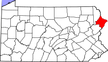
Panther is a village in Greene Township, Pike County, Pennsylvania.
Panther was originally located between the Pennsylvania villages of Canadensis, La Anna, and Newfoundland. Panther now uses Newfoundland's ZIP code (18445) and all mail services are now conducted in the latter village. The building that once housed the Panther Post Office has been converted into a private residence. There is little that remains of the original post office and general store after a fire nearly destroyed the entire building. In the midst of rebuilding another fire nearly burned it to the foundation.
What to look for
There are many bed and breakfasts, and fine dining locations close by, such as The French Manor, Napolitano's, and Renegade's and Up a Creek Inn. Fishing, boating, and any outdoor activity is very popular.
Some history
Home to many farmers over the past few decades, it originally rose with the popularity of lumber and trapping. Some of the earliest maps of America include Panther Road (Route 447) because of this. The remains of many logging trails are still in existence, stretching from Stony Lonesome Road all the way to German Valley Road.
Some early settlers resided in what is now known as the valley at the top of the mountain. A valley stretching from the intersection of Panther Rd and Pine Grove Road all the way to German Valley Road and the peak of Mount Hensel. Some of these pre-Civil War homes still stand today. There are two original one-room school houses. One is currently abandoned and in almost complete disrepair at the corner of Lake Russel Road and Pine Grove Road. All that is left of the German Valley School (historical), is the foundation. This is located 400 feet north of German Valley Road on Sugar Hill Road and about 60 feet away from the road. The foundation can no longer be seen from the road due to overgrowth.
The name
Early trappers and loggers would frequent the trading post in present-day Canadensis. Panther received its name from the abundance of what was known to be "Panthers". There are many theories as to what the animal actually was that gave this town its name due to the ambiguity of the word "panther". Theories include the Nittany Lion, Mountain Lion, Puma, Cougar, Bobcat and even an actual black eastern Panther .[1] Today, there are none in existence in this area; the last mountain lions was seen in 1874. The last wild panther known to have walked in the Pennsylvania woods did so in Berks County.[2]
The currently known large mammals in this area include deer, bear, raccoon, possum, coyote, fox, beaver, ground-hog, and muskrat.
Weather
The high elevation (as high as 2,115 ft) brings a strong winter. Mount Hensel is the tallest peak furthest east in the Pocono Region. Weather fronts often converge at this point along the mountain range to create extreme accumulations in the winter.
References
- ↑ "Wild Animals: black panther, felis concolor coryi, blue ridge mountains". AllExperts.com. Retrieved 2010-10-21.
- ↑
- Hensel, R (2010). "Interviewed: Oct. 2010"
- United States Geological Survey (2010)retrieved "Panther, PA"
- Pennsylvania State Game Commission
Coordinates: 41°16′48″N 75°17′58″W / 41.28000°N 75.29944°W
