Pāpaʻaloa, Hawaii
| Pāpaʻaloa, Hawaii | |
|---|---|
| Unincorporated community | |
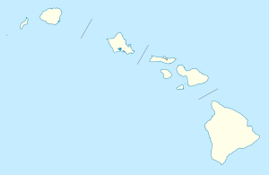 Pāpaʻaloa, Hawaii Location within the state of Hawaii | |
| Coordinates: 19°58′44″N 155°13′16″W / 19.97889°N 155.22111°WCoordinates: 19°58′44″N 155°13′16″W / 19.97889°N 155.22111°W | |
| Country | United States |
| State | Hawaii |
| County | Hawaii |
| Elevation | 10 ft (3 m) |
| Time zone | Hawaii-Aleutian (HAST) (UTC-10) |
| • Summer (DST) | HADT (UTC-9) |
| ZIP codes | 96780 |
| GNIS feature ID | 363109 |
Papaʻaloa (also spelled Papaaloa) is an unincorporated community on the island of Hawaii in Hawaii County, Hawaii, United States. It lies along Hawaii Route 19 north of Hilo, the county seat of Hawaii County.[1] Its elevation is 10 feet (3 m) Because the community has borne multiple names, the Board on Geographic Names officially designated it "Papaaloa" in 1914 and 1954 before assigning the current name in 2001.[2] Although it is unincorporated, it has a post office, with the ZIP code of 96780.[3]
References
- ↑ Rand McNally. The Road Atlas '08. Chicago: Rand McNally, 2008, p. 30.
- ↑ U.S. Geological Survey Geographic Names Information System: Pāpaʻaloa, Hawaii, Geographic Names Information System, 2003-09-30. Accessed 2008-04-08.
- ↑ Zip Code Lookup

This article is issued from Wikipedia - version of the 1/20/2014. The text is available under the Creative Commons Attribution/Share Alike but additional terms may apply for the media files.