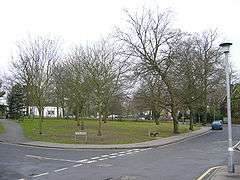
Park Hill Recreation Ground
| Park Hill | |
|---|---|
|
Park Hill Recreation Ground entrance from Central Croydon side | |
| Type | Public park |
| Location | Croydon |
| Operated by | London Borough of Croydon |
| Status | Open all year |
| Public transit access |
East Croydon station, South Croydon railway station Bus 64 and 433 to Birdhurst Gardens stop. |
Park Hill Recreation Ground is a 15 acres (6.1 ha) park near the centre of Croydon, Greater London, managed by the London Borough of Croydon. It runs from Barclay Road to Coombe Road beside the railway line, with the main entrances on Water Tower Hill and Barclay Road. The nearest stations (equidistant to the park) are East Croydon to the north for Tramlink and National Rail services and South Croydon to the south for National Rail.
At the southern end, at the very top of the hill which forms the park, it joins the grounds of Coombe Cliff once the home of members of the Horniman Tea family. From there a steep drive winds down to Coombe Road where a footpath leads to South Croydon railway station for National Rail. The grounds now form part of the park and are open to the Public, but the house itself, is not. Where the drive meets Coombe Road there is a further entrance and a gatehouse, which is now privately owned for residential purposes.
As well as standard amenities, including refreshments, sports faciliites and a walled herb garden,[1] the park is also the site of the historic Croydon Water Tower. Built in 1867, it ceased to provide water to higher areas of the borough in 1923.[2] As of September 2015, the building is grade II listed, but is disused and not open to the public.[2]

Cotelands

Cotelands is a small park near Park Hill, also managed by the London Borough of Croydon. It covers an area of 0.20 hectares. It is really just a green on the corner of Cotelands and The Avenue, next to Park Hill Junior School and near Archbishop Tenison's School.
See also
- Park Hill Junior School
- List of parks and open spaces in Croydon
- Croydon parks and open spaces
- Addiscombe Recreation Ground
- Addiscombe Linear Park
References
- ↑ "Park Hill Recreation Ground". London Borough of Croydon. 2015. Retrieved 26 November 2015.
- 1 2 This is Croydon (10 September 2010). "Water tower is great for views but abandoned". Croydon Advertiser. Retrieved 26 November 2015.
External links
Coordinates: 51°22′16″N 0°05′21″W / 51.37117°N 0.08924°W
