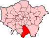
Croydon
| Croydon | ||||
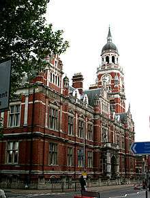
From top to bottom: the Old Town Hall and Clocktower (with the Spreadeagle in the foreground), Katharine Street; the Grants Building, High Street |
||||
 Croydon |
||||
| Population | 173,314 (Addiscombe, Broad Green, Fairfield, Waddon, Croham, Selhurst, Ashburton, Woodside, Sanderstead, Shirley and Selsdon and Ballards wards)[1] | |||
|---|---|---|---|---|
| OS grid reference | TQ335655 | |||
| – Charing Cross | 9.5 mi (15.3 km) N | |||
| London borough | Croydon | |||
| Ceremonial county | Greater London | |||
| Region | London | |||
| Country | England | |||
| Sovereign state | United Kingdom | |||
| Post town | CROYDON | |||
| Postcode district | CR0 CR9 CR2 CR7 | |||
| Dialling code | 020 | |||
| Police | Metropolitan | |||
| Fire | London | |||
| Ambulance | London | |||
| EU Parliament | London | |||
| UK Parliament | Croydon Central | |||
| Croydon North | ||||
| Croydon South | ||||
| London Assembly | Croydon and Sutton | |||


Coordinates: 51°22′22″N 0°06′36″W / 51.3727°N 0.1099°W
Croydon is a large town in south London, England, the principal settlement of the London Borough of Croydon. It is located 9.5 miles (15.3 km) south of Charing Cross. It is one of the largest commercial districts outside of Central London, bearing one of the largest shopping districts and a developed night-time economy. It is identified in the London Plan as one of 11 metropolitan centres in Greater London.[2] It has a population of 52,104 in the 2011 census, comprising the Addiscombe, Broad Green and Fairfield wards.
Historically a part of the hundred of Wallington in the county of Surrey, at the time of the Norman conquest of England, Croydon had a church, a mill, and around 365 inhabitants, as recorded in the Domesday Book of 1086.[3] Croydon expanded during the Middle Ages as a market town and a centre for charcoal production, leather tanning and brewing. The Surrey Iron Railway from Croydon to Wandsworth opened in 1803 and was the world's first public railway. Later nineteenth century railway building facilitated Croydon's growth as a commuter town for London (including the City of London). By the early 20th century, Croydon was an important industrial area, known for car manufacture, metal working and its airport. In the mid 20th century these sectors were replaced by retailing and the service economy, brought about by massive redevelopment which saw the rise of office blocks and the Whitgift Centre, for many decades the largest shopping centre in London until 2008. Croydon was amalgamated into Greater London in 1965.
Croydon lies on a transport corridor between central London and the south coast of England, to the north of two gaps in the North Downs, one followed by the A23 Brighton Road through Purley and Merstham and the main railway line and the other by the A22 from Purley to the M25 Godstone interchange. Road traffic is diverted away from a largely pedestrianised town centre, mostly consisting of the North End. Its main railway station, East Croydon, is a major hub of the national railway transport system, with frequent fast services to central London among other destinations such as Brighton. The town is unique in Greater London for its Tramlink light rail transport system.
History
Toponymy
As the vast majority of place names in the area are of Anglo-Saxon origin, the theory accepted by most philologists is that the name Croydon derives originally from the Anglo-Saxon croh, meaning "crocus", and denu, "valley", indicating that, like Saffron Walden in Essex, it was a centre for the cultivation of saffron.[5][6] It has been argued that this cultivation is likely to have taken place in the Roman period, when the saffron crocus would have been grown to supply the London market, most probably for medicinal purposes, and particularly for the treatment of granulation of the eyelids.[7]
Alternative, although less probable, theories of the name's origin have been proposed. According to John Corbett Anderson,[8] "The earliest mention of Croydon is in the joint will of Beorhtric and Aelfswth, dated about the year 962. In this Anglo-Saxon document the name is spelt (here he uses original script) Crogdaene. Crog was, and still is, the Norse or Danish word for crooked, which is expressed in Anglo-Saxon by crumb, a totally different word. From the Danish came our crook and crooked. This term accurately describes the locality; it is a crooked or winding valley; in reference to the valley that runs in an oblique and serpentine course from Godstone to Croydon." Anderson refuted a claim, originally cited by Andrew Coltee Ducarel, that the name came from the Old French for "chalk hill", because the name was in use at least a century before the French language would have been commonly used following the Norman Invasion. However, there was no long-term Danish occupation (see Danelaw) in Surrey, which was part of Wessex, and Danish-derived nomenclature is also highly unlikely. More recently, David Bird has speculated that the name might derive from a personal name, Crocus: he suggests a family connection with the documented Chrocus, king of the Alemanni, who allegedly played a part in the proclamation of Constantine as emperor at York in AD 306.[7]
Early history
The town lies on the line of the Roman road from London to Portslade, and there is some archaeological evidence for small-scale Roman settlement in the area: there may have been a mansio (staging-post) here.[9][10][11] Later, in the 5th to 7th centuries, a large pagan Saxon cemetery was situated on what is now Park Lane, although the extent of any associated settlement is unknown.[12][13]
By the late Saxon period Croydon was the hub of an estate belonging to the Archbishops of Canterbury. The church and the archbishops' manor house occupied the area still known as "Old Town". The archbishops used the manor house as an occasional place of residence: as lords of the manor they dominated the life of the town well into the early modern period, and as local patrons they continue to have an influence.[14] Croydon appears in Domesday Book (1086) as Croindene, held by Archbishop Lanfranc. Its Domesday assets were: 16 hides and 1 virgate; 1 church, 1 mill worth 5s, 38 ploughs, 8 acres (32,000 m2) of meadow, woodland worth 200 hogs. It rendered £37 10s 0d.[15]
The church had been established in the middle Saxon period, and was probably a minster church, a base for a group of clergy living a communal life. A charter issued by King Coenwulf of Mercia refers to a council that had taken place close to the monasterium (meaning minster) of Croydon.[16] An Anglo-Saxon will made in about 960 is witnessed by Elfsies, priest of Croydon; and the church is also mentioned in Domesday Book. The will of John de Croydon, fishmonger, dated 6 December 1347, includes a bequest to "the church of S John de Croydon", the earliest clear record of its dedication. The church still bears the arms of Archbishop Courtenay and Archbishop Chichele, believed to have been its benefactors.
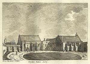
In 1276 Archbishop Robert Kilwardby acquired a charter for a weekly market, and this probably marks the foundation of Croydon as an urban centre.[17] Croydon developed into one of the main market towns of north east Surrey. The market place was laid out on the higher ground to the east of the manor house in the triangle now bounded by High Street, Surrey Street and Crown Hill. By the 16th century the manor house had become a substantial palace, used as the main summer home of the archbishops and visited by monarchs and other dignitaries. The original palace was sold in 1781, by then dilapidated and surrounded by slums and stagnant ponds, and a new residence, at nearby Addington, purchased in its place. Many of the buildings of the original Croydon Palace survive, and are in use today as Old Palace School.
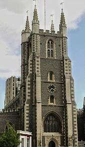
The Parish Church (now Croydon Minster) is a Perpendicular-style church, which was remodelled in 1849 but destroyed in a great fire in 1867, following which only the tower, south porch, and outer walls remained. A new church was designed by Sir George Gilbert Scott, one of the greatest architects of the Victorian age, and opened in 1870. His design loosely followed the previous layout, with knapped flint facing and many of the original features, including several important tombs. Croydon Parish Church is the burial place of six Archbishops of Canterbury: John Whitgift, Edmund Grindal, Gilbert Sheldon, William Wake, John Potter and Thomas Herring. Historically part of the Diocese of Canterbury, Croydon is now in the Diocese of Southwark. In addition to the suffragan Bishop of Croydon, the Vicar of Croydon is an important preferment.

Addington Palace is a Palladian-style mansion between Addington Village and Shirley, in the London Borough of Croydon. Six archbishops lived there between 1807 and 1898, when it was sold. Between 1953 and 1996 it was the home of the Royal School of Church Music. It is now a conference and banqueting venue.
Croydon was a leisure destination in the mid 19th century. In 1831, one of England's most prominent architects, Decimus Burton, designed a spa and pleasure gardens below Beulah Hill and off what is now Spa Hill in a bowl of land on the south-facing side of the hill around a spring of chalybeate water. Burton was responsible for the Beulah Spa Hotel (demolished around 1935) and the layout of the grounds.[18] Its official title was The Royal Beulah Spa and Gardens. It became a popular society venue attracting crowds to its fêtes. One widely publicised event was a "Grand Scottish Fete" on 16 September 1834 "with a tightrope performance by Pablo Fanque, the black circus performer who would later dominate the Victorian circus and achieve immortality in The Beatles song, Being for the Benefit of Mr. Kite!"[19] The spa closed in 1856 soon after the opening nearby of The Crystal Palace.[20] The Crystal Palace was rebuilt on Sydenham Hill in 1854, following its success at the Great Exhibition in Hyde Park. It was destroyed in a spectacular fire in 1936.
Horse racing in the area took place occasionally, notably during visits of Queen Elizabeth I to the archbishop. Regular meetings became established first on a course at Park Hill in 1860 and from 1866 at Woodside, where particularly good prizes were offered for the races run under National Hunt rules. In that sphere its prestige was second only to that of Aintree, home of the Grand National. Increasing local opposition to the presence of allegedly unruly racegoers coupled with the need to obtain a licence from the local authority led to it being closed down in 1890.[21]
The Elizabethan Whitgift Almshouses, the "Hospital of the Holy Trinity", in the centre of Croydon at the corner of North End and George Street, were erected by Archbishop John Whitgift. He petitioned for and received permission from Queen Elizabeth I to establish a hospital and school in Croydon for the "poor, needy and impotent people" from the parishes of Croydon and Lambeth. The foundation stone was laid in 1596 and the building was completed in 1599.
The premises included the Hospital or Almshouses, providing accommodation for between 28 and 40 people, and a nearby schoolhouse and schoolmaster's house. There was a Warden in charge of the well-being of the almoners. The building takes the form of a courtyard surrounded by the chambers of the almoners and various offices.
Threatened by various reconstruction plans and road-widening schemes, the Almshouses were saved in 1923 by intervention of the House of Lords. On 21 June 1983 Queen Elizabeth II visited the Almshouses and unveiled a plaque celebrating the recently completed reconstruction of the building. On 22 March each year the laying of the foundation stone is commemorated as Founder's Day.
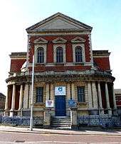
The Grade II listed West Croydon Baptist Church was built in 1873 by one J Theodore Barker. It is a red brick building with stone dressings. Its three bays are divided by paired Doric pilasters supporting a triglyph frieze and panelled parapet.[22]
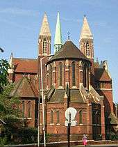
The Parish Church of St Michael and All Angels by J L Pearson in West Croydon was built between 1880 and 1885, and is Grade I listed.[23]
Industrial Revolution and the railway

The development of Brighton as a fashionable resort in the 1780s increased the significance of Croydon's role as a halt for stage coaches on the road south of London. At the beginning of the 19th century, Croydon became the terminus of two pioneering commercial transport links with London. The first, opened in 1803, was the horse-drawn Surrey Iron Railway from Wandsworth, which in 1805 was extended to Merstham, as the Croydon, Merstham and Godstone Railway. The second, opened in 1809, was the Croydon Canal, which branched off the Grand Surrey Canal at Deptford. The London and Croydon Railway (an atmospheric and steam-powered railway) opened between London Bridge and West Croydon in 1839, using much of the route of the canal (which had closed in 1836). Other connections to London and the south followed.
The arrival of the railways and other communications advances in the 19th century led to a 23-fold increase in Croydon's population between 1801 and 1901.[5] This rapid expansion of the town led to considerable health problems, especially in the damp and overcrowded working class district of Old Town. In response to this, in 1849 Croydon became one of the first towns in the country to acquire a Local Board of Health. The Board constructed public health infrastructure including a reservoir, water supply network, sewers, a pumping station and sewage disposal works.
The Surrey Street Pumping Station is Grade II listed; it was built in four phases. starting with the engine house in 1851, with a further engine house in 1862, a further extension in 1876-7 to house a compound horizontal engine and a further extension in 1912.[24]
A growing town

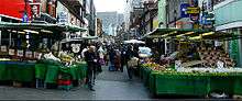
In 1883 Croydon was incorporated as a borough. In 1889 it became a county borough, with a greater degree of autonomy. The new county borough council implemented the Croydon Improvement scheme in the early 1890s, which widened the High Street and cleared much of the 'Middle Row' slum area. The remaining slums were cleared shortly after Second World War, with much of the population relocated to the isolated new settlement of New Addington. New stores opened and expanded in central Croydon, including Allders, Kennards and Grade II listed Grants, as well as the first Sainsbury's self-service shop in the country.[5] There was a market on Surrey Street.[25]
Croydon was the location of London's main airport until the Second World War. During the war, much of central Croydon was devastated by German V-1 flying bombs and V-2 rockets, and for many years the town bore the scars of the destruction. After the war, Heathrow Airport superseded Croydon Airport as London's main airport, and Croydon Airport quickly went into a decline, finally closing in 1959.
By the 1950s, with its continuing growth, the town was becoming congested, and the Council decided on another major redevelopment scheme. The Croydon Corporation Act was passed in 1956. This, coupled with national government incentives for office relocation out of London, led to the building of new offices and accompanying road schemes through the late 1950s and 1960s, and the town boomed as a business centre in the 1960s, with many multi-storey office blocks, an underpass, a flyover and multi-storey car parks.
In 1960 Croydon celebrated its millennium with a pageant held at Lloyd Park and an exhibition held at the old Croydon Aerodrome.
Modern Croydon
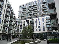
.jpg)
The growing town attracted many new buildings. The Fairfield Halls arts centre and event venue opened in 1962. Croydon developed as an important centre for shopping, with the construction of the Whitgift Centre in 1969. No. 1 Croydon (formerly the NLA Tower)[26] designed by Richard Seifert & Partners was completed in 1970. The Warehouse Theatre opened in 1977.
The 1990s saw further changes intended to give the town a more attractive image. These included the closure of North End to vehicles in 1989 and the opening of the Croydon Clocktower arts centre in 1994. An early success of the Centre was the "Picasso's Croydon Period" exhibition of March–May 1995.
The Croydon Tramlink began operation in May 2000 (see Transport section below).
The Prospect West office development was built in 1991 to 1992, and its remodelling planned in 2012[27] has now been completed. Renamed Interchange Croydon when it was reopened in 2014, the 180,000 square foot office development was the first new grade A office development of its size to open in Croydon for more than 20 years.[28]
Another large shopping centre, Centrale, opened in 2004 opposite the Whitgift Centre, and adjoining the smaller Drummond Centre. House of Fraser and Debenhams are the anchor stores in the combined centre. In addition, there are plans for a large, new one billion pound shopping centre, in the form of a new Westfield shopping mall to add to the two which the company currently has in London; Westfield plans to work jointly with Hammersons and to incorporate the best aspects of the two companies' designs.[29] Work is expected to start in 2016, with completion in 2019.[30] There are several other major plans for the town including the redevelopment of the Croydon Gateway site; and extensions of Tramlink to Purley Way, Streatham, Lewisham and Crystal Palace.
Apart from its very large central shopping district, Croydon has a number of smaller shopping areas, especially towards the southern end of the town, where restaurants are located. Two of Croydon's restaurants are listed in The Good Food Guide.[31]
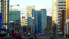
Croydon has many tall buildings such as the former Nestlé Tower (St George's House), and is considered to be London's third main central business district, after the Square Mile and the Docklands, and South London's main business centre.[33] The London Borough of Croydon’s strategic planning committee in February 2013 gave the go-ahead to property fund manager Legal and General Property’s plans to convert the empty 24-storey St George’s House office building, occupied by Nestlé until September 2012, into 288 flats.[34]
The Croydon area has several hospitals: the main one is Croydon University Hospital in London Road.
The Mayor of London, Boris Johnson, has said he would support Croydon being granted city status[35] and announced £23m of additional funding to help redevelop the town at the Develop Croydon Conference on 22 November 2011.[36]
Several apartment developments, for instance Altitude 25 (completed 2010), have been built in recent years, and several more are being built or planned. Saffron Square,[32] which will include an iconic 43-storey tower, has been under construction in Wellesley Road since 2011, and most phases have now been completed. Other developments with towers over 50 floors high have been given planning approval. These include the 54-storey "Menta Tower" in Cherry Orchard Road near East Croydon station, and a 55-storey tower at One Lansdowne Road, on which construction was set to begin in early 2013. The latter is set to be Britain's tallest block of flats, including office space, a four-star hotel and a health club.[37]
In May 2012 it was announced that Croydon had been successful in its bid to become one of twelve "Portas Pilot" towns, and would receive a share of £1.2m funding to help rejuvenate its central shopping areas.[38]
In November 2013, Central Croydon MP Gavin Barwell gave a presentation at a public meeting on the Croydon regeneration project, detailing various developments underway due to be completed in coming years.[39]
On 26 November 2013, Croydon Council approved a redevelopment of the Town Centre by The Croydon Partnership, a joint venture by The Westfield Group and Hammerson.[40][41] London Mayor Boris Johnson approved the plan the following day.[42] The Croydon Advertiser listed the approval as an "Historic Night for Croydon".[43]
In 2015 it was announced that a Boxpark branch comprising shops, restaurants and bars would open in Croydon. The London Evening Standard said that this and other developments were reviving the town which was in the process of gentrification.[44]
Future
The town is expected to see changes as part of Croydon Vision 2020, an urban planning initiative.
Government

Status
For centuries the area lay within the Wallington hundred, an ancient Anglo-Saxon administrative division of the county of Surrey.[45] In the later Middle Ages – probably from the late 13th century onwards – residents of the town of Croydon, as defined by boundary markers known as the "four crosses", enjoyed a degree of self-government through a town court or portmote, and a form of free tenure of property.[46] These privileges set the area of the town apart from its rural hinterland, where the more usual restrictive rules of manorial tenure applied. However, Croydon did not hold any kind of formal borough status.
In 1690, the leading inhabitants petitioned William III and Mary for Croydon to be incorporated as a borough. The application was initially approved, the King authorising the drafting of a charter, but the process was then abruptly halted, apparently through the intervention of Archbishop John Tillotson, who probably feared a threat to his own authority over the town. The application was revived the following year, when Queen Mary again authorised a charter, but once again it was abandoned. A second petition in 1707 was effectively ignored.[47][48]
Croydon's growth in the 19th century brought the issue of incorporation back on to the political agenda, and in 1883 the ancient parish of Croydon, apart from its exclave of Croydon Crook or Selsdon, was created a municipal borough within Surrey. In 1889, because the population was high enough, it was made a county borough, exempt from county administration.
In 1965 the County Borough of Croydon was abolished and the area was transferred to Greater London and combined with the Coulsdon and Purley Urban District to form the London Borough of Croydon.
In recent decades, the borough has on several occasions sought city status. (This would be a purely honorific change of title, making no practical difference to the borough's governance.) A draft petition was submitted by the County Borough to the Home Office in 1951, a more formal petition in 1954, and two more applications in 1955 and 1958. When the London Borough was created in 1965, the Council endeavoured to have it styled a City, as was the City of Westminster. Further bids for city status were made in 1977, 1992, 2000, 2002, and 2012. All have failed. The borough's predominant argument has always been its size: in 2000 it pointed out that it was "the largest town which does not have the title of City in the whole of Western Europe". The grounds on which it has been turned down have invariably been that it is (as was stated in 1992) merely "part of the London conurbation, rather than a place with a character and identity of its own". Undeterred, council representatives have more than once described Croydon as "a city in all but name".[49][50]
Modern governance
The London Borough of Croydon has a Labour controlled council with 40 Labour councillors and 30 Conservative councillors elected on 22 May 2014.
Most of the town centre lies within the Addiscombe and Fairfield wards, which form part of the Croydon Central constituency.[51] The rest of the town centre is in the Croham ward, which is part of the Croydon South constituency. These wards are all in the London Borough of Croydon, which is responsible for services along with other agencies such as education, refuse collection, road maintenance, local planning and social care. The Addiscombe ward is currently represented by Labour Councillors . The Fairfield and Croham wards have, by contrast, habitually elected Conservative members. The area also forms part of the London constituency of the European Parliament. The sitting Member of Parliament for Croydon Central is Gavin Barwell, a member of the Conservative Party. The sitting Member of Parliament for Croydon South is Chris Philp, also a member of the Conservatives. The Member of Parliament for Croydon North is Steve Reed, for the Labour Party.
Police and fire services
The police service is provided by the Metropolitan Police with Croydon Police Station on Park Lane opposite the Croydon Flyover.[52] The London Fire Brigade fire station is in Old Town, with two pumping appliances.
Demography
Fairfield ward, which is the major ward covering the central town, was 40% White British, 16% Indian, and 10% Other White in the 2011 census.[53] In addition, the Broad Green ward was 23% White British, 13% Indian, 13% Other Asian, and 11% Black African.[54] The Addiscombe ward was 45% White British and 10% Other White.[55]
Geography

.jpg)
Croydon town centre is near the centre of the borough of Croydon, to the north of the North Downs and the Pilgrims' Way path. To the north of Croydon are typical London districts, whereas a short distance southeast (such as Coombe and Selsdon) is green, hilly and rural land. To the west are industrial areas, going inside the London Borough of Sutton. The southern suburbs are mainly affluent.
The town is bordered by Waddon immediately southwest of central Croydon. To the west, inside the London Borough of Sutton lies Beddington. To the north are Broad Green, Thornton Heath and Selhurst. To the south lies South Croydon, and going further south are Purley and Sanderstead. To the east lie Addiscombe and Shirley.
Croydon High Street runs from South Croydon up to the point where it meets the street called North End. North End is the main shopping street, while Croydon High Street is the main restaurant quarter.
The High Street is also home to the late 17th century, Grade II listed Wrencote House. This building is described as being of exceptional national architectural and historic importance. Dating from the late 17th century, it has a distinctive 'H' plan form over its four floors, including basement and attic storey. Distinctive external features include its rich red brick facade with black headers and heavily carved and enriched wooden eaves cornice.[56]
Wellesley Road on the A212 road forms a north-south axis through the town centre. In line with London Plan policy, there have been a number of proposals to create greater integration between East Croydon station, which lies on one side of the A212, and the town centre of Croydon, which lies on the other side of it. Croydon Vision 2020 aims to tackle this though such solutions as making the road easier for pedestrians to cross by creating a centre island pathway.
Culture
Arts
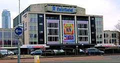
There are several arts venues. Foremost is the Fairfield Halls, opened in 1962, which consists of a large concert hall frequently used for BBC recordings, the Ashcroft Theatre and the Arnhem Gallery. Fairfield is the home of the London Mozart Players. Many famous faces have appeared at the Fairfield Halls, including the Beatles, Bucks Fizz, Omid Djalili, Robert Cray, JLS, Chuck Berry, BB King, Don McLean, the Monkees, Johnny Cash, Dionne Warwick, Gladys Knight, Morecambe and Wise, Tom Jones, the Stylistics, Status Quo, Level 42, A-HA, John Mayall, Jools Holland, Kenny Rogers, James Last, and Coolio. The main concert hall was used for the conference scene in the Ron Howard film The Da Vinci Code (2006).
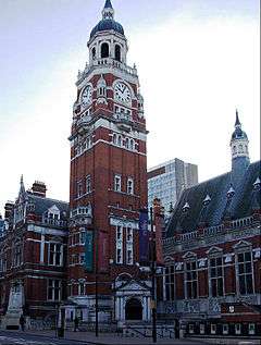
Croydon Clocktower, built by the London Borough of Croydon in the mid-1990s, houses a state-of-the-art library, a performance venue in the old reference library, the David Lean Cinema and the town museum. The building links into the Town Hall and some areas of the building, most notably the Braithwaite Hall, are part of the original town hall and library complex, built in 1892–1896 to a design by Charles Henman Jun.[57] A bronze statue of Queen Victoria was erected outside the buildings in 1903.[58]
The Warehouse Theatre (which closed in 2012), was a studio theatre known for promoting new writing, comedy and youth theatre. It had to close because of the major Ruskin Square redevelopment, but will re-open in the future in a new larger theatre building within the new development.
The Pembroke Theatre had many productions with well-known actors before its closure in about 1962.
There are several local and small venues for comedy and community events dotted around Croydon and its districts. Croydon Youth Theatre Organisation celebrated its 40th birthday in 2005. There are several community arts groups, particularly in the large Asian community.
.jpg)
The Spread Eagle Theatre is a new 50-seat studio theatre. Opened in October 2013, it is situated in the town centre, 10 minutes' walk from East Croydon Station. The Spread Eagle works closely with its sister venue, the Old Joint Stock Theatre in Birmingham. Both venues champion 'big plays for small spaces' with an emphasis on new writing, supporting emerging artists and theatre companies.
A calendar titled "Rare Roundabouts of Croydon", with a picture of a different Croydon roundabout each month, has enjoyed some success.[59]
Literature
Croydon is the setting of two poems by British Poet Laureate Sir John Betjeman, "Croydon" and "Love in a Valley".
The borough has been the residence of many renowned authors and novelists, including Sir Arthur Conan Doyle, who set up house in Norwood, D.H. Lawrence, and French novelist Émile Zola, who lived for a time in the Queen's Hotel, Upper Norwood. Cicely Mary Barker, author and illustrator of the Flower Fairies series of books, was born in Croydon.
Croydon is the setting of novels. The now defunct airport lent itself to the mysteries The 12.30 from Croydon and Death in the Clouds, and the town is mentioned in some Sherlock Holmes mysteries.
Croydon is referred to in a rhyme dating back to the 18th century, revised in the Victorian era to:
| “ | Sutton for good mutton; Cheam for juicy beef; |
” |
Music
Croydon has been at the centre of the development of the dubstep genre, a relatively recent musical development that traces its roots from Jamaican dub music, UK Garage and drum and bass. Artists such as Benga and Skream, who honed their production and DJing skills whilst working at the now defunct Big Apple Records on Surrey Street, along with Norwood's Digital Mystikz, DJ Chef, Timi Korus and Thornton Heath's Plastician, form the core roster of dubstep DJs and producers. Moreover, UK rappers and grime artists Stormzy, Krept and Konan, Nadia Rose and Section Boyz all hail from or can trace their roots to the London Borough of Croydon.
Croydon also has a rock scene producing such local talent as Frankmusik and Noisettes.
In addition to the Fairfield Halls, there have been several venues in Croydon that have hosted rock acts. Established in 1976, the Cartoon was a popular live music venue that closed in 2006. The Greyhound in Park Lane, played host to acts such as Led Zeppelin, Jimi Hendrix, the Who, David Bowie, Queen, Siouxsie and the Banshees, the Damned, the Boomtown Rats, A-ha in (1987) and others during the 1960s and '70s. The Greyhound also saw the debut of the Electric Light Orchestra in 1972.[61]
The composer Samuel Coleridge-Taylor (1875–1912) lived at 30 Dagnall Park, Selhurst, until his death. He grew up in Croydon and sang in the church choir at St George's and taught at the Crystal Palace School of Music and many other schools of music. He died from pneumonia after collapsing at West Croydon station. There is an impressive grave with a touching poem at Bandon Hill Cemetery, and exhibits about him in the Clock Tower Museum, Katharine Street.
The town centre was for 30 years home to Europe's largest second-hand record store, Beano's, offering rare vinyl, CDs and books. In November 2008 it was announced that Beano's would close. The premises, off Church Street near the Grant's cinema complex, are to become a "market place" with stalls for rent by small business and individuals.[62]
The oldest currently surviving shop in Croydon is 46 South End. Dating back to the 16th century, this Grade II listed building still retains all its original Tudor features. Records show that the premises has been a shop for at least 163 years, where street directories from 1851 give the names of E.C. Johnson & Thorpe. The building is currently in use as a music shop[63]
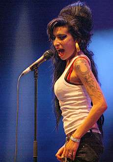
Croydon is home to the BRIT School for performing arts and technology, based in Selhurst, which has produced stars such as Adele, Jessie J, Amy Winehouse, Leona Lewis, Katie Melua, Katy B, Kate Nash, Imogen Heap, Rizzle Kicks, Dane Bowers and members of the Feeling & the Kooks. Independent of such institutions, Croydon is also the home of artists like Nosferatu D2,[64] Magic Brother, Bad Sign & Cassettes.
Media
Croydon plays host to the popular Channel 4 show Peep Show. The ITV police drama The Bill, although set in East London, was filmed in Croydon and many of the town centre locations were filmed around Surrey Street and St George's House (the Nestle building). Sun Hill Police Station is in nearby Mitcham. The opening credit sequence for the sitcom Terry and June featured the eponymous stars walking around the Whitgift Centre and the Fairfield Halls. In 2007, the music video for pop star Mika's single "Big Girl (You Are Beautiful)" was shot in various locations around the town, including High Street and Surrey Street Market.
Croydon has its own fully independent television station: it does not receive any government or local authority grant or funding and is supported by donations, sponsorship and by commercial advertising.[65] In 2012, Croydon Radio, an internet radio station, began in the area.[66]
Sport and leisure
Parks and open spaces
The borough has many woods for walking in, which together account for 8.5% of London's woodland resource (626.46 hectares).[67]
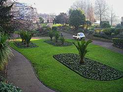
Among several other parks and open spaces around Croydon, there is an area of landscaped green space in the town centre called Queens Gardens; it is located adjacent to the town hall and Clocktower art centre.
Clubs and teams
The most prominent sports club in the borough is Crystal Palace Football Club, based in the purpose-built stadium of Selhurst Park in the north of the borough since 1924. Palace won promotion to the Premier League (the top tier of football in England) at the end of the 2012–13 season. Croydon has a Non-League football club, Croydon F.C. and Purley Saint Germain, who play at Croydon Arena.
Streatham-Croydon RFC, founded in 1871, is one of London's rugby union clubs, playing just north of the town centre at Frant Road in Thornton Heath.
Croydon Amphibians SC plays in Division 2 British Waterpolo League. In 2008, the team won the National League Division 3.[68]
Transport


Rail
Fast trains to central London have journey times of 13 minutes to London Bridge and 15 minutes to London Victoria from East Croydon station, the largest and busiest station in Croydon and the tenth busiest in Greater London. Services from East Croydon run both north and south on the Brighton Main Line railway. To the south, trains run to the counties of Sussex, Surrey and Kent with services including through-train to Hastings, Southampton, Brighton, Portsmouth and Gatwick Airport. To the north, through-trains run to Central London stations including Victoria, London Bridge as well as Thameslink services to St Pancras International, Bedford, St Albans and Luton.
West Croydon station is used by routes to the north and west. The East London Line operated by London Overground was extended to West Croydon in May 2010, establishing connections to Surrey Quays, Shoreditch, Dalston and Highbury & Islington. There are also several local rail stations in the borough. Passenger trains through Croydon are provided by Govia Thameslink Railway brands Southern and Thameslink.[69]
Tramlink
The Tramlink tram system, operated by Tramtrack Croydon, a wholly owned subsidiary of Transport for London,[70] opened in 2000; Croydon is its hub. Its network consists of three lines, from Elmers End to West Croydon, from Beckenham to West Croydon, and from New Addington to Wimbledon, with all three lines running via a loop in central Croydon. It is the only tram system in London. It serves Mitcham, Woodside, Addiscombe and the Purley Way retail and industrial area.
The system was previously known as the 'Croydon Tramlink', having been established under the Croydon Tramlink Act 1994.
Buses
Transport for London operates many bus routes in and around Croydon. Most buses serve West Croydon bus station, next to the railway station and tram stop.
Road
A few miles to the south of Croydon is a small gap in the North Downs, a route for transport from London to the south coast. The London to Brighton road used to pass through the town on North End before the A23 Purley Way was built to the west.
Croydon Airport
Croydon airport opened on 29 March 1920 by combining two smaller airfields used for defence in World War I . It had a complex of buildings adjoining Purley Way to the west of the town. It was the main airport for London before World War 2 . By 1952 it was realised that it was unsuitable for post war aircraft and its role was decreased. It finally closed in 1959. The name is still used as a landmark and bus stop designation.
River Wandle
The River Wandle is a tributary of the River Thames, flowing some 9 miles (14 km) to Wandsworth and Putney from its source in Croydon. It roughly forms the borough's western boundary with the London Borough of Sutton, and for part of its length also forms the boundary between the London Boroughs of Croydon and Lambeth. One of its tributaries rises in Selhurst.
Croydon's early transport links
The horse-drawn Surrey Iron Railway was the world's first public railway. It was opened in 1803, had double track, was some 8.5 miles (13.7 km) long and ran from Wandsworth to Croydon, at what is now Reeves Corner. In 1805 it was extended to Merstham as the Croydon, Merstham, and Godstone Railway. The railway boom of the 1840s brought superior and faster steam lines and it closed in 1846. The route is followed in part by the modern Tramlink. The last remaining sections of rail can be seen behind railings in a corner of Rotary Field in Purley.
With the opening of the London, Brighton and South Coast Railway line to London Victoria in 1860 extra platforms were provided at East Croydon, which the LBSCR treated as a separate station named New Croydon. The South Eastern Railway (SER) was excluded from this station, which ran exclusively LBSCR services to London at fares cheaper than those the SER offered from the original station.[71] In 1864, the LBSCR obtained authorisation to construct a ½-mile long branch line into the heart of the town centre near Katharine Street, where Croydon Central station was built. The line opened in 1868 but enjoyed little success and closed in 1871, only to reopen in 1886 under pressure from the Town Council before finally closing in 1890. The station was subsequently demolished and replaced by the Town Hall.[72] In 1897-98, East Croydon and New Croydon were merged into a single station with three island platforms, which remain today, but the two stations kept separate booking accounts until 1924.[71]
The Croydon Canal ran for 9.5 miles (15.3 km) from what is now West Croydon station. It travelled north largely along the course of the present railway line to New Cross Gate, where it joined the Grand Surrey Canal and went on into the Thames. It opened in 1809 and had 28 locks. It had a strong competitor in the Surrey Iron Railway and was never a financial success. It sold out to the London & Croydon Railway in 1836. The lake at South Norwood is the former reservoir for the canal.
Croydon Airport on Purley Way was the main airport for London until it was superseded by London Heathrow Airport and London Gatwick Airport. Starting out during World War I as an airfield for protection against Zeppelins and developing into one of the great airports of the world during the 1920s and 1930s, it welcomed the world's pioneer aviators in its heyday. As aviation technology progressed and aircraft became larger and more numerous, it was recognised in 1952 that the airport would be too small to cope with increasing air traffic. The last scheduled flight departed on 30 September 1959. The air terminal, now known as Airport House, has been restored and has a museum open one day a month.
Notable people

- Adele, (1988-) singer who attended the BRIT School, Croydon
- Dame Peggy Ashcroft (1907–1991), actress was born in Croydon and lived in George Street as a child. She is honoured in the naming of the Ashcroft Theatre, part of the Fairfield Halls. She was a school friend of architect Jane Drew[73]
- Raymond Chandler (1888–1959), screenwriter and author.
- Paul Garelli (1924–2006), French Assyriologist
- Ben Haenow (1985–), winner of the eleventh series of The X Factor
- Roy Hodgson (1947-). Former England football manager. Born and grew up in Croydon.
- D. H. Lawrence (1885–1930), author lived at 12 Colworth Road, Addiscombe, 1908–1912 whilst a teacher at Davidson Road School.
- Sir David Lean (1908–1991), film director was born in Croydon on 25 March 1908.[74][75]
- Kirsty MacColl (1959–2000), singer and songwriter was born and grew up in Croydon
- Ralph McTell (1944–), musician, composer of Streets of London
- Katie Melua (1984–), singer, songwriter, musician who went to the Brit School for Performing Arts at Selhurst, Croydon
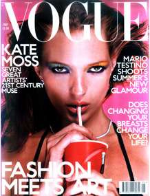
- Kate Moss (1974–), model; who attended Riddlesdown High School
- Malcolm Muggeridge (1903–1990), author and media personality was the son of H. T. Muggeridge, a prominent Croydon Labour councillor. He also taught at John Ruskin Central School in the 1920s
- Peter Sarstedt (1941–), singer, winner of Ivor Novello Award – resident
- Captain Sensible (1954-), guitarist with The Damned - former resident
- Amy Winehouse (1983–2011), singer who attended the BRIT School, Croydon
- Edward Woodward (1930-2009) Actor. Born and for many years lived in Croydon
- Sir Arthur Conan Doyle (1859-1930), Writer, most noted for his fictional stories about detective Sherlock Holmes, lived at No. 12 Tennison Road, Croydon
- Stormzy, British Grime MC and rapper, born Michael Omari, was born and raised in Croydon
Education
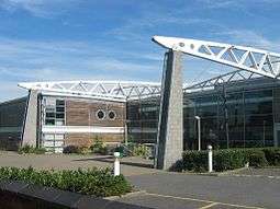
The town is home to Croydon College, with its main site on Park Lane and College Road near East Croydon station. It has over 13,000 students attending one of its three sub-colleges.[76] The sub-colleges were created in 2007. The three sub-colleges are the Croydon Sixth Form College, Croydon Skills and Enterprise College and the Croydon Higher Education College. The Higher Education College offers university-level education in a range of subjects from Law through to Fine Art. Croydon Skills and Enterprise College delivers training and education opportunities.
The town has five fee-paying schools, three of which are part of the Whitgift Foundation. Two are boys' schools: Whitgift School was situated near the Almshouses until 1931 when it moved to its current site in Haling Park in South Croydon, the Middle School (renamed Trinity School of John Whitgift in 1954) remained on the site until 1965 when it moved to Shirley Park. A direct grant grammar school until 1968, it is now a member of the Headmasters' Conference. Old Palace School, an independent girls' school situated in the old Summer Palace of the Archbishops of Canterbury, joined the Whitgift Foundation group of schools in 1993. Croham Hurst School, an independent girls' school in South Croydon, became part of Old Palace in 2007 and its old buildings are now used as the Old Palace junior school. The site of the old Whitgift grammar school is now the Whitgift shopping centre whose freehold is owned by the Whitgift Foundation.
Croydon is also home to three single-sex Catholic state schools. The formerly independent John Fisher School in Purley has not charged fees since the late 1970s, but during the 1990s was selective, choosing boys via exams, interviews, tests, previous school reports and written statements. The school ended its selection policy in 1999, and now accepts pupils under a points system, which discriminates in favour of those who have high mass attendance and whose families are most involved in the Catholic Church. Coloma Convent Girls' School is one of England's Catholic girls' schools: formerly a grammar school, it has now, like John Fisher, adopted points-based admission criteria. St. Joseph's College, located on Beulah Hill in Upper Norwood, is a boys' school with a mixed sixth form.
Croydon High School for Girls is an independent girls' school in Selsdon, and a member of the Girls' Day School Trust. The Japanese Saturday School of London, a weekend Japanese programme, uses Croydon High School as its Croydon Campus (クロイドン校舎 Kuroidon Kōsha).[77]
Royal Russell School is a co-educational independent boarding and day school in South Croydon and is a member of the Headmasters' Conference.
.JPG) The Old Palace School
The Old Palace School Croydon College's main buildings in Central Croydon
References
- ↑ "Archived copy". Archived from the original on 20 December 2014. Retrieved 2014-06-09.
- ↑ Mayor of London (February 2008). "London Plan (Consolidated with Alterations since 2004)" (PDF). Greater London Authority. Archived from the original (PDF) on 2 June 2010. Retrieved 21 December 2013.
- ↑ Powell-Smith, Anna. "Croydon - Domesday Book". opendomesday.org.
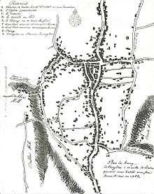
- ↑ Lancaster, Brian (March 2012). "Jean-Baptiste Say's 1785 Croydon street plan". Croydon Natural History & Scientific Society Bulletin. 144: 2–5.
- 1 2 3 Ayto, John; Ian Crofton (2005). Brewer's Britain and Ireland. Weidenfeld & Nicolson. ISBN 0-304-35385-X.
- ↑ Gover, J.E.B.; Mawer, A.; Stenton, F.M. (1934). The Place-Names of Surrey. English Place-Name Society. 11. Cambridge: Cambridge University Press. pp. 47–48.
- 1 2 Bird, David (2012). "Croydon, Crocus and Collyrium". London Archaeologist. 13 (4): 87–90.
- ↑ Corbett Anderson, John; Ian Crofton (1882). A Short Chronicle Concerning the Parish of Croydon. London: Reeves and Turner. pp. 19–20. ISBN 0-304-35385-X. Republished in 1970 by SR Publishers, East Ardsley, Wakefield
- ↑ Shaw, Muriel (September 1988). "Roman Period Burials in Croydon". CNHSS Archaeology Section Newsletter (71): 2–6.
- ↑ Davison, Jim; Potter, Geoff (1998). "Excavations at 14 Whitgift Street, Croydon, 1987-88 and 1995". London Archaeologist. 8: 227–232.
- ↑ Maggs, Ken; De'Athe, Paul (1987). The Roman Roads of East Surrey and the Kent Border. Westerham: North Downs Press. pp. 40–44.
- ↑ McKinley, Jacqueline I. (2003). "The Early Saxon Cemetery at Park Lane, Croydon". Surrey Archaeological Collections. 90: 1–116.
- ↑ Hines, John (2004). "Sūþre-gē — the Foundations of Surrey". In Cotton, Jonathan; Crocker, Glenys; Graham, Audrey. Aspects of Archaeology and History in Surrey: towards a Research Framework for the County. Guildford: Surrey Archaeological Society. pp. 92–98. ISBN 0954146034.
- ↑ Harris, Oliver (2005). The Archbishops' Town: the making of medieval Croydon. Croydon: Croydon Natural History and Scientific Society. ISBN 0-906047-20-X.
- ↑ "Surrey Domesday Book". Archived from the original on 30 October 2007.
- ↑ Harris, Archbishops' Town, p. 250
- ↑ Harris, Archbishops' Town, pp. 253–6.
- ↑ The Changing Face Of Norwood Norwood Society, 27 February 2008. Accessed April 2011
- ↑ "London Borough of Croydon: The Lawns - The Lawns History". Croydon.gov.uk. Retrieved 17 July 2011.
- ↑ Warwick, Alan R. "Chapter 5". The Phoenix Suburb: A South London Social History. Crystal Palace Foundation. ISBN 0-904034-01-1.
- ↑ Beavis, Jim: The Croydon Races
- ↑ "Heritage Gateway - Results". heritagegateway.org.uk.
- ↑ "Heritage Gateway - Results". heritagegateway.org.uk.
- ↑ "Heritage Gateway - Results". heritagegateway.org.uk.
- ↑ "Surrey Street Market".
- 1 2 "Croydon, Route & What to See". London Footprints. Retrieved 20 March 2008.
- ↑ Planning Croydon
- ↑ "Rejuvenated office block opens in Croydon town centre". Croydon Guardian.
- ↑ "Westfield and Hammerson form £1bn joint venture to redevelop Croydon town centre".
- ↑ "Croydon's Westfield/Hammerson development 'likely to be finished in 2019'".
- ↑ Carter, Elizabeth (2011). The Good Food Guide 2012. The Good Food Guide. pp. 163–164. ISBN 978-1-84490-123-4.
- 1 2 "New Builds - Saffron Square - Sold". berkeleygroup.co.uk.
- ↑ "Croydon Conservatives". croydonconservatives.com.
- ↑ Carpenter, Jamie (8 February 2013). "Croydon Council approves Nestlé tower office-to-flats plan". planningresource.co.uk. Retrieved 23 June 2013.
- ↑ Cahalan, Paul; Truman, Peter (30 July 2008). "Exclusive: Boris backs Croydon city bid". Your Local Guardian. Retrieved 23 June 2013.
- ↑ Boris set to unveil Ł23 million for Croydon regeneration
- ↑ "One Lansdowne Road". czwg.com.
- ↑ "High Streets to share £1.2m funding". BBC News. 26 May 2012.
- ↑ Barwell, Gavin (25 January 2014). "Public meeting on regeneration in Croydon 2013". Prezi. Retrieved 31 August 2015.
- ↑ "What's New". Croydon Partnership. Retrieved 31 August 2015.
- ↑ "Croydon £1bn shopping centre plan approved". BBC News. BBC. 26 November 2013. Retrieved 31 August 2015.
- ↑ Davies, Gareth (27 November 2013). "Boris Johnson approves Croydon's £1bn Whitgift redevelopment". Croydon Advertiser. Retrieved 31 August 2015.
- ↑ Davies, Gareth (26 November 2013). "Council gives green light to Westfield/Hammerson plan". Croydon Advertiser. Retrieved 31 August 2015.
- ↑ Butter, Susannah (28 August 2015). "Cool Croydon: how bars, burgers and a new Boxpark are making Kate Moss's hometown a hipster hotspot". London Evening Standard. Retrieved 16 February 2016.
- ↑ "An 1868 Gazetteer description of Croydon". UK and Ireland Genealogy. 2003. Retrieved 17 July 2008.
- ↑ Harris, Archbishops' Town, pp. 245–9, 254–6. The locations of the crosses (recorded in 1580–1 and 1706) were Hand Cross (junction of Church Road and Church Street: modern Reeves Corner); Crown Hill Cross (junction of Crown Hill and High Street); Stake or Stay Cross (junction of modern George Street and Park Lane); Hern Cross (junction of High Street and Coombe Road); and possibly "at Burchall's House", which may have been at the southern end of Old Town. In 1977 the four sites (including the supposed Burchall's House site, but excluding Crown Hill) were marked by modern plaques.
- ↑ Victoria History of the County of Surrey, vol. 4, p. 218.
- ↑ Harris, Archbishops' Town, pp. 271–2.
- ↑ Beckett, John (2005). City Status in the British Isles, 1830-2002. Aldershot: Ashgate. pp. 100, 103, 110, 122–4, 129, 131, 143, 146, 150, 166, 168, 175–6. ISBN 0-7546-5067-7.
- ↑ "Results of Diamond Jubilee Civic Honours Competition announced". Cabinet Office. 14 March 2012. Retrieved 27 March 2012.
- ↑ "London Borough of Croydon map of wards" (PDF). Croydon Council. 2006. Archived from the original (PDF) on 27 June 2008. Retrieved 18 July 2008.
- ↑ "Metropolitan Police: Croydon Police Station". Metropolitan Police. 2007. Retrieved 18 July 2008.
- ↑ "Fairfield - UK Census Data 2011". ukcensusdata.com.
- ↑ "Broad Green - UK Census Data 2011". ukcensusdata.com.
- ↑ "Addiscombe - UK Census Data 2011". ukcensusdata.com.
- ↑ http://planning.croydon.gov.uk/DocOnline/88608_19.pdf
- ↑ Bridget Cherry and Nikolaus Pevsner, London 2: South. Buildings of England series. Penguin Books, 1983. ISBN 0-14-071047-7. Page 214.
- ↑ "Queen Victoria statue - Croydon". London Remembers.
- ↑ "Roundabout calendar is gift hit". BBC News.
- ↑ "Chapter XIV: Local Allusions to Women". sacred-texts.com. Retrieved 5 December 2013.
- ↑ Whalley, Kirsty (15 September 2010). "ELO man dies". Croydon Guardian. Newsquest Media Group. p. 15.
- ↑ "Record collectors' shop faces the music". BBC News.
- ↑ "Just Flutes of London, Specialist Flute Shop". justflutes.com.
- ↑ "Fan Releases Nosferatu D2"²s Album Again, Ignites Cult Following". Public Radio International.
- ↑ "Croydon TV". croydontv.co.uk.
- ↑ "Croydon Radio". croydonradio.com.
- ↑ "London Borough of Croydon: Habitat Action Plan" (PDF). croydon.gov.uk. Retrieved 28 November 2016.
- ↑ "The British Water Polo League". bwpl.org.
- ↑ "UK rail network map" (PDF). National Rail website. National Rail. 2006. Retrieved 25 May 2008.
- ↑ "TfL announces plans to take over Tramlink services". 17 March 2008. Archived from the original on 12 April 2008. Retrieved 24 May 2008.
- 1 2 White, H.P., op. cit. p. 79.
- ↑ Treby, E., op. cit. p. 106.
- ↑ "Peggy Ashcroft" at Internet Movie Database http://www.imdb.com/name/nm0001919/
- ↑ "Who's Who in the Cinema", The Movie volume 13 p. 259. Orbis Publishing (1981)
- ↑ "David Lean" at Internet Movie Database http://www.imdb.com/name/nm0000180/
- ↑ "About Croydon College". 2007. Retrieved 18 July 2008.
- ↑ "<学校紹介>" (Archive). The Japanese Saturday School of London. Retrieved on 5 April 2015. - See "9.校舎 "
Further reading
- Daniel Lysons (1792), "Croydon", Environs of London, 1: County of Surrey, London: T. Cadell
- James Thorne (1876), "Croydon", Handbook to the Environs of London, London: John Murray
- Edward Walford (1883), "Croydon", Greater London, London: Cassell & Co., OCLC 3009761
External links
| Wikimedia Commons has media related to Croydon, Greater London. |