Parkes Way
| Parkes Way Australian Capital Territory | |
|---|---|
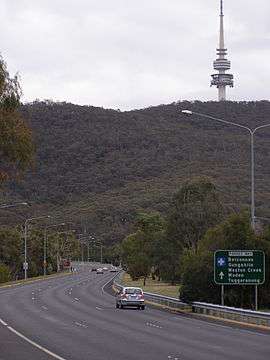 | |
| Parkes Way heading towards Black Mountain | |
| General information | |
| Type | Highway |
| Opened | 29 November 1961.[1] |
| Gazetted | 21 July 1960[2] |
| Maintained by | Territory and Municipal Services |
| History |
Further stages of Parkes Way were built progressively and completed on the following dates:
|
| Major junctions | |
| East end |
|
| |
| West end |
|
| Highway system | |
|
Highways in Australia National Highway • Freeways in Australia Road infrastructure in Canberra | |
| |
Parkes Way is a major road in Canberra, Australia, which runs east-west between Kings Avenue and the Glenloch Interchange. At Glenloch Interchange it intersects with William Hovell Drive, Tuggeranong Parkway and Caswell Drive (Gungahlin Drive Extension). The road is freeway standard from the Commonwealth Avenue overpass to Glenloch Interchange. Parkes Way is named for prominent Australian federalist, Sir Henry Parkes.[2]
It passes by the edge of Black Mountain and under part of the Australian National University. It also passes just south of the City and north of Commonwealth Park and Kings Park on the shore of Lake Burley Griffin.
Parkes Way was created with an 80 km/h speed limit which remained in place until 2008 when it was changed to 90 km/h.
Future
Draft plans of the "City to Lake" Plan by the ACT government would see Parkes Way be split into 2 levels from the Edinburgh Avenue exit to the Anzac Parade exit.[4] The top level would be a boulevard with street level access to new buildings in the area and intersections to other roads. The bottom level would be a freeway standard tunnel.
Interchanges and intersections
| District | Location | km | mi | Destinations | Notes |
|---|---|---|---|---|---|
| Canberra Central | Barton–Russell–Parkes tripoint | 0 | 0.0 | Kings Avenue / Morshead Drive – Russell, Parkes | Eastern terminus at interchange |
| Parkes | 1.2 | 0.75 | Anzac Parade – Australian War Memorial, Reid, Campbell | Roundabout | |
| Parkes–City boundary | 1.9 | 1.2 | Coranderrk StreetCivic, Reid | Roundabout, with bypass lanes westbound | |
| Parkes–City–Acton tripoint | 2.5 | 1.6 | Half-cloverleaf interchange, no access to Commonwealth Avenue northbound or from Commonwealth Avenue southbound | ||
| Acton–City boundary | 3 | 1.9 | Edinburgh Avenue north / Lawson Crescent south – Civic, Australian National University | Interchange | |
| Acton | 4.4 | 2.7 | Clunies Ross Street north / Lady Denman Drive south | Westbound exit and eastbound entrance | |
| Canberra Central – Molonglo Valley – Belconnen tripoint | | 6.6 | 4.1 | Tuggeranong Parkway south / William Hovell Drive west / Caswell Drive north – Woden, Tuggeranong, Belconnen, Gungahlin | Western terminus at Glenloch Interchange |
See also
![]() Australian Roads portal
Australian Roads portal
References
- ↑ "FIRST WAY SECTION OPEN TO-DAY.". The Canberra Times (ACT : 1926 - 1995). ACT: National Library of Australia. 29 November 1961. p. 4. Retrieved 31 May 2013.
- 1 2 "Search for street and suburb names". ACT Planning and Land Authority. Retrieved 2013-05-31.
- ↑ "NEW PARKES WAY SECTION OPEN.". The Canberra Times (ACT : 1926 - 1995). ACT: National Library of Australia. 4 April 1963. p. 7. Retrieved 1 June 2013.
- ↑ City to the Lake – ACT Government
| Controlled-access roads: | ||
|---|---|---|
| Limited-access roads: |
| |
| Major interchanges: | ||
| Proposed or cancelled |
| |
*Partially limited-access ^Partially controlled-access roadway under construction | ||