Paso de Jama
| Paso de Jama | |
|---|---|
 | |
| Elevation | 4,200 m (13,780 ft)[1] |
| Location | Argentina–Chile border |
| Range | Andes |
| Coordinates | 23°14′15″S 67°04′35″W / 23.2375°S 67.076389°WCoordinates: 23°14′15″S 67°04′35″W / 23.2375°S 67.076389°W |
 | |
The Paso de Jama is a mountain pass through the Andes between Chile and Argentina, at an elevation of 4,200 m (13,800 ft) at the border.[2][3] It is the northernmost road border crossing between the two countries. The pass is reached via Chile Route 27 and via National Route 52 (Argentina). The Chile Route 27 reaches an altitude of 4,810 m (15,780 ft) 100 km west of the border.[2]
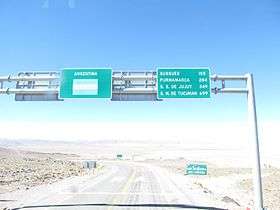
The pass links the city of Jujuy in Argentina with San Pedro de Atacama in Chile. The road was opened on 6 December 1991, and is paved throughout since the year of 2005. It is open throughout the year, although occasionally closed by snow. It is used by truck traffic between northern Argentina and Paraguay and the ports of northern Chile.
The Argentine border station is five kilometers east of the border in the small settlement of Jama at 4,100 metres (13,500 ft), 23°14′14″S 67°01′22″W / 23.23722°S 67.02278°W . The Chilean border station is at San Pedro de Atacama, 160 km from the pass.
References
- ↑ "Región de Antofagasta" (in Spanish). Chilean Government - Difrol. Retrieved 7 March 2015.
- 1 2 Google maps, terrain mode
- ↑ South American Handbook 2009 ISBN 978-1-906098-36-0 p. 761. A map in a paper for the National Radio Astronomy Observatory puts the elevation at 4,825 m (15,830 ft).
External links
- Enjoy Argentina website
- Argentine Gendarmeria website (in Spanish)