Patdi
| Patdi patdi sona ni hatadi | |
|---|---|
| town | |
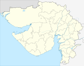 Patdi  Patdi Location in Gujarat, India | |
| Coordinates: 23°11′N 71°48′E / 23.19°N 71.80°ECoordinates: 23°11′N 71°48′E / 23.19°N 71.80°E | |
| Country |
|
| State | Gujarat |
| District | Surendranagar |
| Population | |
| • Total | 30,000 |
| Languages | |
| • Official | Gujarati, Hindi |
| Time zone | IST (UTC+5:30) |
| PIN | 382765 |
| Telephone code | 02757 |
| Vehicle registration | GJ |
| Nearest city | Viramgam |
| Literacy | 40% |
| Website |
gujaratindia |

Patdi is a town located 90 km west of Ahmedabad in Gujarat, India with a population of approximately 20,000. Ahmedabad (Intl' Airport)90 km away is the nearest airport. Patdi has less frequency of train connections. The nearest station having enough trains is Viramgam (30 km).
Climate
Due to the neighbouring "Desert", the climate is dry but not much different from other parts of Gujarat. Patdi used to be a state under the rule of the kings now known as Patdi(Desai) Darbar and was the first state in India which had electricity by private rajwadas.
Economy
The main business of Patdi is salt production and related products. It provides a salt transportation channel to India. Patdi provides the best market for the consumer needs of neighbouring villages. It also provides a farmers' market and cotton processing units.
Patdi was one of the Desai ruled state before 1950. This town is on the edge of Little Rann of Kachchh.
This is the inner fort of Patdi which is secured by dip water and city suburbs. Patdi is also known for its Surajmalji highschool.
History
Website: www.patdi.net present Darbar saheb of patdi is Darbar shrine karni Sinh kishan Sinh desai