Penningsveer
| Penningsveer | |
|---|---|
| Town | |
|
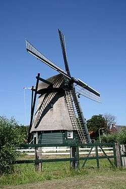
Windmill De Veer | |
 | |
 Penningsveer in the municipality of Haarlemmerliede en Spaarnwoude. | |
| Coordinates: 52°23′34″N 4°40′34″E / 52.39278°N 4.67611°ECoordinates: 52°23′34″N 4°40′34″E / 52.39278°N 4.67611°E | |
| Country | Netherlands |
| Province | North Holland |
| Municipality | Haarlemmerliede en Spaarnwoude |
| Time zone | CET (UTC+1) |
| • Summer (DST) | CEST (UTC+2) |
Penningsveer is a town in the Dutch province of North Holland. It is a part of the municipality of Haarlemmerliede en Spaarnwoude, and lies about 3 km east of Haarlem.[1] The town is named after the ferry (Dutch:veer) that (for a penny) used to take travellers across the Liede. Travellers over land on their way to Amsterdam would pass through Spaarnwoude before reaching Halfweg. That route became obsolete when the Haarlemmertrekvaart was dug in 1631.
References
- ↑ ANWB Topografische Atlas Nederland, Topografische Dienst and ANWB, 2005.
This article is issued from Wikipedia - version of the 3/15/2013. The text is available under the Creative Commons Attribution/Share Alike but additional terms may apply for the media files.