Pennsylvania Route 407
| ||||
|---|---|---|---|---|
 | ||||
| Route information | ||||
| Maintained by PennDOT | ||||
| Length: | 12.470 mi[1] (20.069 km) | |||
| Major junctions | ||||
| South end: |
| |||
|
| ||||
| North end: |
| |||
| Location | ||||
| Counties: | Lackawanna, Susquehanna | |||
| Highway system | ||||
| ||||

Pennsylvania Route 407 (PA 407) is a 12.5-mile-long (20.1 km) state highway located in Lackawanna and Susquehanna Counties in Pennsylvania. The southern terminus is at U.S. Route 6 (US 6)/US 11 in South Abington Township, Pennsylvania near Clarks Summit near the northern terminus of Interstate 476 (I-476), also known as the Pennsylvania Turnpike's Northeast Extension. The northern terminus is at PA 374 near Glenwood. PA 407 is a two-lane road that serves Clarks Green and Waverly in northern Lackawanna County. This route was part of the Philadelphia and Great Bend Turnpike, a turnpike that was built in 1826. PA 407 was designated in 1928 between US 6/US 11 in Clarks Summit and PA 107 in Fleetville. The route was extended north to PA 374 in 1961. PA 407 was rerouted to its current southern terminus in 2004.
Route description
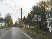
PA 407 begins at an intersection with US 6/US 11 in South Abington Township, Lackawanna County, heading north on two-lane undivided South Abington Road. The road heads through commercial areas and woods, turning north-northwest and passing under a viaduct carrying I-476 (Northeast Extension of the Pennsylvania Turnpike). The route heads into residential areas, becoming the border between Clarks Summit to the west and South Abington Township to the east. PA 407 becomes the border between Clarks Summit to the west and Clarks Green to the east before fully entering Clarks Green as it passes more homes, becoming North Abington Road. The road heads into Waverly Township and becomes Abington Road, heading through less dense residential areas with some woods and fields. The route heads through the community of Waverly, where it forms a short 2 block concurrency with PA 632.[2][3]
PA 407 heads northeast into woodland with some fields and residences. The road enters North Abington Township and turns northwest as North Abington Road, passing through more rural areas. The route heads into forested areas of Lackawanna State Park and turns north, coming to an intersection with the western terminus of PA 524. PA 407 turns northwest and crosses Lake Lackawanna into Benton Township, turning north again and reaching a junction with PA 438 in the community of Wallsville. The road leaves the state park and heads through a mix of farmland and woodland with some homes, becoming an unnamed road and intersecting PA 107 in Fleetville. The route heads through more rural areas and passes through Kochners Corners, becoming Philadelphia-Great Bend Turnpike.[2][3] PA 407 enters Lenox Township in Susquehanna County and becomes an unnamed road, crossing the East Branch Tunkhannock Creek and ending at an intersection with PA 374.[2][4]
History
PA 407 follows the alignment of the Philadelphia and Great Bend Turnpike, a turnpike that was built in 1826.[5] This turnpike was chartered in 1811 and ran between Philadelphia and Great Bend. The Philadelphia and Great Bend Turnpike was built to attract settlers to rural Pennsylvania.[6] When Pennsylvania first legislated routes in 1911, what is now PA 407 was not given a number.[7] In 1928, PA 407 was designated to run from US 6/US 11 in Clarks Summit north to PA 107 in Fleetville. At this time, the entire length of road was paved.[8]
PA 407 was extended north to the junction with PA 374 in 1961 as part of the construction of I-81 (the Penn-Can Highway).[9] In 2004, PA 407 was rerouted to use South Abington Road to intersect US 6/US 11 at its current location instead of using Grove Street to intersect the routes in the center of Clarks Summit. The former alignment of PA 407 on Grove Street between Clarks Summit and Clarks Green became known as SR 4026.[10]
Major intersections
| County | Location | mi[1] | km | Destinations | Notes |
|---|---|---|---|---|---|
| Lackawanna | South Abington Township | 0.000 | 0.000 | ||
| Waverly Township | 3.403 | 5.477 | South end of PA 632 overlap | ||
| 3.514 | 5.655 | North end of PA 632 overlap | |||
| North Abington Township | 6.248 | 10.055 | |||
| Benton Township | 7.391 | 11.895 | |||
| 8.989 | 14.466 | ||||
| Susquehanna | Lenox Township | 12.470 | 20.069 | ||
| 1.000 mi = 1.609 km; 1.000 km = 0.621 mi | |||||
See also
 U.S. Roads portal
 Pennsylvania portal
References
- 1 2 Bureau of Maintenance and Operations (January 2015). Roadway Management System Straight Line Diagrams (Report) (2015 ed.). Pennsylvania Department of Transportation. Retrieved June 30, 2015.
- Lackawanna County (PDF)
- Susquehanna County (PDF)
- 1 2 3 Google (December 8, 2011). "overview of Pennsylvania Route 407" (Map). Google Maps. Google. Retrieved December 8, 2011.
- 1 2 Lackawanna County, Pennsylvania Highway Map (PDF) (Map). PennDOT. 2011. Retrieved December 6, 2011.
- ↑ Susquehanna County, Pennsylvania Highway Map (PDF) (Map). PennDOT. 2011. Retrieved December 7, 2011.
- ↑ Hitchcock, Frederick Lyman (1914). History of Scranton and Its People, Volume 1. New York City: Lewis Historical Publishing Company. p. 12. Retrieved August 7, 2015.
- ↑ "History". Covington Township, Lackawanna County. Retrieved August 7, 2015.
- ↑ Map of Pennsylvania Showing State Highways (PDF) (Map). Pennsylvania Department of Highways. 1911. Retrieved January 1, 2014.
- ↑ Map of Pennsylvania (Map). Pennsylvania Department of Highways. 1928. Retrieved May 7, 2015.
- ↑ "Changes in Highway Route Numbers Listed for Northeast Pennsylvania". The Evening Times. Sayre, PA. April 24, 1961. p. 10. Retrieved August 5, 2015 – via Newspapers.com.

- ↑ Lackawanna County, Pennsylvania Highway Map (PDF) (Map). PennDOT. 2004. Retrieved August 7, 2015.