Perth (suburb)
| Perth Perth, Western Australia | |||||||||||||
|---|---|---|---|---|---|---|---|---|---|---|---|---|---|
 Perth central business district, viewed from the Horseshoe Bridge on William Street | |||||||||||||
 Perth | |||||||||||||
| Coordinates | 31°57′S 115°51′E / 31.95°S 115.85°ECoordinates: 31°57′S 115°51′E / 31.95°S 115.85°E | ||||||||||||
| Population | 9,237 (2011 census)[1] | ||||||||||||
| Established | 1829 | ||||||||||||
| Postcode(s) | 6000 | ||||||||||||
| LGA(s) |
City of Perth City of Vincent | ||||||||||||
| State electorate(s) | Perth | ||||||||||||
| Federal Division(s) | Perth | ||||||||||||
| |||||||||||||
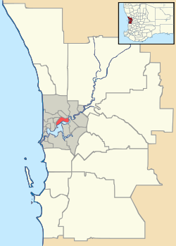
Perth is a suburb in Western Australia that includes both the central business district of the Perth metropolitan area,[2] and a suburban area spreading north to the northern side of Hyde Park. It does not include the separate suburbs of Northbridge or Highgate.
Perth is split between the City of Perth and the City of Vincent local authorities. Perth was named after Perthshire in Scotland.[3]
Built environment
The dominant land use in Perth is commercial. Office buildings include 108 St Georges Terrace, QV.1, Brookfield Place and Central Park – the tallest building in the city and the seventh tallest in Australia.[4]
Significant buildings

The Perth Town Hall, built between 1868 and 1870, was designed as an administrative centre for the newly formed City of Perth. By the late 1950s the Town Hall was considered too small for the council's requirements so Council House, a modernist steel and glass building, was commissioned. Completed in 1960, Council House has divided opinions over its architectural merit.[5] Both the Town Hall and Council House are on the Register of the National Estate.[6][7]
Demographics
Perth has a residential population of 6,341. Residents of Perth are drawn from a number of backgrounds – 40% of the population were born in Australia with minorities from England (6.5%), New Zealand (2.4%), Malaysia (2.1%), Vietnam (2.1%) and Italy (1.9%).[1]
Arts and culture
The Perth Cultural Centre includes facilities such as the Art Gallery of Western Australia, the State Library of Western Australia, the State Theatre Centre of Western Australia and the Western Australian Museum.[8] The Perth Concert Hall is located on St Georges Terrace and His Majesty's Theatre on Hay Street.
Transport
Three freeways service the suburb – Mitchell Freeway, Kwinana Freeway and Graham Farmer Freeway.[9]
Public transport facilities include three train stations (Perth railway station, McIver railway station, Elizabeth Quay railway station) and two bus stations (Elizabeth Quay Bus Station and Roe Street Bus Station), as well as the East Perth Terminal, servicing intrastate and interstate rail and bus services.[10] The Barrack Street Jetty is the home of Transperth ferry services. Perth is served by four free Central Area Transit (CAT) bus routes and a number of open and high rise public car parks.[11][12][13]
Streets
The main east-west streets through the city block are St Georges Terrace, Hay Street, Murray Street and Wellington Street.
The main north-south streets are Barrack Street and William Street.
Five streets have had sections converted to pedestrian malls: Murray Street, Hay Street, James Street, Museum Street and Forrest Place.
Sport
Sporting facilities include Perth Oval, the home ground of association football (soccer) team Perth Glory and Super Rugby team Western Force.[14] Between 1910 and 1999 it was the home of Australian rules football team East Perth.
At the western end of Wellington Street is the Perth Arena, an indoor stadium designed to host indoor sports such as tennis and basketball.[15] The Perth Entertainment Centre, which was located adjacent to the new Arena, was the home court for the Perth Wildcats between 1990 and 2002. Tennis clubs are located at Robertson Park and Loton Park.
References
| Wikivoyage has a travel guide for Perth City suburb. |
- 1 2 Australian Bureau of Statistics (31 October 2012). "State Suburbs: Perth". 2011 Census QuickStats. Retrieved 4 July 2012.
- ↑ "Free Maps – Perth Inner – Metropolitan" (PDF). Landgate. 2008. Retrieved 10 April 2012.
- ↑ "History of Metropolitan Suburb Names". Landgate. Retrieved 10 April 2012.
- ↑ "Home". Central Park. Retrieved 29 April 2009.
- ↑ "Register of Heritage Places – Assessment Documentation – Council House" (PDF). Heritage Council of Western Australia. Retrieved 29 April 2009.
- ↑ "Places Database – Council House, Perth". Heritage Council of Western Australia. Retrieved 29 April 2009.
- ↑ "Places Database – Perth Town Hall". Heritage Council of Western Australia. Retrieved 29 April 2009.
- ↑ "Attractions". City of Perth. Retrieved 15 February 2014.
- ↑ "Main Roads Metropolitan Road Fact Sheet". Main Roads Western Australia. Retrieved 29 April 2009.
- ↑ "Transperth Network Map – Sheet 4". Transperth. Retrieved 29 April 2009.
- ↑ "Perth Suburb Profiles – Perth". REIWA. Retrieved 29 April 2009.
- ↑ "City of Perth Parking". City of Perth. Retrieved 29 April 2009.
- ↑ "Perth CAT map". Transperth. Retrieved 29 April 2009.
- ↑ "Teams". nib stadium. Retrieved 12 May 2012.
- ↑ "Perth Arena". Department of Treasury and Finance, WA. Retrieved 29 April 2009.