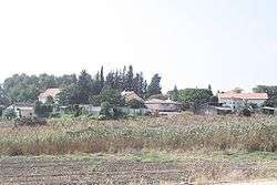
Petahya
| Petahya פְּתַחְיָה | |
|---|---|
 | |
 Petahya | |
| Coordinates: 31°52′2.63″N 34°53′14.28″E / 31.8673972°N 34.8873000°ECoordinates: 31°52′2.63″N 34°53′14.28″E / 31.8673972°N 34.8873000°E | |
| District | Central |
| Council | Gezer |
| Affiliation | HaOved HaTzioni |
| Founded | 1951 |
| Founded by | Tunisian immigrants |
| Population (2015)[1] | 890 |
Petahya (Hebrew: פְּתַחְיָה) is a moshav in central Israel. Located in the Shephelah near Mazkeret Batya, it falls under the jurisdiction of Gezer Regional Council. In 2015 it had a population of 890.
History
The village was established in 1951 by immigrants from the Tunisian youth movement HaNoar HaTzioni. They were later joined by immigrants from Algeria and India. It was initially named Gezer 10, but later renamed Petahya, a word derived from "a personal name in [the] Bible .. (I Chron. 24:16)".[2][3]
Today most of its residents work in vineyards.
References
- ↑ "List of localities, in Alphabetical order" (PDF). Israel Central Bureau of Statistics. Retrieved 16 October 2016.
- ↑ Carta's Official Guide to Israel and Complete Gazetteer to all Sites in the Holy Land. (3rd edition 1993) Jerusalem, Carta, p.378, ISBN 965-220-186-3
- ↑ Place Names in Israel. A Compendium of Place Names in Israel compiled from various sources. Translated from Hebrew, Jerusalem 1962 (Israel Prime Minister’s Office. The Israeli Program for Scientific Translations) p.223
| Wikimedia Commons has media related to Petahya. |
This article is issued from Wikipedia - version of the 9/28/2016. The text is available under the Creative Commons Attribution/Share Alike but additional terms may apply for the media files.