Petoa
| Petoa | |
|---|---|
| Municipality | |
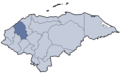
 Petoa Location in Honduras | |
| Coordinates: HN 15°16′N 88°17′W / 15.267°N 88.283°W | |
| Country | Honduras |
| Department | Santa Bárbara |
| Villages | 14 |
| Area | |
| • Total | 209.9 km2 (81.0 sq mi) |
| Population (2015) | |
| • Total | 12,381 |
| • Density | 59/km2 (150/sq mi) |
| Climate | Aw |
Petoa is a municipality in the Honduran department of Santa Bárbara.
Coordinates: 15°16′N 88°17′W / 15.267°N 88.283°W
This article is issued from Wikipedia - version of the 1/17/2016. The text is available under the Creative Commons Attribution/Share Alike but additional terms may apply for the media files.