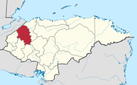
Santa Bárbara Department, Honduras
| Santa Bárbara | |
|---|---|
| Department | |
 | |
| Country |
|
| Municipalities | 28 |
| Founded | 1825 |
| Seat | Santa Bárbara, Honduras |
| Government | |
| • Type | Departmental |
| Area | |
| • Total | 5,024 km2 (1,940 sq mi) |
| Population (2015)[1] | |
| • Total | 434,896 |
| • Density | 87/km2 (220/sq mi) |
| Time zone | -6 |
| Postal code | 22101 |
Santa Bárbara is one of the 18 departments (departamentos) into which Honduras is divided. The departmental capital is Santa Bárbara.
Geography
The department covers a total surface area of 5,115 km² and, in 2005, had an estimated population of 368,298 people.
Economy
The department, historically, is known for harvesting mahogany and cedar trees for exportation.[2]
Municipalities
- Arada
- Atima
- Azacualpa
- Ceguaca
- Chinda
- Concepción del Norte
- Concepción del Sur
- El Nispero
- Gualala
- Ilama
- Las Vegas
- Macuelizo
- Naranjito
- Nueva Frontera
- Nuevo Celilac
- Petoa
- Protección
- Quimistán
- San Francisco de Ojuera
- San José de Colinas
- San Luis
- San Marcos
- San Nicolás
- San Pedro Zacapa
- Santa Bárbara
- Santa Rita
- San Vicente Centenario
- Trinidad
References
- ↑ "GeoHive - Honduras extended". Retrieved 2015. Check date values in:
|access-date=(help) - ↑ Baily, John (1850). Central America; Describing Each of the States of Guatemala, Honduras, Salvador, Nicaragua, and Costa Rica. London: Trelawney Saunders. p. 119.
Template:Honduras
Coordinates: 14°55′N 88°14′W / 14.917°N 88.233°W
This article is issued from Wikipedia - version of the 8/18/2016. The text is available under the Creative Commons Attribution/Share Alike but additional terms may apply for the media files.