Peyzac-le-Moustier
| Peyzac-le-Moustier | |
|---|---|
|
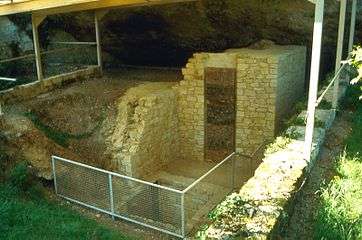
Prehistoric site of Le Moustier | |
 Peyzac-le-Moustier | |
|
Location within Nouvelle-Aquitaine region  Peyzac-le-Moustier | |
| Coordinates: 44°59′30″N 1°04′47″E / 44.9916°N 1.0797°ECoordinates: 44°59′30″N 1°04′47″E / 44.9916°N 1.0797°E | |
| Country | France |
| Region | Nouvelle-Aquitaine |
| Department | Dordogne |
| Arrondissement | Sarlat-la-Canéda |
| Canton | Montignac |
| Intercommunality | Vallée de la Vézère |
| Government | |
| • Mayor (2001–2008) | François Labatut |
| Area1 | 10.1 km2 (3.9 sq mi) |
| Population (2008)2 | 151 |
| • Density | 15/km2 (39/sq mi) |
| Time zone | CET (UTC+1) |
| • Summer (DST) | CEST (UTC+2) |
| INSEE/Postal code | 24326 / 24620 |
| Elevation |
60–263 m (197–863 ft) (avg. 96 m or 315 ft) |
|
1 French Land Register data, which excludes lakes, ponds, glaciers > 1 km² (0.386 sq mi or 247 acres) and river estuaries. 2 Population without double counting: residents of multiple communes (e.g., students and military personnel) only counted once. | |
Peyzac-le-Moustier is a commune in the Dordogne department in Nouvelle-Aquitaine in southwestern France.
Population
| Historical population | ||
|---|---|---|
| Year | Pop. | ±% |
| 1793 | 406 | — |
| 1800 | 217 | −46.6% |
| 1806 | 324 | +49.3% |
| 1821 | 410 | +26.5% |
| 1831 | 420 | +2.4% |
| 1836 | 417 | −0.7% |
| 1841 | 440 | +5.5% |
| 1846 | 442 | +0.5% |
| 1851 | 439 | −0.7% |
| 1856 | 454 | +3.4% |
| 1861 | 484 | +6.6% |
| 1866 | 503 | +3.9% |
| 1872 | 456 | −9.3% |
| 1876 | 486 | +6.6% |
| 1881 | 510 | +4.9% |
| 1886 | 508 | −0.4% |
| 1891 | 368 | −27.6% |
| 1896 | 351 | −4.6% |
| 1901 | 309 | −12.0% |
| 1906 | 304 | −1.6% |
| 1911 | 276 | −9.2% |
| 1921 | 240 | −13.0% |
| 1926 | 237 | −1.2% |
| 1931 | 210 | −11.4% |
| 1936 | 220 | +4.8% |
| 1946 | 195 | −11.4% |
| 1954 | 181 | −7.2% |
| 1962 | 151 | −16.6% |
| 1968 | 157 | +4.0% |
| 1975 | 119 | −24.2% |
| 1982 | 112 | −5.9% |
| 1990 | 117 | +4.5% |
| 1999 | 147 | +25.6% |
| 2008 | 151 | +2.7% |
See also
References
| Wikimedia Commons has media related to Peyzac-le-Moustier. |
This article is issued from Wikipedia - version of the 11/9/2016. The text is available under the Creative Commons Attribution/Share Alike but additional terms may apply for the media files.